Menu

Show posts

This section allows you to view all posts made by this member. Note that you can only see posts made in areas you currently have access to.

Show posts Menu

Messages - locuscycling

#1
Troubles & Questions / Dynamic elevation -problem
December 10, 2016, 17:49:34
Like in Manual
Dynamic elevation-Displays altitude value at the map screen center. It is based on available online altitude public file sources.

It have worked for ca 3 years for me  but not today
http://oi67.tinypic.com/28whxcg.jpg
of course i have http://oi63.tinypic.com/2wbuyya.jpg


,Maybe it is in connection with  this Topic -http://forum.locusmap.eu/index.php?topic=5459.0
( sometimes i have this Srtm  and Vector map directory  Errror  )- i dont think it is becouse of Sd Card or becouse of Phone - i have new Smartphone and new SD Card but error sometimes occurs. .
#2
Quote from: jusc
Do you use an Android 6.0X custom rom? I have the same issue after each update of Locus. No solution until now..

I have Android 5.0.2 .

Quote from: poutnikl
A general advice is to update simultaneously the vector map and related RD5 files. The RD5 files are much smaller than vector maps of the same area.

Since ca 1 year till last ''crash'' i didn't update RD5 files  and Vector map as well.
Changes are microscopic so i don't see any reason to update.
Generally on my bike i use only rasters.

#3
I downloaded ,,new'' E10 N50 file and it works . thx for an Idea.

(But it also means that i have to download and replace  all my RD5 files ( ca 4gb in more then 50 files ))
#4
After few years of excellent( no problems)  working  finally duo Locus+Brouter  stop working for me.


Another problem - Entering Locus i get this screen


I have to go to ,Settings'' and give Vector map folder. It works for some time, probobly till new update ,i don't know
I have all my maps ( vector + raster ) and Brouter details ( segment, profiles ..)  on Micro Sd,

Where is the problem?
#5
Here few screens about my problem

1 .Track ( created, imported doesn't matter) http://oi58.tinypic.com/2w2igie.jpg
2.Next sreen http://oi57.tinypic.com/f78mq.jpg
3.Next - choose navigation option http://oi61.tinypic.com/2qjm9fp.jpg
4.Rhen when i choose prowadzenie/guidance my phone immediatelly show this http://oi61.tinypic.com/5ph8wx.jpg

In previous it was all Ok. with this guidance/prowadzenie.

#6
Last version installed today.

When i tap my track/route on the map and as always try to choose Guidance- Locus crash imediatelly.
Communication-''Unfortunatelly Locus Pro get closed''
( when i tap Navigation it is OK ) 

( I need guidance only to have altitude profile and km to go)
#7
As in topic.

Few days ago I bought (used) Xperia Active , then went to GooglePlay to look for Locus Pro - but it is nothing.
( probobly- This app is not compatibile with the phone)

Not long  ago i used ( new ) Xperia Active and it was no Problem with Locus.( in sense possible to find in Google Play and install)

Here I see -
Android 2.3.4 
2.6.32.9-perf SEMCUser@SEMCHost#1
4.0.2.A.0.84- compilation number

Maybe this phone is to old for Locus newest version or.......  it was combination in System .?????

( Of course I can sent this phone eand get my money back , but it cost .....like nothing . If lLocus would working i prefer to give this phone a chance)

#8
Troubles & Questions / Re: Dashboard Chart -
April 26, 2015, 14:05:40
Thx, it works now.
#9
Troubles & Questions / Re: Dashboard Chart -
April 26, 2015, 13:42:30
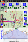
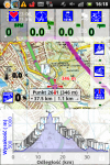
From last version there is a problem the same like from my post nr1. in this topic (direction sign on Altitude Chart in DASHBOARD). Like here:


In the previous version it was enough ( to avoid  sign on Alt. Chart) not to mark ''Przelicz instrukcje''= recalculate instructions,directiona)  I mean this screen:


In last version it doesn't work for me - I always have this ugly signs on Chart, very annoying.
Now Chart is difficult to read. I do like always here:

I click ,,guidance'' then opened my Dashboard.

I think there is also a problem with X axis  on this Dashboard Chart.
I have in seetings max range of visibility(  m)  = 6000
Sometimes it works - sometimes not (see this post  screen 1)
#10
Troubles & Questions / Adroid Kit Kat -Srtm Problems
December 04, 2014, 00:21:49
Today i made Phone( S4 MINI) upgrade from 4.2 to Kit Kat and some problems as written here http://www.locusmap.eu/locus-run-since-update-device-android-4-4-2-kitkat/

With maps i see no problems- it is possible to give a path to ext microsd (point C)  but what to do with SRTM files.

I have ca. 3gb ( all Europa) .
I know it is possible to copy part of these files  to Device Locus/Data/Srtm but maybe there is better solution????
#11
I have ordered -sensor  ''special one'' from Wahoo ( ant+ + bluetooth 4.0) .
Hope to test it next week...

edit
Yes it works , i tried myself Wahoo sensors. ( both Bluetooth +Ant )
I bought and tried 2 sensors

http://www.bike24.com/1.php?content=8;navigation=1;menu=1400,1420,1422;product=78652
http://www.bike24.com/1.php?content=8;navigation=1;menu=1400,1420,1422;product=51116

http://pl.tinypic.com/view.php?pic=sxp1cn&s=8#.VHzTysnBkY0


There are 3 conditons

1. Smartphone .Tablet have to support Bluetooth 4.0
2.Android version should be 4.3 or higher
3.Apk have to read BLE ''sensors''  It is not so easy. For example Strava read only Cadence without speed from sensor. Endomondo i think only Heartrate.

Unfortunatelly my wifes Galaxy S4 Mini is still 4.2 that is why i have to test sensors on Tablet .( Galaxy TAB III)

Connections works without problem.

 
http://pl.tinypic.com/view.php?pic=sxp1cn&s=8#.VHzTysnBkY0

Connected at home not on bike but i think will  be no problems.
#12
Troubles & Questions / Re: Dashboard Chart -
November 26, 2014, 16:21:07
The problem is that  (actual )Dashboard in my small Xperia Active  is already 7 fields + Altitude Chart on the bottom of the screen .
Maybe in the future( new phone)  with little biger screen it will be easier to arrange.

But my solution with 2 track is working, no problem.
Anyway I like this Chart very much, thx.
#13
Troubles & Questions / Re: Dashboard Chart -
November 25, 2014, 16:28:32
I didn't have much time to study Locus lately but my little Problem(s) is solved

1. About clear direction signs on chart  it is enough to clear mark as in photo
Then we have chart without direction signs.


2.About Rectangle- Maybe it is better solution but I found this one.
a) Create a track in Locus ( or import  from gpx) save this same track under two names. ( track a track b)
b) Open all two  tracks to see on map
c) Open ''Guide'' mode for one of the two tracks.( for ex. track a)

Then when we follow track on map  we get Altitude Chart ( in Dashboard) from one track ( here from track a) and rectangle with important info. from track b.
#14
New topic ,becouse  i am not 100% sure.

I  have read here http://help.locusmap.eu/topic/bluetooth_sensors  that it is possible in Locus to connect Smartphone through Bluoetoth 4.0 technology with sport sensors like speed/cadence , heartrate . Is it true? 
If yes it works like Ant + , no problems???

What about energy consumpition compared with ANT + is it similar????

( I ask becouse i think  now it is no sense to wait for cycling( small , good battery,good photomaker ) Phone and nearly every new phone have bluetooth 4.0 .)
#15
Troubles & Questions / Dashboard Chart -
September 10, 2014, 23:36:53
 Is it possible to delete this traffic direction from Chart ?? How to do it , I want to see only altitude chart .


or


It looks awfully.

Another problem .I used to  work with Locus this way:
1.Create a route (track) from point to point  in Locus or sometimes in ,,Bikeroutertoaster''
2.Open this route in Locus ---
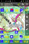
3. Try to fallow this route. I didn't use ''turn by turn ''nawigation   I saw little rectangle with track information as altitude , trip managed , trip left.......  .This rectangle automattically appearde and dissapeared again and again  ,.... it was very good.


In new versions i don't  have this rectangle .

Some time ago i didn't use ,,nawigation '' or Guide mode just opened a track.

Now (with Altitude Chart in Dashboard )   i  started ,,Guide'' but can see this rectangle only manually  ---when i target created track-then track changed colour and rectangle appear.

What is more when i didn't start ,,Guide'' just open a track still i dont have automatic ,, rectangle''