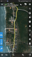
After lots of hours of work, finally the latest version of DTMs of Spain are ready for Download:
https://data.opendataportal.at/dataset/dtm-spain
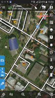
I therefor used the latest available source-files of the Spanish survey Institute. Most improvements are in regions which lack of LIDAR source data in the previous DTMs: Andalusia and the Balearic Islands.
Now the whole territory of Spain is covered by high quality LIDAR data.
https://data.opendataportal.at/dataset/dtm-spain
I therefor used the latest available source-files of the Spanish survey Institute. Most improvements are in regions which lack of LIDAR source data in the previous DTMs: Andalusia and the Balearic Islands.
Now the whole territory of Spain is covered by high quality LIDAR data.
The following users thanked this post: flyingman_ch


 Deine jetzigen Einstellungen verwenden also vermutlich gar nicht den Barometer, sonder nur die Dateien.