Menu

Show posts

This section allows you to view all posts made by this member. Note that you can only see posts made in areas you currently have access to.

Show posts Menu

Messages - jonny.blue

#16
See attachment.  Display on/off feature in Locus Pro  ;)
https://docs.locusmap.eu/doku.php?id=manual:user_guide:settings:control#screen_on_off_control
See auto screen turn off. (Set to 0)

Auto screen turn-off
setting of the interval before turning the screen off again
is set in 5 second steps from 0 to 120 seconds. 0 = screen turning off is disabled (until the system (Android) turns the screen off)
The following users thanked this post: jonny.blue
#17
Quote from: jonny.blue on June 22, 2020, 21:34:58
Normaly with this option the map is centered after a delay of 5s (or with expert settings definable) ... but in LM4 it doesn't work.
The following users thanked this post: jonny.blue
#18
It works well now. But I didn't understand the interest of it. Since I have Locus map open to follow the navigation along a route, I didn't get the interest of lauching the recording from outside of the app. What do people like usually with the widget ?
The following users thanked this post: jonny.blue
#19
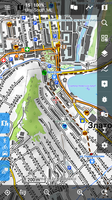
Here is an example of adding customization code to the script. I used the Outdoor theme from locus store which works with v3 maps because it is a very small and simple theme (only 1400 lines).

In the customisation section of the script is uses the keys and values of rules in the theme to isolate and apply specific modifications to certain tags and their attributes, e.g.:

      if inscope(current_keys, "highway") then
         if current(current_vals) = "motorway_junction" then
            if current_tag = "circle" then
               line = update_tag(line, "r", 1.5, 0)
               line = update_tag(line, "stroke-width", 2, 0)
            end if
            if current_tag = "caption" then
               line = update_tag(line, "font-size", 1, 3)
               if instr(line,"caption k="+Chr(34)+"addr:housenumber"+Chr(34)) > 0 then
                  line = update_tag(line, "dy", 0, 0)
               end if
            end if
         end if
      end if


This looks for lines of the theme that are in scope of k="highway" v="motorway_junction" and then tweaks:
   - the circle's radius and stroke-width
   - its caption's  font-size and dy offset (but only for addr:housenumbers captions).

Here is the theme content before from v3:

<!-- highway exits -->
<rule e="node" k="highway" v="motorway_junction" zoom-min="11" zoom-max="13">
   <circle r="6" scale-radius="false" fill="#dFdFFF" stroke="#FF0000" stroke-width="2.0"/>
</rule>
<rule e="node" k="highway" v="motorway_junction" zoom-min="14">
   <circle r="6" scale-radius="true" fill="#dFdFFF" stroke="#FF0000" stroke-width="1.2"/>
   <caption k="addr:housenumber" display="always" dx="-2" dy="10" priority="95" font-style="bold" font-size="6dp" fill="#FF0000" stroke="#FFFF00" stroke-width="1.2dp" scale-font-size="14,1.3"/>
   <caption k="name" display="always" dy="-14dp" scale-dy-size="16,1.2" font-style="bold" font-size="7dp" fill="#0100C8" stroke="#FFFFFF" stroke-width="1.2dp" scale-font-size="14,1.3"/>
</rule>


and after in the converted v4 version:

<!-- highway exits -->
<rule e="node" k="highway" v="motorway_junction" zoom-min="10" zoom-max="12">
   <circle r="2.7" scale-radius="false" fill="#dFdFFF" stroke="#FF0000" stroke-width="0.9"/>
</rule>
<rule e="node" k="highway" v="motorway_junction" zoom-min="13">
   <circle r="2.7" scale-radius="true" fill="#dFdFFF" stroke="#FF0000" stroke-width="0.54"/>
   <caption k="addr:housenumber" display="always" dy="0" priority="95" font-style="bold" font-size="9" fill="#FF0000" stroke="#FFFF00" stroke-width="1.08" />
   <caption k="name" display="always" dy="-14" font-style="bold" font-size="10" fill="#0100C8" stroke="#FFFFFF" stroke-width="1.08" />
</rule>


I should point out that the stroke-width of circles also have a scale of 0.9 and 0.25 applied to it elsewhere in the script, hence 2 * 0.9 * 0.25 * 2 = 0.9. As you can guess, I was just applying correction by trial error until things looked reasonable...

Note the parameters for update_tag are:
   - update_tag( line, tag_name, scale, offset )
and it applies a scale and offset to numerical tag values. E.g. The following line:

         line = update_tag(line, "font-size", 2, -4)

when applied to the following theme line:

   <pathText k="name" font-style="bold" font-size="9" fill="#606060" stroke="#ffffff" stroke-width="2.0"/>

will result in the font-size being processed as:  new-font-size = (old-font-size * 2) - 4 = 14. i.e.:

   <pathText k="name" font-style="bold" font-size="14" fill="#606060" stroke="#ffffff" stroke-width="2.0"/>.

The script has a variable called "zoom_offset" which is set to -1 in this example. It subtracts 1 from all the zoom-min and zoom-max values to readjust the v4 converted theme to look similar in scales as the original v3 theme. Of course, if there are map elements that appear at zoom level 14, the will not appear at zoom level 13 in the v4 map.

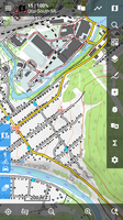
The screenshots show the original v3 Outdoor theme, converted to v4 theme and the original OutdoorV4 theme.


I'm posting the converted outdoor theme only as an example of what the script can do. I haven't checked it extensively and you are probably better off using the official OutdoorV4 theme.
The following users thanked this post: jonny.blue
#20
So let's move a little ;)

New Alpha version 3.44.1.2 for testing.

Three major changes:

- I'm trying to unite work with points. So in this version is introduced new screen visible over the map and also everywhere in the app, that display detail of points. It should be fully working for all points except geocaches (here is currently an option to display old screen). The same system will be created for tracks, once we all will be satisfied with points :).

- Route planner: a new itinerary that displays a list of all shaping/via points with the option to reorder. Optionally in the RP settings is an option to enable chart for segments ;)

- Route planner: when using online GraphHopper, you now get an alternative route (if GH server think it exists). There is missing some more simple way to compare both routes, anyway, it's already well usable.

Feedback is of course welcome.

Version for download here
The following users thanked this post: jonny.blue
#21
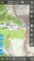
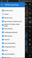
Tiramisù as OpenTopoMap

   
for the topography, and exploration on the maps

only for V4 maps!

For V3 (lomaps and other)  TOTM 1.9.2 - > https://forum.locusmap.eu/index.php?topic=6027.0

in the future it will be slightly improved:

  • all water except springs (rivers, streams, lakes, canals, etc.)
  • all railway and tram
  • all labels
  • setting priorities
  • streets, driveways and younger roads in the direction of greater elegance (at the moment - too thick)
on my smartphone 282 ppi, 320 dpi

It also works well on Oruxmap, Cruiser, and most likely in other mapsforge-compatible programs
(tested in Oruxmaps 7.4.22, Cruiser 1.7)


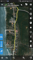
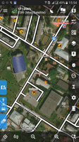
Map: ESRI satellite;  Overlay 85%: OAM Ural ML;  Layer "Terrain" in the theme is OFF


Waiting for comments and constructive criticism.
The following users thanked this post: jonny.blue
#22
As a result of the changed way the new beta deals with scaling maps for devices of different resolution, I've put together new versions of my Mapsforge version 4 compatible themes. They are effectively add-ons to the Voluntary themes. At present they are solely for the beta version and will simply not appear in the list of available themes in the current release, hence I have named them Voluntary Mapsforge beta and Velocity beta.
Download, unzip and add to your Locus themes directory.
Please let me know if they work for you.
The following users thanked this post: jonny.blue
#23
Habe heute noch das Galaxy note9/512GB erhalten und muss feststellen, dass auch mit diesem Gerät das Prolem genau das gleiche ist, wie mit den anderen. Habe mit Android 8.1. und danach mit Android 9 getestet und finde immer das gleiche Problem. Arbeitsspeicher und Prozessorleistung sind nicht das Problem. Das Problem liegt in der Unfähigkeit von Android, mit einer sehr großen Zahl kleiner Dateien umzugehen, wie man sie in srtm (bei mir) findet. Habe Gerätespeicher getestet und von Karte - ohne Unterschied. Nimmt man die vorhandenen 1sec-Dateien und füllt für Europa mit 3sec auf, erhält man ca. 950 srtm-Dateien von denen ca. 100 zu den 25MB-Dateien gehören (1 sec). Damit laufen die von mir verwendeten Systeme (s.o.) noch einigermaßen ordentlich. Wenn man einen weiteren Kontinent dazu nimmt (zu EU), beginnt das Problem und nimmt man die ganze Welt (über 25.000 Dateien), ist mit allen Geräten Ende der Vorstellung.
In diesem Sinne habe nun alles zurückgegeben und bleibe bei S7 und TabS mit großen Karten und beschränke mich eben auf die EU. Bzw. wechsle die Daten, je nach dem, wohin ich gehe.
Spielt man alle Karten (ganze Welt) von OAM auf, bremst das nicht merkbar. Nur die zugehörigen Höhendaten verhunzen alles.


The following users thanked this post: jonny.blue
#24
@johny.blue
Sort the Found folder according to the latest update.
You'll have a cache in the order you found them.
Beware - in case of subsequent editing, the cache moves up! (or at the end).
The following users thanked this post: jonny.blue
#25
Hi
ich häng dir mal zwei Beispiele an,

den "peak2" unter cursors speichern
bei den meisten Cursors ist die aktuelle Position in der Mitte des Pfeiles (Drehpunkt) diesen hab ich mir erstellt da ich bei niedrigen Zoomstufen oftmals am Abzweig vorbei gegangen bin.
Bei Verwendung dieses Cursors ist die aktuelle Position immer an der Pfeilspitze !

den "navi" unter navigation speichern
- für Car wird ein gelber PKW
- für cycle ein voller roter Pfeil
- für foot ein rot umrandeter Pfeil
bei der Navigation angezeigt
The following users thanked this post: jonny.blue
#26
Themes - Vector maps / Re: [Theme] Voluntary UK
September 29, 2017, 16:08:55
Voluntary theme has been updated. The new version is available in the first post, or through Locus Store in the app.
http://forum.locusmap.eu/index.php?topic=2915.msg19296#msg19296
The main enhancements are:
- Option to show "difficult" paths in LoMaps and maps from OpenAndroMaps
- Names for archipelagos, islands and islets in latest maps from OpenAndroMaps (from 1 Oct 2017)
- Minor but important changes in the order of rendering of one-way streets, route overlays, railways, aeroways, ferries and bridges; white underlay for paths on bridges; revised border rendering.

The following users thanked this post: jonny.blue
#27
I added terrain models of Luxembourg and some German provinces:

http://data.opendataportal.at/dataset/dtm-germany
http://data.opendataportal.at/dataset/dtm-luxembourg
The following users thanked this post: jonny.blue
#28
Troubles & Questions / Re: hold map center
August 15, 2016, 00:52:59
Quote from: jonny.blue on August 14, 2016, 20:02:44- and just a question: Is there anywhere a chance to change the value of the skip-back time
edit line  "map_hold_center_method_timeout=5" in your config.cfg
The following users thanked this post: jonny.blue
#29
Themes - Vector maps / [Theme] HiLo hiking theme
February 11, 2016, 09:44:13
User LocusUser#1 has build a new Theme.
You will find more screenshots and the theme itself in following thread:
http://forum.locusmap.eu/index.php?topic=4982.msg41086#msg41086

but please post questions and discussions in english right here...

.
The following users thanked this post: jonny.blue
#30
Hallo Locus Benutzer,

ich möchte euch hier nun mein Theme für Vektorkarten vorstellen. Entstanden aus dem Wunsch nach Karten im Outdooractive.com Style. Ich habe viele Karten ausprobiert, bin aber immer wieder auf die Karten von Outdooractive zukück gekommen.

Dieses Theme beschränkt sich rein auf die Darstellung des Nötigen. Es basiert auf dem Locus internen Theme, jedoch mit einigen Fehlerkorrekturen und vielen, vielen Anpassungen.

Dieses Theme funktioniert nur mit Locus!, nicht mit anderen Apps!

Ich habe es auf einen Samsung S4 mini mit 240DPI entwickelt und dafür auch die Skalierung eingestellt, ich weiss nicht wie es auf Smartphones mit höherer Auflösung aussieht.

Sowohl LoMaps als auch die OpenAndroMaps Vektorkarten funktionieren mit diesem Theme.
LoMaps enthalten jedoch nicht alle Tags, somit wird das ganze Potential nur mit den OpenAndroMaps Karten ausgeschöpft.

Über Anregungen, Kritik und Fehlermeldungen würde ich mich freuen.


Installation:
Dieses Thema kann einfach aus dem Locus Store in der App installiert werden:
Gehe zum Locus Store > Nutzung / Graphic / Themes - Vector maps und scrolle dort nach unten zu Locus community / HiLo theme.

oder

Lade die Zip-Datei unter diesem Beitrag hier herunter und entpacke das Archiv nach ../HiLo. Kopiere dann diesen Ordner mit allen Dateien und Unterordnern nach ../Locus/mapsVector/_themes/


Update:
V10, 06.09.2017
- Die Pattern für Wald verändert, um der Darstellung von "Outdooractive" näher zukommen
- Texte in den Wanderwegemarkierungen (OSMC:SYMBOL) werden nun etwas zuverlässiger dargestellt.
- Nicht ständig Wasserführende Bäche, Flusse, etc. (waterway intermittent=wwi_yes) werden gestrichelt dargestellt (nur bei OpenAndroMaps)
- leisure=playground (Spielplätze) werden nun richtig angezeigt, Symbolgröße wurde angepasst und Beschriftung (ab Zoom 17) hinzugefügt
- amenity=kindergarten (Kindergarten) wird nicht mehr in der gleichen Farbe wie school (Schule) angezeigt, hat nun keine besondere Farbe mehr
- Fehler bei der Darstellung von scrub behoben, landuse steht nun vor natural im Code
- Parkplätze wo der Zugang eine Lizenz oder eine Genehmigung verlangt (access=permit) werden nun dargestellt (nur bei OpenAndroMaps)
- Wege mit Maut (highway=toll) werden nun mit roten Punkten dargestellt (wie bei OAM "Elevate")
- Wege wo der Zugang eine Lizenz oder eine Genehmigung verlangt (access=permit) werden nun mit roten Punkten dargestellt (nur bei OpenAndroMaps)
- Das Symbol für bus_stop (Bushaltestelle) wird nun in Deutschland anders dargestellt wie im rest der Welt (nur bei LoMaps)
- Das Anzeigen von rock (Freistehende Steine) war nicht korrekt, daher die Anzeige nur auf node begrenzt.
- Die Anzeige von rock (Freistehende Steine) wurde um stone (markante Steine) (für LoMaps) und nat_stone (für OpenAndroMaps) ergänzt
- Das Symbol für rock (Freistehende Steine) neu gezeichnet
- Landschaftsmerkmale schaltet nun auch rock (Freistehende Steine) ab
- Die Farbe von highway=primary und trunk (Bundesstrassen und Schnellstrassen) in ein etwas kräfigeres Gelb geändert
- Fehlerhafte Anzeige von information=map|board behoben
- OSMC Wegesymbol "bcg_green_circle" hinzugefügt
- man_made=cutline (Schneise im Wald) wird nun dargestellt (nur bei OpenAndroMaps)
- man_made=cairn (Hügel von Steinen, Steinmännchen) wird nun dargestellt (nur bei OpenAndroMaps)
- Darstellung der Wege vom Typ sac_scale=T5|T6 in schwarz mit lang-kurz-kurz-lang Strichen
- Unterstützung von "raw_sac_scale" bei OpenAndroMaps entfernt
- mountain_pass (Bergpass, Sattel) wird nun angezeigt, schaltbar über die Landschaftsmerkmale

History:
V9, 27.01.2017, Bei Landstrassen und Bundesstrassen werden nur noch die "ref"s der Strasse angezeigt und keine Radwege/Wanderwege "ref"s mehr, Landstraßennummern mehr in Bold, Autobahnnummern Darstellung etwas verbessert, Staatsgrenzen werden nun deutlicher dargestellt, Landschaftsmerkmale schaltet nun auch Klippen ab, attraction hat eine eigene Farbe bekommen, damit es eine Unterscheidung zu pedestrian (Fußgängerzone) gibt, platform (Bahnsteig) wird nun richtig dargestellt, lift_gate (Schranken) werden nun dargestellt, ab Zoom 17, Die Namen von Stadtteile werden nun schon ab Zoom 13 angezeigt, Neues Symbol peak_cross wird bei Gipfel mit Kreuz angezeigt, Neues Symbol cross  wird bei Kreuz angezeigt, Krater werden nun angezeigt, ab Zoom 12 (nur bei OpenAndroMaps), Gletscherspalte wird nun angezeigt, ab Zoom 14 (nur bei OpenAndroMaps), Bei den Contourlinien wird die Beschriftung nun nicht mehr gedreht dargestellt (benötigt Locus Map ab Version 3.21.1), die Details stehen in der Read_me.txt.
V8, 14.10.2016, Wanderwegesymbole werden nun auch bei OAM Karten dargestellt, außerdem  können diese nun wahlweise dargestellt werden, Darstellung der Strassen- und Wegenamen verbessert, Hauptstrassen werden nun wie bei Outdooractive in hellgelb dargestellt, Nackter Fels wird nun mit Synbol dargestellt, Schutt, Hangschutt|Schotter, Kies wird nun mit Synbol dargestellt, Überwiegend mit Gras bewachsene Fläche oberhalb der Baumgrenze wird nun dargestellt und noch viele kleine Verbesserungen, die Details stehen in der Read_me.txt.
V7, 18.08.2016, Rettungspunkte können nun wahlweise dargestellt werden, Landschaftsmerkmale (Stromleitungen, Dämme, Bäume) können nun wahlweise dargestellt werden, Darstellung von breiten Wasserwegen und Wasser verbessert, Diverse Trinkwasserquellen werden nun angezeigt, Ländergrenzen werden nun in einer anderen Linienart dargestellt, Buhnen in Gewässer werden angezeigt und noch viele kleine Verbesserungen.
V6, 10.06.2016, die Radwege (cycleway) werden wieder angezeigt, die Höhe von Gipfeln wird nun mit angezeigt, Grenzen geschützter Gebiete können nun wahlweise dargestellt werden und noch viele kleine Verbesserungen, die Details stehen in der Read_me.txt.
V5, 08.04.2016, Viele, viele Verbesserungen (?), die Details stehen in der Read_me.txt, area und line ohne "dp" in den Größenangaben und damit nicht DPI abhängig, ich hoffe das die Darstellung so besser an die verschiedenen DPI's angepasst ist.
V4, 11.03.2016, Der Style der Wanderwege ist nun wählbar, Höhenlinen in der Optik angepasst, verwende nun wieder "dp" in den Größenangaben (wie in V2), Symbol für Museum ab Zoom 14.
V3, 04.03.2016, viele kleine Änderungen und Anpassungen, Wanderwege nun immer in Outdooractive Optik mit transparentem Hintergrund, Fernwanderwege können einzeln angezeigt werden.
V2, 17.02.2016, Anpassungen an der Optik, etliche Bugfixe, Wanderwege bei OpenAndroMaps nun in Outdooractive Optik.
V1, 10.02.2016, -
The following users thanked this post: jonny.blue