Menu

Show posts

This section allows you to view all posts made by this member. Note that you can only see posts made in areas you currently have access to.

Show posts Menu

Messages - lor74cas

#91
@Žajdlík Josef
hmm so it seems to be bug on Android 5.0 so thanks, this start logo removed from this Android version.

@zossebart
forget mentioned tool is intent in this case. I'm a) still not sure if this is a really useful method and b) I believe it needs few more parameters, not just related to navigation but at least for track recording.

@lor74cas
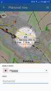
heh ... it's quite extreme in your case. Garmin & Geoching4Locus are not inside in Locus Map, so there is no chance. Rest ... it is complicated. Every "big service" needs own notification that say user that it's running and consume device resources. Since Android 7 or 8 (not sure now) you may specificy in the app system settings, which notifications will be visible (as on attached screenshot) so you may remove them over this tool.

@slarti76
I can't imagine it display sooner. G5 is not so old so 10 seconds is way too much. The same delay is in all other app starts or just for the first time? Weird, anyway really can't imagine why this happens and how to speed up. In the first moment, Locus notice that UI is visible, it displays loading dialog.
The following users thanked this post: lor74cas
#92
@lor74cas
Hello, I wrote you an email through help desk 2 weeks ago (I hope it got through to you?). But it might be a good idea to share it here for others as well.
I tried once more after your report and finally hopefully found the cause of the problem. It should be fixed in the current version of LM Pro and the LT service should wake up correctly after connectivity state change.

Regarding unlimited session timeout usability problems we will probably limit upper bound to some more sensible limit like 1 or 2 weeks, at least until more mature group management is in place.

And by the way, web is still not fixed the way we would like to. We unfortunately have to find somebody else to fix it, since our current contractor is apparently not up for the task.
The following users thanked this post: lor74cas
#93
@lor74cas
Hello, I did not want to bother you with the help desk unnecessarily. It is just that I kind of missed the problem previously and did not try to reproduce thoroughly which was my personal mistake. I am sorry about that. The help desk just helps me to organize problems better and resolve them separately, especially because there was a lot of confusion and various errors concerning the LT web.
Anyway I tried to replicate again while locking the phone during the connection loss and could finally reproduce with my Samsung phone. The fix should be out with the new app version in a few days.

@Andrew Heard
Hi, I have checked the backend database and I can see the problem regarding your two positions. One position was recorded by the Locus Map Free and the other one by the Locus Map Pro. They are technically two separate clients due to some implementation details even when running on the same phone and with the same account. Leaving the group LM Free should hide your old position. Alternatively I could delete both last recorded positions on the server if it bothers you.
The following users thanked this post: lor74cas
#94
@Andrew Heard Thank you for mentioning this, it is true that private groups can set the "time out" to longer time.
But @lor74cas is right, this seems like a bug and increasing the time limit will only mask the problem somehow. I will add to my live tracking issues to solve.

@lor74cas Might only be a bug on the web, will have to try with two phones. The live tracking not reporting any failed transmissions might not be a problem. If there is no connection available Locus will notice this and postpone the attempt until the connection is available. The same should apply with GPS I think, so there should be no attempts to send the position until GPS fix is available.
But I would expect that as soon as a GPS or a connection is available there should be an attempt to synchronize position immediately (if last scheduled attempt had already been missed). So this is definitely not intended behaviour.
The following users thanked this post: lor74cas
#95
Other features / Re: Update of map core (2019)
April 06, 2019, 14:47:28
Nice work. The map scaling is working.

I have done some quick map and theme versions checks.

Map v3: ok
Map v4: ok incl. multilanguage, ? symbol in the menu.
Map v5: ok incl. multilanguage, ? symbol in the menu.

Theme Locus: ok, but only for map v3
Theme v1: ok
Theme v4: ok, but only for map v4 or v5
Theme v5: not selectable
Are these restriction still needed?

I have seen some symbols and text on the map which are not coming from the actual selected theme. Not all elements are cleared during a theme change.
The following users thanked this post: lor74cas
#96
Quote from: menion on December 18, 2018, 07:18:51
Complains about magnifier: I personally found it useful, which is why I do not see problems related to it.
@menion - I never found the UX intuitive/ only worked over short visible distance.

Quote from: menion on December 18, 2018, 07:18:51
Any suggestion how to visualize moving point better? Btw. drag&drop works, it is just needed to move with point immediately, do not wait (otherwise long-click is performed and here comes bug).
now there are excellent alternatives to tap/ drag with magnifier it doesn't bother me.
The following users thanked this post: lor74cas
#97
In 3.32.2.8: as Andrew writes, the new planner is very good. I just have one comment. When I change the shaping point to a transit, I have no option to confirm the name. With the back button, changes are canceled, so the only confirmation option is a click on the map screen. I do not think this is a procedure that would follow other Locus control.

CZ: V 3.32.2.8: jak píše Andrew, nový plánovač je moc dobrý. Měl bych jen jednu připomínku. Když změním tvarovací bod na průjezdní, nemám žádnou možnost potvrdit název. Tlačítkem zpět se změny zruší, takže jediná možnost potvrzení je klik do obrazovky s mapou. Myslím, že to není postup, který by navazoval na jiné ovládání Locusu.

The following users thanked this post: lor74cas
#98
V 3.32.2.8: @menion - the Route Planner just gets better & better. The latest changes are very impressive.
The following users thanked this post: lor74cas
#99
I spent many hours and weeks to collect and edit the source data for creating a DTM for the whole country of Italy. Most of the Italian regions provide more or less high quality data. For those who don't, I used 1" SRTM data.
Now the project is finished and available here:

http://data.opendataportal.at/dataset/dtm-italy
The following users thanked this post: lor74cas
#100
No problems for me; either way. I only reply to your comment "I see no reason..." with my reason :)

Just a general comment:- Until now I have used the "external BRouter" method of route planning - http://docs.locusmap.eu/doku.php?id=manual:user_guide:tracks:planning:brouter. I can quickly generate X routes for X profiles, then compare & contrast. But now, finally, the new Route Planner has overtaken this method for convenience. With Shaping points & NOGO areas it just gets better & better.
The following users thanked this post: lor74cas
#101
Quote from: menion on October 03, 2017, 08:47:01
I never thought about them as about tool that should "shape" an planner route. And to be true, I still see no reason for this.
Often BRouter needs no encouragement but sometimes I encourage the chosen route with a Shaping point, sometimes with a NOGO area. Each has it's use and advantage depending on the characteristics of the current route. Generally for me a NOGO is only needed for the life of the route. No longer. As my cycle touring is always to a new area.
The following users thanked this post: lor74cas
#102
Perfect, glad to hear it! For me it looks like some problem on Google Drive side, anyway issue should be handled in Locus no matter what happen. I'll try to improve it little bit. Biggest problem anyway seems to be, that Locus loads Drive directory even that you do not need it. I'll have to rewrite this "File browser" to something similar that I made to "Search screen" few months ago, where only single page is loaded/visible at once.
The following users thanked this post: lor74cas
#103
UPDATE:
V7, 18.08.2016,
Emergency access points can now be optionally shown, landscape features (power lines, dams, trees) can now optionally be shown, improved representation of wide waterways and water, various drinking water sources are now displayed, national borders are now displayed in a different line style, groynes in waters appear and many small improvements, the details are in the Read_me.txt.

The download link is in the Home Post to find.
The following users thanked this post: lor74cas
#104
New Beta version 3.18.6.2
Many fixes already reported by users + first attempt to new version of "items" screen (available in menu > more) and first attempt to custom configuration for BRouter profiles directly over Locus.
Locus will now display also profiles stored in Locus/data/brouter (for those who wants to play with it). Such profiles also support "on the fly" definition of "avoid_motorways" and "avoid_toll" parameters. Check sample attached file if interested. Hope you find it useful.

@michaelbechtold: well, reason is currently quite simple ... because I have function "get me best vector map for this area", which is used in this case. Because all maps except LoMaps do not have precisely defined bounding area, it is little bit risky to use just a method "use current map". In such case, there is a chance, then map won't cover required area.

I'm sorry, for now I do not have a better solution. Because of this, it may end, that user itself will be able to manually choose a map, that he wants to use. Just an option ...

The following users thanked this post: lor74cas
#105
Quote from: lor74cas on July 19, 2016, 20:46:40
Hello
I think that country border lines and hike paths have a colour too similar

Hello lor74cas,
this is not a problem in locus, this is a problem in the HiLo theme.

But you're right, the colors are too similar, so I have the line style of the country border lines completely changed.

This changes comes with next update of the HiLo theme, not with next update of locus.


The following users thanked this post: lor74cas