Menu

Show posts

This section allows you to view all posts made by this member. Note that you can only see posts made in areas you currently have access to.

Show posts Menu

Messages - Viajero Perdido

#46
@Viajero Perdido
Weird, I was quite sure that I've found the reason of this issue. So the change in update interval still ends with the same error message right? Damn. Give me some time. Maybe more people write the same issue, maybe I find anything I do not see now ... thanks.

@tapio
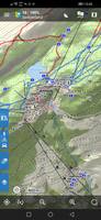
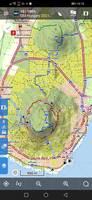
hmm, it may not be connected to dark mode. It looks like that app is unable to pick the correct map for the preview so use the blank map. And because you use dark mode, it is black, nothing more.

Anyway reliability of creating previews is quite bad  :-\

@Andrew Heard
Both "itineraries" have different use-case. In the route planner, it is mainly about the option to see all segments on one screen and the option to change easily it's order. In the active navigation route planner, it is about a common itinerary known from bigger navigation apps. It should be read-only and give quick overview of what will come.
Can't imagine how to merge them to be true  ???
The following users thanked this post: Viajero Perdido
#47
Quote from: slarti76 on April 17, 2021, 15:30:27
Well, played around with the syncing, back and forth, Route Planner, Track Editor - couldn't find any wrong behaviour whatsoever!  ;D ;D ;D
the Cloud Sync doco should be improved (written) asap so users like in this topic https://forum.locusmap.eu/index.php?topic=7334.msg63206#msg63206 & https://help.locusmap.eu/topic/24280-cant-save-a-planned-route-to-library-on-web-planner don't get confused/ better understand how it operates/ don't have an unnecessary bad experience/ don't loose data or have duplicated data ==> give undeserved reviews. Bad ratings don't help anyone.
The following users thanked this post: Viajero Perdido
#48
@menion could what you have extensively written above go into some doco page (as soon as possible) you can reference/ link so you don't endlessly answer questions like this. At present https://docs.locusmap.eu/doku.php?do=search&id=main&q=sync returns no results.
The following users thanked this post: Viajero Perdido
#49
Hello,

I created an icon package which contains symbols from the US National Park Service. There are over 250 symbols in 16 categories available in two packages - one normal and one inverted (dark).

A picture showing some of the symbols and additional information (description, source material) can be found on my website:
https://www.dfgtec.com/map-nps-symbols.html
The following users thanked this post: Viajero Perdido
#50
Web portal & sync / Re: Web planner / portal
April 07, 2021, 13:01:57
@lor74cas
1) Clean all btn confirmation - Yes, it makes sense. Thanks for the clarification.
2) Use metres only for elevation gain/loss - We will consider it. Please, what is the motivation for you (precision, ..)?
3) Logged in but icon still anonymous - I do not understand. Please, could you give me more info: Thx
4) Elevation chart for saved tracks - sure, it is in progress and should be there soon.
5) Hiding top bar - Good idea, we will consider it but for now more important tasks are on the list :)
6) More accurate altimetetry calculation - this is more related to the routing itselft. Please, ask here: https://forum.locusmap.eu/index.php?topic=7202.0

@jajaballard
1) Switching profiles - Your use case makes sense. We do not plan to change the current behavior but we will try to find some way to enable recalculating all segments using particular profile

@Andrew Heard
1) Brouter UX - sure, this is also one of our inspiration source. Please, if you want to add some idea for implementation, there is newly created space for it. Please, add it there and collect votes :). - https://help.locusmap.eu/topics/idea/status/all/category/30/sort/new_updated/page/1
2) No preview - web planner is generating thumbnail only when saving planned route to your library. Preview image is synced from your device and used on the web. If preview is missing, it is missing and "No preview" is displayed

@francisco
1) Ideas - great, most of them is already collected here - https://help.locusmap.eu/topics/idea/status/all/category/30/sort/new_updated/page/1 so you can vote to help us prioritize :)
2) Increase development effort - believe me that there is quite a lot of development happening. Unfortunatelly, not everything is easily visible in the UI. Regarding webplanner BETA - yes, you are right that we have a lot of to improve here. On the other hand web planner is only one piece of puzzle of premium GOLD plan ...

@tapio
1) Showing multiple tracks - yes, it is planned. Thanks a lot for creating idea on helpdesk
2) Preview image - this was intended to be consistent with the app. We could consider optionally hiding it and saving some space. If you would really like this implemented, please, create idea for it so it can be discussed and collect votes (so we can give it a priority).Thx
3) Embedded WP - thx
4) Blue color of own tracks - yes, it is confusing. But honestly, it is really hard to find some universal color which won't clash with some color in the map and will have good contrast with the map.
5) Edit of tracks - sure, this will be possible. It is on our list but no yet implemented. The best way to put more priority on this is to create idea and collect votes  - https://help.locusmap.eu/topics/idea/status/all/category/30/sort/new_updated/page/1

@Žajdík Josef
1) Statistics of longer routes - This should be solved once collapsing of waypoints is implemented
2) Elevation/Slope - good idea. Could you please create idea for it so it can collect votes? https://help.locusmap.eu/topics/idea/status/all/category/30/sort/new_updated/page/1
3) Customized profile - this is something we would like to add but I do not see it comming in the nearest feature.
4) Change of planning profile - Already on our list and should be implemented soon
5) Missing solar power plants in the map - thanks. I will forward ti to the LoMaps author.

@gergy
1) Missing elevation gain and loss - this was already added so you can check it ;)
2) Detail of online LoMaps - I am not author of it. I will forward this to him. Generally, it would be best to ask in dedicated thread - https://forum.locusmap.eu/index.php?topic=7191.0. Thanks :)

@Frivold
1) Difference between online and offlien LoMaps - Ideally it should be the same map but there are a little different  source data that are used for rendering so some differences will be there. But I am not the creator of maps. Better to ask in dedicated thread for more detailed answer - https://forum.locusmap.eu/index.php?topic=7191.0
2) Holes in the map - known issue which was already reported to the provider of source data. We are waiting for the solution. Until then we can, unfortunately, do nothing about it :/

@zossebart
1) Elevation chart missing for saved tracks - yes, it is not a bug. This was not implemented, yet. This is one of my top priorities tasks so it should be available soon :).

@Viajero Perdido
Thanks :)
1) Start location - if you give browser permission to use your location then start location should be near you. Anyway we are thinking about improvement here (I - saving your last location to browser memory and using when you reload browser or II - automatically figuring out approximate location based on IP address).
2) Search - We had some issues there. Please, try now, it should work (finding "Edmonton"). But keep in mind that search gives preference  to results near your current location. So if you are searching "Edmonton" from Europe then you will need to write almost whole name to have it in results ..
3) Usage of webfonts - yes, that's true. I see it as a standard practice. Don't you have problem also on other webs?
4) Displaying geocaches in the overlay - I am almost sure that "using" Groundspeak data won't be possible. But I guess your use case is to see your points on the map (e.g. imported geocaches). This is planned feature and should come in next few months.

@dyoghenes
Thanks a lot!
1) Excluding navigation hints - yes, it makes sense. I have this on my list but it is not high priority for us right now. ETA could be months. To give it more priority, please, create idea and collect votes for it :) - https://help.locusmap.eu/topics/idea/status/all/category/30/sort/new_updated/page/1


The following users thanked this post: Viajero Perdido
#51
It might help to clean temporary data in Locus (in settings > various). Some time ago I had the same problem. The new theme name is quite similar to the old name and Locus keeps the name in some not obvious storage place.
In my case, I even downloaded and installed Locus freshly. But I can assure you, that it is not a problem of the theme. I have theme running on several devices without any problem.
Regards,
Bernard
The following users thanked this post: Viajero Perdido
#52
Yes, we are finally official  :-*

I'll re-organize a few categories on the forum and the new topic for LM4 is here: https://forum.locusmap.eu/index.php?topic=7273.0 .

Well, what to say ... is Thanks enough? Maybe not, but it is probably not important. I believe, you here are mostly satisfied with the changes we did last in almost two years. Weather at least in central Europe starting to be really nice so I wish you mainly: stay healthy (families as well) and enjoy at least a little hike & bike adventures. It is something that connects us right?  ;)
The following users thanked this post: Viajero Perdido
#53
Quote from: Viajero Perdido on March 25, 2021, 15:12:35
Hi.  Just did some sofa-testing of the pre-release version.

I looked at a geocache I'd loaded via GPX.  It didn't show the favorite points (shown as "-", likely because not included in GPX), so I went Update.  Now, I couldn't find the section showing favorite points, the top of the scrolling panel I guess.  Had to exit that view and re-tap the geocache to see it.  A bug?

It's a known bug. Somebody reported it before. unfortunately Menion couldn't simulate it. I have it, too.
The following users thanked this post: Viajero Perdido
#54
To the Locus and OpenAndroMaps community,

I have generated big updates for my OpenAndroMaps Locus themes. The new themes "Outdoor" and "Desert" will replace all my previous themes (outdoor, desert, navigation, outdoorV4, desertV4).
The themes got many new features, improvements and corrections. You will find more details on my website www.maiwolf.de/locus/ [in German]. There is now also an online legend for the themes as well as a PDF download version of the legend.

Always download the newest version on: www.maiwolf.de/locus/

I am happy for any comments, suggestions and ideas. I will try to constantly improve the themes in the future.

Bernard
The following users thanked this post: Viajero Perdido
#55
Thanks guys, appreciate your feedback. As I wrote, we decided to keep heads down, and very simply free/silver/gold names will be used. Not a rocket science, but at least clear without any worries.

And Andrew, marketing people? Eh, well, I do not like marketing. You can't even imagine how I curse my work when doing some subscription/promo screens last days/weeks  :D.

Anyway, names of subs tiers finished ... let's rather do some useful tasks ..
The following users thanked this post: Viajero Perdido
#56
Ah, it's locked, sorry.
Yes, we were aware of this alternative explanation of the "plain" word. And it was intended as it should be an alternative name for the "Free" version. Anyway, I was overvoted so plain/hill/mountain won't be used  :'(
The following users thanked this post: Viajero Perdido
#57
OpenMaps


Simple modified theme.
Source here: https://openmaps.eu/mapsforgedownload

The resources are the same, but in the process of modification, smartphones with different DPI were used.

for V3 - OpenMaps LE.xml   (dpi=240.. 320)
for V4 - OpenMaps Mapsforge.xml (dpi=480 )

therefore there is a difference in line thickness, font sizes, overall readability, etc.

The legend is here: https://openmaps.eu/renderthemes/maplegend_EN.pdf

Screenshots


The menu also turned out different for V3 and V4
   
For example, in V3 (OpenMaps LE.xml) , Mary's path is removed, and instead of it - car parking.

The following objects, specific for both OAM and LM, were added:
cutline, grassland, barrier | natural = ditch | gully, safety_rope | ladder | rungs, man_made = adit | adit_disused, minor_line, type = communication ...
Сhanged cliff | earth_bank, embankmen  and many, many other little things that you can no longer remember...

This theme was with me on many trips (more than 2,000 km in the mountains), over the years, during which it was corrected, as needed. Therefore, I had to make it under V4 too ...(Thanks Felipe! Be happy, man, and I started your seed.)

No further plans to improve it, just share it with you :)
The following users thanked this post: Viajero Perdido
#58
Themes - Vector maps / [Theme] VanLifeMapV4
January 17, 2021, 15:43:13
Hi, I just published my first version of map theme for Locus and I want to share it with you.

You can get the latest version here:
https://github.com/martin-holy/VanLifeMapV4/releases

Change log:
2021.02.02:
- New POI amenity=townhall
- New POI landuse|amenity=cemetery|grave_yard
- Code simplification: cat="poi_shops"
2021.01.28:
  - Render POI amenity=college same as amenity=school insted of amenity=university
  - Render POI amenity=food_court same as amenity=fast_food insted of amenity=restaurant
  - New POI equivalents for shop=chemist: herbalist, drugstore
  - New POI equivalents for shop=butcher: seafood, deli, fish
  - New POI equivalents for shop=organic: farm, greengrocer, cheese
  - New POI equivalents for shop=laundry: dry_cleaning
  - New POI equivalents for shop=books: newsagent
  - New POI equivalents for shop=beverages: alcohol
  - New POI equivalents for shop=mall: department_store
  - New POI equivalents for shop=convenience: general, kiosk
  - New POI equivalents for shop=doityourself: hardware, houseware, trade
  - New POI equivalents for shop=sports: outdoor, dive, fishing, hunting
  - New POI equivalents for shop=car: car_repair, car_parts
  - New POI equivalents for tourism=hotel: guest_house, motel
  - New POI equivalents for memorial=plaque: plate, blue_plaque
  - New POI equivalents for memorial=statue: bust, sculpture
  - New POI equivalents for memorial=stone: obelisk, stele
  - New POI equivalents for historic=wayside_shrine: wayside_chappel
  - New POI equivalents for historic=archaeological_site: archaeological
  - New POI equivalents for man_made=petroleum_well: pumping_rig
  - New POI shop=motorcycle|motorcycle_repair|motorcycle_parts
  - New POI shop=hairdresser
  - Optional hiking roads signs
2021.01.23:
- Changed rendering for: barrier=ditch, natural=cliff, natural=earth_bank, natural=gully, natural=crevasse, man_made=embankment, embankment=emb_yes, man_made=groyne
2021.01.21:
- Fixed casing on intersections and crossroads
- New POI shop=car
2021.01.19:
- Display hiking routes from level 8
- Display hiking routes names from level 8
- Display hiking routes symbols from level 13
- Offset of name and ref for hiking and cycling routes = 2
- New category "Cycling" with colored cycling routes from level 7
2021.01.17:
- First public release
The following users thanked this post: Viajero Perdido
#59
Menion, I just realised that the most frequent question, if following a route and out in the wilds, is not answered by Locus directly:

"Wait. What's the (on track) distance from here until... the next hut?"

This simple question comes up so often... Somebody asks you "how far until...?" The answer could be presented in the trackpoint popup or in the new point info.

Currently I do the maths with values which are presented. E. g. (targets distance from start) minus (currentpos distance from start).
The following users thanked this post: Viajero Perdido
#60
Themes - Vector maps / [Theme] OS Map
May 29, 2020, 17:45:48
The OS Map theme tries to emulate the Ordnance Survey 1:25k and 1:50k map styles as closely as is possible within the constraints of Locus Map and data provided by the vector maps. It should work with both LoMap and OAM maps (v3 and v4). I must give credit to John Campbell for his Voluntary UK theme that I used as a starting point (v. 190101).

The OS Map theme also provides a darker variation of OS style of map designed for use at night-time to help avoid spoiling night-vision whilst keeping a recognizably Ordnance Survey style of map.

The theme now consists of four main theme files, day/night for v3 maps and day/night for v4 maps. There are two PDF map legends, one for day and one night.

Here is a comparison of the same map rendered with: Internal Theme, Voluntary UK, OS Style and my new 4 OS map styles:


SCROLL TO VIEW THE COMPARISONS >>>>

Here are the list of all the changes made for each release:

v20200427
Initial release for v3 maps only

v20200529
Added v4 map support
Added option to highlight toll roads (default is not highlighted). Highlight means orange outline and orange dots as you zoom in.
Added option to set OS style roads names (pathtext) for countires that are left hand traffic or right hand traffic. This is only applicable to dual carriage ways.
Added drawing of footpaths and bridleways that are on dashed track/service roads.
Added thicker dashed 1:50k style for airport runways (was using thinner 1:25k for 1:50k before)
Added defibrillator symbol (non OS symbols)
Added OS text symbols for: Libraries, Shelters, Cairns, Caves, Adits [Mines, Mines (dis)], Waterfalls (Falls in blue)
Added library buildings to list of important building, i.e bolder outlines.
Added place markers for towns/cities (similar to Elevate theme) at low zoom levels (e.g. 5-7).
Added support for sizing of town/city names based on population density (popcat)
Changed borders (admin_level) to improve support for non-UK counties by grouping togther Parishes=9/10, Districts=7/8, Counties=5/6, National=2/3/4
Changed pharmacy amenity symbol to also include chemist shops (non OS symbols).
Changed order of options, putting least changed options towards bottom of list.
Changed embankments to draw at a higher level priority to avoid them being overdrawn by water ways and residential areas.
Changed footbridges to draw at a higher level priority to avoid them being overdrawn by water ways.
Changed tunnels to use smaller dashes for better match OS map style.
Changed 1:50k trunk_link and motorway_link roads to use correct/matching outline widths on bridges.
Changed highway labels at zoom levels 7-12 to use captions instead of pathtext for OS labels
Changed priorities of several symbols to improve visibility of churches, information and museums at lower zoom levels.
Changed car parks at lower zoom levels (upto zoom 15) to only show ~|destination|customers|public car parks.
Changed hill name sizes slightly larger
Changed (corrected) selection of national hiking routes to only include iwn|nwn, i.e. remove rwn|lwn|uwn.
Changed (corrected) selection of national cycling routes to only include icn|ncn, i.e. remove rcn|lcn|ucn.
Changed (corrected) wells so they now get displayed.
Changed doctors captions from red to black text.
Changed v3 theme place names to match/harmonise to style used on v4 theme.
Removed tourism brown dashed ways accidentally left in from donor theme (UK Voluntary)
Removed access cross hatchings on footpaths accidentally left in from donor theme (UK Voluntary)
Removed surface dashes on 'white' roads accidentally left in from donor theme (UK Voluntary) - If this is going to be in the theme then I need to think about how to do it in an OS style way...

v20200530
Fixed validation errors (one was a real issue in V4 theme for railway stations at zoom 13, rest were technical errors but not impacting display of maps).

v20200607
Split v3 and v4 theme files into separate day and night theme files so they can have different map=background tags, different PDF legends and increase performance.
Added night mode symbols for transmitters, windmills, wind turbines, lighthouses, ruins/archaeological, battlefields, telephones, helipads, bollards.
Added night mode PDF legend.
Added four .lnk files to map the two PDF legends to relevant four theme files.
Changed priority of cemetery symbol lower than church symbol.
Changed night mode track core colour to match service/residential roads.
Changed night mode tunnels to use own night equivalent of day tunnel colours.
Changed night mode steps to look similar to day time steps and less like a ladder.
Changed night mode turning circles and passing places to be more visible.
Changed area ways for residential roads to match residential road outlines for all map themes.
Changed AED, playground and shooting symbols to remove white outline/background to match other symbols.
Changed 50k toilet symbol to fix errors in tiny-svg rendering.

v20210103
Added cycle lanes and cycle tracks with display option "cycle lanes/tracks".
Added option to hide hiking route diamonds.
Added option to hide cycling route circles.
Changed emphasise hiking routes to highlight routes with route label from zoom level 7 to 14, 15 upwards as before.
Changed emphasise cycling routes to highlight routes with route label from zoom level 7 to 14, 15 upwards as before.
Changed emphasise hiking routes highlight colours, green for national and yellow for local.
Changed emphasise cycling routes highlight colours, red for national and blue for local.
Changed (renamed) option "left/right hand traffic road labels" to "drive on the left/right side" as this option now also affects oneway cycle lanes/tracks.

v20210210
Added captions for beaches, mud flats and sand banks.
Added captions for fells.
Added customer and private parking symbols.
Added cutlines (in woods/forests)
Added ditches that are barriers.
Added earth banks using typical OS slope pattern.
Added emphasise cycle lanes/tracks options using purple highlight colour.
Added gullies, rendered as OS cutting pattern.
Added hedges as a non-os option.
Added military bunkers (active and dis-used) symbols.
Added post boxes with red circle for left hand traffic and yellow square for right hand traffic - symbols to match the typical post box shape/colour used in LHT/RHT countries.
Added public artwork symbol.
Added town hall as an important building (bolder outline of building).
Added town hall symbol.
Changed abandoned/disused railways to render before rivers.
Changed climbing symbol to be larger.
Changed embankments for footpaths to be narrower.
Changed grade1 tracks to be thinner and matching the rest of the tracks.
Changed many railway/highway tunnels to render as transparent dashed outlines.
Changed OS 50k cycleways (single black dashes) to appear sooner from Z14.
Changed piers and walls to render after waterways to avoid being hidden by waterway areas.
Changed tidalflats that are hidden under water areas to be visible.
Changed waterways (in a major way), now they are all rendered as casings first and then as cores to avoid blue lines where they join.
Removed erroneous rendering of "water_park" as water, this was an incorrect understanding of its purpose (thanks John Percy for the hint).

v20210216
Added "dash unsealed roads" overlay option to give unsealed roads a dashed outline/casing.
Added "road surface/grade textures" overlay option to give unsealed roads a texture pattern that represents the type of surface, from Z14 onwards.
Added "emphasise road surface/grade textures" overlay option to highlight roads surfaces at lower zoom levels, from Z12 onwards.

v20231013
Removed springs and wells from 50k maps, as per OS map's convention.
Added support for LoMap v4 maps.
Added options to control what is shown as psuedo public right of way: "accessible footpaths" and "designated footpaths".
Added mountain bike routes using purple cirlces with options to hide routes, circles or highlight the routes.
Added option to emphasise public rights of way using colours that align with the UK signage arrows.
Added permissive footpaths and steps in orange.
Added tidal footpaths, steps and tracks in light blue.
Added support for private footpaths in dark red.
Added naming of pedestrian ways (including sealed footways/paths)
Added naming of ferry routes.
Added allotments, ATMs, banks, breakwaters, fire stations, groynes, hunting stands/butts, ice cream vendors, police stations, recycling, sewage works (OAM), water works (OAM).
Added mountain range support for gullies and saddles (passes betweem mountains).
Added support for additional types of bridge: cantilever, aqueduct, boardwalk, trestle.
Added on street parking.
Added new types of parking (for public, customer and privte): underground parking and covered parking.
Added hollow circle markers for off-road cycle routes, on road routes remain as solid circle markers.
Added support for OAM to show covered reservoirs, cuttings, tree rows, os_open_data crags, peninsulas.
Added support for OAM peak distances to introduce and name mountain peaks in order of importance/size.
Added support for LoMap v4 maps to represent "public rights of way" using proper OS map symbology for public footpaths/bridleways, byways open to all trafficm restricted byways, other routes.
Changed for OAM maps to pseudo-represent "public rights of way", i.e. green/pink dashes for public hiking routes, designated footpaths and bridleways (note OAM does not support PROW tags).
Changed default options for 25k to be feature rich, and 50k to be OS minimal features.
Changed "public rights of way" to use slightly large dashes to be more visible and closer in style to OS maps.
Changed buildings in 25k views to merge as you zoom out, avoids clutter of lots of small buildings.
Changed order of drawing of features that were hidden under water, e.g. sand banks, rocks, tidal mud, etc.
Changed beaches to be transparent so the coastline shows through as represents a high tide water mark.
Changed what is included in residential areas to be closer to OS maps.
Changed garden symbol to be limited to public gardens only.
Changed contours to be slightly lighter and more in line with OS maps.
Changed spacing of route markers (diamond and circles) to be spaced slightly further apart.
Changed sealed footpaths to be shown as solid pedestrian ways.
Changed tidal mud and inland marsh to render more like OS maps, mud is just brown with no symbols, marsh is just blue marsh symbol.
Changed mini-roundabouts to be slightly larger to be more visible.
Changed golf symbol to also include miniature golf courses.
Changed naming of commons to appear sooner and lower zoom levels.
Changed preserved railway symbol to also include funicular and narrow_gauge railways.
Changed embankments to be slightly shorter triangles, reduces self erasure when they overlap or are close together.
Changed priorities of various symbols to prioritise those that align with OS map conventions first.

v20231218
Removed residential roads from filled in residential areas at zoom level 12.
Removed unused categories and tidied up style menu definitions
Added colour icons to style menus to indicate options by colour groups, green=hiking, orange=cycling, purple=mtb, brown=urban, black=roads, white=non-OS.
Added option "Show symbols earlier" so you can have less symbol intrusion at Z15 and lower, useful in urban/city areas.
Added option "Building names earlier" so you can have more building namers appear earlier from Z16 onwards.
Added option "emphasise all sealed roads too" so you can selectively also highlight ALL roads that are sealed, or disable (if you prefer a less distracting urban view).
Added footpath names visible from Z16.
Changed "surface textures" options to also include all steps, footpaths and bridleways.
Changed option "road surface/grade textures" to "surface textures" to be shorter menu entry.
Changed option "emphasise road surface/grade textures" to "emphasise surface textures" to be shorter menu entry.
Changed size of covered reservoir symbol at Z13/Z14 to be smaller.
Changed unclassified roads to appear from Z12 (was Z13).
Changed smaller service roads to appear from Z13 (was Z12).
Changed 50k pylons to be smaller at high zoom levels.
Changed place name priorities to work better.
Fixed missing bridges casings at Z13/Z14.
Fixed symbol/pattern filenames to be have matching cases in both theme and filing system - enables theme to work correctly with OruxMaps.

From v20210216  onwards the theme now supports road surfaces and sealed/unsealed roads:


The theme ZIP files and PDF legends are too large to attached to this post (limit of 2MB) so, I am now releasing everything via a shared google drive folder:

    OS Map Theme Releases

Link to latest release:

    OS Map v20231218.zip

Links to the latest OS Map Legends:

    OS Map Day Legend
    OS Map Night Legend

The theme is now provided in a ZIP file form that can be simply copied into Locus Map's _theme folder, e.g.:

\<root>\Android\data\menion.android.locus.pro\files\Locus\mapsVector\_themes (i.e. for LM Classic)
\<root>\Android\data\menion.android.locus\files\Locus\mapsVector\_themes (i.e. for LM 4)

No need to unzip the theme file anymore.

If you have already started using the earlier OS Map theme version then you probably should delete it before installing this updated version as it uses the same theme folder called "OS Map" but now uses four different named theme files - to cover day/night themes for v3/v4 maps.

Note that the legends are now included in the theme and can now be viewed directly from the theme menu in LM 3.46+ via a long press of the theme icon, see attached screenshot.

From v20231218 onwards, the theme now includes support for public rights of way (currently only LoMap v4 maps). There is now an appendix in the PDF legends that explains how these are interpreted, which is mostly UK specific:

The following users thanked this post: Viajero Perdido