Menu

Show posts

This section allows you to view all posts made by this member. Note that you can only see posts made in areas you currently have access to.

Show posts Menu

Messages - bm.ffb

#1
I have used OpenAndroMaps for years and I got so excited about the maps that I wanted to understand more details. Yes, my OpenOutdoorMaps are nearly the same but


  • I was interested to understand the making of mapsforge maps. Since I did not find a comprehensive and detailed information on the flow of making these kinds of maps I tried to document the process in quite some detail.
  • Nobody has to use the maps. This is a free offer as many other maps. Everyone can decide.
  • You can choose any map area you want and generate a map.
  • If you need an immediate update of your map you can do it.
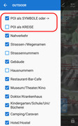
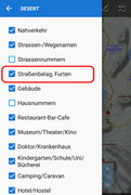
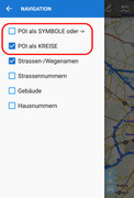
  • When one understands the map making process you can adjust/add/remove/consolidate tags for your purposes. Therefore, the current OpenOutdoorMaps have differences compared to other maps. I. e. there is more detail information on parking areas, road access and so on.
  • Since I am using a rather old device I was interested in maps with smaller file sizes. This is the reason why I omitted tags which are not interesting for me. In this way the OpenOutdoorMaps are considerable smaller in file (storage) size.

Choose any map you like and be happy.
The following users thanked this post: Tapio, T-mo, Magellan
#2
Just to mention. I have generated a few maps for the northern alps region. You will find download links here:

https://www.maiwolf.de/openoutdoormap/index.html#karten

There are maps for:
TEST (part of upper Bavaria)
Bayern (Bavaria)
Baden-Württemberg (Baden-Wuerttemberg)
Österreich (Austria)
Schweiz (Switzerland)

The following users thanked this post: Magellan, LocusUser#1
#3
In many weeks of testing I have developed a Windwos batch script to generate maps for Locus which are very close to maps probided by OpenAndroMaps. This script enables you to generate a topographic map for any area of the world.

The script and all necessary software will run on a "normal" Windows 10 PC. All details will be found on my website. Although the website is in German, you can translate the most parts easily and the script inself is mostly in English. You will find download links for the map-generation-script, all necessary other scripts and download links for all software packages.

The maps generated with this script will be named OpenOutdoorMap (OOM) . There is also a test-map for download.

https://www.maiwolf.de/openoutdoormap

I am happy to get any feedback und suggestions.

Regards
Bernard
The following users thanked this post: balloni55, 0709, Tapio, Magellan, Andrew Heard, LocusUser#1, Viajero Perdido, jonny.blue, ThomasSc
#4
It might help to clean temporary data in Locus (in settings > various). Some time ago I had the same problem. The new theme name is quite similar to the old name and Locus keeps the name in some not obvious storage place.
In my case, I even downloaded and installed Locus freshly. But I can assure you, that it is not a problem of the theme. I have theme running on several devices without any problem.
Regards,
Bernard
The following users thanked this post: Viajero Perdido
#5
To the Locus and OpenAndroMaps community,

I have generated big updates for my OpenAndroMaps Locus themes. The new themes "Outdoor" and "Desert" will replace all my previous themes (outdoor, desert, navigation, outdoorV4, desertV4).
The themes got many new features, improvements and corrections. You will find more details on my website www.maiwolf.de/locus/ [in German]. There is now also an online legend for the themes as well as a PDF download version of the legend.

Always download the newest version on: www.maiwolf.de/locus/

I am happy for any comments, suggestions and ideas. I will try to constantly improve the themes in the future.

Bernard
The following users thanked this post: Magellan, Andrew Heard, Viajero Perdido, jonny.blue, poutnikl, Enigma
#6
Dear Viajero,

you are right. The combination of highway=path and tracktype=* (means some value is given) is so far not displayed in my V4 themes.
According to the openstreetmap wiki this combination should not be used:
https://wiki.openstreetmap.org/wiki/Tag:highway=path?uselang=en-US
I think the mentioned definition is useful: a way is either a track or a path, but not both.

But, as long as nobody else complains, I have adjusted the outdoorV4 and desertV4 themes to display this strange combination (I have tested it on the Alberta_ML map). The update in on my website: www.maiwolf.de/locus

Regards,
Bernard
The following users thanked this post: Andrew Heard
#7
To the Locus and OpenAndroMaps community,

I finally adapted also my "desert" theme and created a new "desertV4" theme, which can be used with the new multi-language mapsforge V4 OpenAndroMaps. It is compatible only with these new maps!
Please take the theme as a draft. I am happy for any comments, suggestions and there will be constant improvements.

Download the newest version on www.maiwolf.de/locus/

Bernard
The following users thanked this post: Tapio, Andrew Heard, Viajero Perdido, flyingman_ch
#8
Dear Viajero,

the display of a cycleway as part of a mixed-use trail (or path) is just an overlay in addition to the trail (path) display itself. To show it more clear I have set the cycleway a bit more transparent and moved it just a tiny bit away from the actual trail (path) display. Maybe this helps. As a cyclist I definitively want to see the cycleway even if it is "misclassified" as "highway=path" + "bicyle=designated".

The change version is on my website (I have double checked).

Regards
Bernard
The following users thanked this post: tramp20, Viajero Perdido
#9
Dear all,

I was able to generate a new version of the "outdoor" theme suitable for v4 maps. Please have a look here:
https://forum.locusmap.eu/index.php?topic=6551.0

The conversion of the "desert" theme is under way.

Reagards,
Bernard
The following users thanked this post: tramp20, Andrew Heard
#10
Dear Viajero,

thanks for the screenshot.
I think I have understood your request. I have found a fix and placed a new version on my website (www.maiwolf.de/locus/). Please check it out.

Regards,
Bernard
The following users thanked this post: Viajero Perdido
#11
To the Locus and OpenAndroMaps community,

after many try-and-error runs I was able to adapt my "outdoor" theme and create the new "outdoorV4" theme, which can be used with the new multi-language mapsforge V4 OpenAndroMaps. It is compatible only with these new maps!
In general, I have tried to make the theme identical to the existing "outdoor" theme. Due to problems with many tags used for the configuration of font sizes and priorities, many small changes had to be made. You will find more details (i. e. which tags had to be ommitted) an my website www.maiwolf.de/locus/ [in German].
Please take the theme as a draft. I am happy for any comments, suggestions and there will be constant improvements. Maybe, I will adapt in the future also my existing "desert" theme.

Download the newest version on www.maiwolf.de/locus/

Bernard
The following users thanked this post: Menion, Magellan, Andrew Heard, Viajero Perdido, poutnikl, flyingman_ch, ciclolars
#12
Dear Andrew and Henk,

I have invorporated your ideas. Please find the new versions on my website (see on top).

Regards,
Bernard
The following users thanked this post: tramp20, Henk van der Spek, Andrew Heard
#13
To all users of Locus and Openandromaps,

I have just published some major updates for my themes "outdoor" and "desert" and added the new theme "navigation". You can find some description (in German) and the downloads also on:

www.maiwolf.de/locus/
Please use always my website to download the NEWEST version of the theme!

Here a brief summary of changes:
- the 3 themes use a common backbone, meaning in general they use the same styling and symbols
- they differ in zoom levels, detail levels and amount of selectable features
- they can be used in parallel on the same device
- all symbols (nearly) are now switched to svg (scalable vector graphics)
- the most predominant symbols can be switched to be only small circles to not overpopulate and confuse the map
- the "navigation" theme is thought to be used for car navigation and shows road bigger but leaves off some other elements (i. e. elevelation lines)

Feel free to use them and send me feedback.
I am constantly trying to improve these themes.

Regards

Here are some screenshots and the themes for download.

Theme icons which show up in Locus:


The "outdoor" theme:


The "desert" theme:


The "navigation" theme:


The following users thanked this post: gynta, Henk van der Spek, Magellan, flyingman_ch, ThomasD.
#14
Dear friends of the openandromaps and the "outdoor" theme,

about a year ago I have published my "outdoor" theme. Since then I have made many changes to the theme and developed a version specifically useful for lower polulated areas. I have called it "desert" because most ideas came to me on a trip in Namibia. All features and designs are equal in both themes, most differences are only in the zoom-level appearance and font-sizes.

Again the themes concentrate on details needed special for a variety of outdoor activities (water sources, drinking water taps, supermarkets, bakeries, hostels, campgrounds, as well as alpine huts and via ferrata). The themes also show ski slopes and sledding areas.
They are also enhanced for the usage during a city trip using public transport. I. e. they will show subway lines (blue) and tram lines (green), each with all stations.

Enjoy.

UPDATE: The outdoor theme is now called outdoorX!
=> Both themes are now exclusively found at:
http://www.maiwolf.de/locus


.
The following users thanked this post: Magellan