Menu

Show posts

This section allows you to view all posts made by this member. Note that you can only see posts made in areas you currently have access to.

Show posts Menu

Messages - voldapet

#391
Dobrý den,
omlouváme se za pozdní odpověď - váš příspěvek jsme přehlédli. Nicméně k problému. Předpokládám, že se Vám jej nepodařilo vyřešit. Mohl bych Vás prosím požadat např. o screenshot označené oblasti, kterou chcete stahovat, abychom problém nasimulovali. Ještě se zeptám: maximální měřítko, které jste potvrdil bylo 15? Nepotvrdil jste například i stažení měřítka = 16?

Děkuji
Petr V.
#392
OK thank you! :) So the winner is:
"Locus - Outdoor Navigation - (nicht nur) für Geocaching"
#393
Hi Guys,
can I ask you for help with one translation to German? We're preparing banner for Geocaching event (GPS Maze). Banner will contain one main phrase - something like:

Locus - Outdoor navigation (not only) for Geocaching

My translation (with translator):
Locus - Die touristische Navigation (nicht nur) für Geocaching

Would you please correct me, rewrite it or completely change it.
Thank you!
#394
Maps / Re: New vector maps for Locus - feedback
March 19, 2015, 08:01:23
It's little bit complicated (as jusc wrote). Auto loading would make sense if Locus would support only one own map. But users often use some own custom maps. Even different maps for the same area. For this reason it would complicated to create good logic for auto-loading personal and vector maps.In addition there is also technical complication.

About the resolution of vector maps. I don't know where you downloaded the maps. Users often download them from OpenAndroMaps page and I guess that these maps contain almost the same data as maps from Locus store. BTW you can download first three vector maps from Locus store for free. So you can check the "resolution" And finally only way how to pay in Locus store are Google InApp Billing payments.
#395
Maps / Re: New vector maps for Locus - feedback
March 18, 2015, 13:27:58
Hi,

do you mean that you can see white tiles (rectangle) in the middle of some vector map? If yes, would you please send me the screenshot or name of the broken map?
Hovewer Locus has  auto-load feature for vector map - see: Menu > Settings > Map -advanced >Vector maps > Map auto-load. If you enable it, Locus automatically loads map on the border (if exists).

Unfortunately Personal maps and Vector maps are "separated" at this moment. It means that Locus can automatically load only vector map or only personal map. It's not possible to combine automatic loading personal and vector maps.

German versus Bavaria maps. I'm sorry but all vector map have the same resolution and all maps contain the same data (if you use vector maps from Locus Store)
#396
Maps / Re: OSM-FR
March 12, 2015, 08:54:42
Quote from: Chon on March 09, 2015, 12:24:24
Hello,
any news from OSM-FR ?

Well there is a response from OSM-FR admins:
"I afraid our single server will not be able to handle the additional load.
We are planning to reorganize our tile server in the coming months so
come back and ask us again let's say around july...
"

So maybe later :)
#397
Interní témata jsou zadrátované v aplikaci, aby bežný smrtelník nemusel zkoumat, že vůbec nějaké soubory s tématy existují.
Témata jsou xml soubory, které je možné editovat. Můžete si stáhnout i externí témata vytvářené komunitou a upravovat je k obrazu svému: http://forum.locusmap.eu/index.php?board=40.0 Případně starší verze interních témat je ke stažení http://docs.locusmap.eu/lib/exe/fetch.php?media=manual:map_tools:locus_internal_themes.zip
#398
10L je zkratka pro LoCoins - jedná se o virtuální měnu určenou pro nákupy v Locus Store. 100L = 1euro + DPH,  tedy 100L je cca 32Kč. Důvodem virtuální měny je cena map. Některé mapy stojí např. 5L tedy ani ne 2Kč a takto malé transakce Google Play nepodporuje.

Co se týče tlačítek: něco už naznačil menion, ale tlačítka jsou bohužel potřeba. Navíc "Přidat online mapu" je až na konci seznamu map, je to skutečně takový problém?
#399
Ahoj,

ta položka v online mapách má zásadní význam. Omlouvám se, ale přidávat nastavení kvůli této jedná položce je zbytečné komplikování již tak přeplácaného nastavení. Krom toho "Menu > Store" a "Online > Přidat další" jsou částečně odlišné. První navede do základní struktury, ale druhé přímo do seznamumožných online map.

40L nebo 10L je cena za mapu

#400
@Kona
well, fort in Poznan has tag layer=-1 it means that it lays under ground. For this reason is park (the green area) rendered above the fort. You can even see the name of fort because position of labels is not influenced by layer tag.

We're facing to the some problems with tunnels or water streams. We use some workaround for mentioned elements but not for the building or forts.
The only way is to make forests or parks little bit transparent. On the other hand transparent forest areas cause another issue in Slovakia. Some forest areas are overlapped and result is different colour for overlapped regions. So it's little bit complicated to solve it. I mean it is possible but it could cause another complications...
#401
Hi,

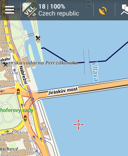
Good point with names of bridges - implemented.
Fixed subway stations and bridges with names will be available in next Locus version (release probably next week).

#402
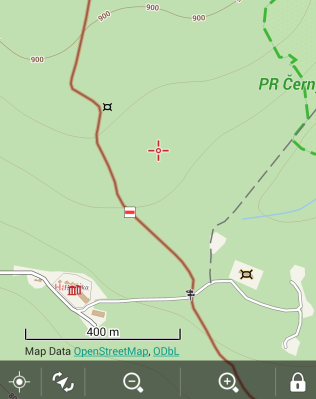
To klidne otravuj(te). Ostatne to neni otravovani, ale vylepsovani a to je dulezite. Jeste k bunkrum...jeste budou chtit vylepsit protoze u stavajicich map nedokazu oddlisit velky bunkr od ROPiku. To ovsem bude mozne az u dalsiho update samotne mapy.
#404
Barvy linii jsou v vetsinou v OSM datech uvedene, ale momentalne je nedokazeme obecne prenest do vektorovych map
#405
Linie metra a vstup budou v pristi verzi - viz screenshot.Co se tyce barvy tras, tak to bohuzel jednoduse momentalne nepujde. Bunkry asi az pozdeji :)