Menu

Show posts

This section allows you to view all posts made by this member. Note that you can only see posts made in areas you currently have access to.

Show posts Menu

Messages - jusc

#1
Quote from: jusc on November 10, 2023, 16:01:41Hello everyone,

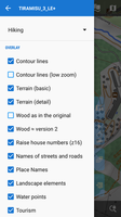
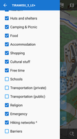
some time ago I had developed a theme for the V3 vector maps. I would now like to start developing a theme for the V4/V5 maps
At that time, I remember that there were special functions that could only be used with Locus.
...
Is this still available for the V4/V5 maps?
The simple answer is "No".
But curve="cubic" and text-orientation="left" (etc) have been adopted into the Mapsforge renderer that Locus now uses.
The following users thanked this post: jusc
#2
Oh, lovely. A quick test with your Autobahn example: bg-rect not working 😭 OAM MF V5 map.
The following users thanked this post: jusc
#3
V1.2 mit Christians OAM-Vektor-Karten vom Nov. 2023 - für Europa - als Hintergrund (ZL 8+) ist jetzt online, als direkte Downloads und als Torrents.
The following users thanked this post: jusc
#4
As best I can recollect:
In Inkscape
- Ungroup everything [Objects]
- Simplify paths until just before the drawing visibly distorts [Path]
- Clean up document [File]
- Save as Plain SVG [File]

In SVGCleaner
- Use defaults

But I don't know which are the key steps. It was just trial and error for me.
The following users thanked this post: jusc
#5
@menion
Did you not change the SVG engine at some stage? I remember I had trouble in the past making sure my SVG icons were sufficiently simplified to work in Locus. I think that changed at some point, unless I just simplified them myself in Inkscape as a matter of course.
The following users thanked this post: jusc
#6
Right. We try to sum info about this issue in our manual here.
The following users thanked this post: jusc
#7
It sounds like an aggressive power saving mode on the S23. Many people report such experience. I'd investigate Android power saving settings.
The following users thanked this post: jusc
#8
Quote from: jusc on September 28, 2019, 12:44:31
What is to do? Doesn´t the  features of the Locus V3 rendering engine work any longer?
Is there any description for Locus themes of all tags I can use?
Locus uses the standard mapsforge engine for maps V4 and higher. As the Locus extensions were never ported back to mapsforge, they can't be used.
I made a reference which tags are supported by which mapsforge version here:
https://www.openandromaps.org/en/oam-forums/topic/mapsforge-rendertheme-reference
The following users thanked this post: jusc
#9
Because of another problem, you can download Ver. 3.33.2 here.
The following users thanked this post: jusc
#10
Source: Tiramisù 3.0.2 for Oruxmaps and MapsForge compatible applications
http://tartamillo.wordpress.com


**********************************************************************
*  Great thanks Maki for such a Grand work and a sense of beauty!  *
**********************************************************************


Now able to work in Locus. Some layers have been added. This theme is only for maps version 3. (lomaps and other V3)
Redone the "scrub", now this is a clarified version of the forest from version 2.
The "wood" is now correctly displayed taking into account the type of foliage and has a different shade, for example, coniferous - darker. Increased object signatures, house numbers, regrouped layers
and many many other small things ....

[ 
Satellite map  + overlay Lomaps with the included layers of tourism and huts only ... everything else is off

Updated to 3LE+5 (12/02/2018):
- slightly increased the visibility of the trails
- buildings names in Place Names
- underground waterways
- intermittent streams and rivers (OAM only)
- embankment's  (OAM)
- and the little things are different
The following users thanked this post: jusc
#11
Hi! Long time, no see :)
I tried to find the answer to my problem, but couldn't.

So the problem is that I have an OSM map of Finland, and the "Voluntary Hike UK" theme works fine with it. Then I got a very detailed map of Finland (http://kartat.hylly.org/), but it requires the use of a different theme.

I moved the new map into a new folder, but still when I select a theme, it is used on both maps, and they are not compatible :(

So how can I choose one theme for an OSM map and a different theme for this new map?

TIA, stebu
The following users thanked this post: jusc
#12
See the new profile set based of template v2.5.5
https://github.com/poutnikl/Trekking-Poutnik

The above mentioned bug is fixed, and there is introduced new parameter
assign   StrictNOBicycleaccess  0 # 0 allows but penalizes foot only access / 1 forbides foot only access.

there is n ot yet an extra profile set to use the flag, will be introduced later.
It must be changed manually for now.
The following users thanked this post: jusc
#13
um besser Auskunft geben zu können habe ich heute auf meinem alten SGS2 CM 13 :D
Locus und BRouter komplett gelöscht, wieder neu installiert und eine neu fat32 formatierte SD eingesetzt.
hab dann zuerst auf der externen SD die Ordner angelegt, siehe SS
Als nächstes die externen  Pfade angelegt, siehe SS
- download einer Karte aus dem Store mit Höhendaten, Karte wurde auf der ext SD unter mapsVector und die Höhendate auf der ext SD unter data_strm ohne weiteres Zutun gespeichert
- ein Test Backup landete auch im richtigen Ordner auf der ext SD


als nächstes werd ich versuchen die "segments4" von Brouter auf die ext SD zu verschieben und die storageconfig.txt ändern, mal sehen ob das auch funktioniert

EDIT:
auch das funktioniert ;D
zuerst auf der ext SD einen Ordner "brouter_segments4" angelegt,
als nächstes auf der internen SD, wo BRouter installiert sein muss  die "storageconfig.txt" geändert, Achtung das # muss entfernt werden! anschließend gespeichert !!, siehe SS

nun die Datenfiles von der internen SD auf die ext SD in den "brouter_segments4" Ordner verschoben
Nach einem Neustart des SGS2 funktioniert das routing  perfekt 8)
The following users thanked this post: jusc