Main Menu
Menu

Show posts

This section allows you to view all posts made by this member. Note that you can only see posts made in areas you currently have access to.

Show posts Menu

Messages - nIgel

#1
Ok, thanks for that.
Since I have root I did install SysLog (https://github.com/Tortel/SysLog) now and hope to remember to use it, if the problem appears again (the aformentioned tunnel is 100km far from home).
#2
Nothing fancy, just a simple red line.

... but GC Livemap didn't update the screen with new caches too. Only after the mentioned zoom in zoom out action. Though cursor and map did update.
#3
Sorry for this late feedback I normally don't pass the tunnel where the error happend.

Second test today revealed problem persists even with changes in the accuracy but I saw that I forgot to mention that Geocaching4Locus was running with GC Live-map. Zooming in and out brought the red track line back on the screen. While returning I tried the car profile and no track line appeared on the map. So I changed the car profile to "show only part of the track on the map" to optimize the performance and the track showed up on the map and no disappearing of it after passing the tunnel.
So I guess that means it is a performance problem of my phone.
#4
The problem was not, that it didn't record. It did record, just didn't show it on the map. I waited quite some time after the tunnel and had a solid fix. Don't think changing that value will solve it but I'll try.
#5
Thanks for the quick reply, I'll do my best:
PS: Could it be that I overflowed the system while tracking with pedestrian settings while driving a car?
#6
Hopefully writing in the right topic.
Locus Pro 3.55.1
Error with recorded track shown on Mapscreen:
Recorded track is shown red on Mapscreen, that is how it is supposed to be.
After loosing GPS in tunnel track is not shown further on Mapscreen. Had to stop recording and start again to show it:
#7
Gave it a try.
First had some problems with the offroad data, downloading the large German Database via PC and copying it into the relevant directory didn't work but after I downloaded it via Locus everything worked fine and really smooth.

Great one, thanks for implementing!
#8
Quote from: menion on May 31, 2014, 11:45:12
you have to have HARDWARE menu button on your device
Right you are, my stupid mistake.
Was searching this menu-button which is shown in your pic in the upper right corner (Ant manager + 3 vertical dots).
#9
@Menion:
Thanks for the quick response. I was thinking to do this but my problem is that there is no menu-button. To underline this I attached the screenshot in my previous post.
#10
Thanks for the new version.
I'm glad that zooming isn't restricted on rastermaps any more. Helps with geocaching. The rest of the list of features and improvements will take some time to test it.
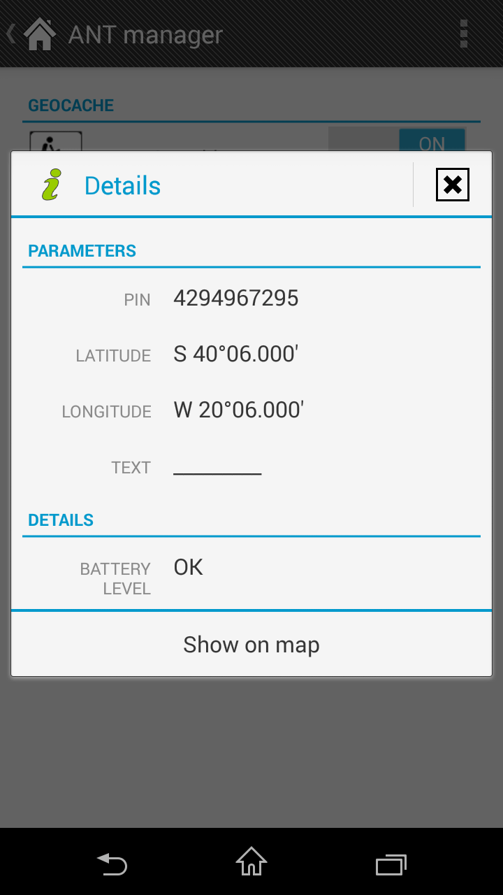
Since I own a device which has ANT+ on board I tested the new CHIRP feature. But couldn't get it working (attached screenshot). Probably a bug relating to my old Android 2.3.4. version? Using the ANT+ Plugin Demo App I had no problems finding a Chirp device.
Device is SE Xperia Mini (ST15i).
#11
QuoteRMAP SQLite ist doch eine Datenbank,oder nicht??
Eine Rasterkarte bei der die einzelnen Kacheln in einer SQLite Datenbank gespeichert sind.

Schau mal hier: //http://www.gps-workshop.de/Digitale_Karten.html

Quotewenn Locus einen automatischen Mapswitch machen würde, wäre das eine ideale Sache

Ich bin mir nicht sicher, ob so etwas geplant ist.
Vielleicht sollte man Menion mal höflich fragen?

Edit:
Ah, da haben wir es ja:
//https://getsatisfaction.com/locus/topics/possibility_for_different_map_source_at_each_zoom_level
Jetzt müßten es nur noch mehr Leute unterstützen, vielleicht interessiert sich ja Menion dann dafür.
#12
Schönes Tutorial!

Ich hätte 2 Anmerkungen:
1) Mobac verwirrt weil es 2 RMAP-Formate kennt, das Eine ist das von Compe, das Andere beruht auf einer SQLite Datenbank. Locus kann wohl beide öffnen, solange die Compe-RMAP nicht verschlüsselt ist. Beide RMAP-Formate sind übrigens Rasterkarten, ich denke Mobac kreiert auch nur Rasterkarten.
2) Wenn ich das richtig verstanden habe, hast dich du dich im letzten Schritt für die SQLite-RMAP Erstellung entschieden, um eine Hypermap mit verschiedenen Zoomstufen zu kreieren (das geht leider aus dem Text nicht deutlich hervor, das Bild läßt es aber vermuten). Allerdings frage ich mich nach eingehender Betrachtung deiner Karte mit den verschiedenen Maßstäben, ob sich der Aufwand und die Datenmenge lohnen. Denn soo groß scheint der Unterschied zwischen den einzelnen Zoomstufen nicht zu sein (zumindest im Auswahlbereich). Mir hätte vermutlich die 25.000 Auflösung gereicht und fürs Grobe dann eine Vektorkarte.

Herrlich verdreht und auch genial finde ich übrigens deinen Ansatz, die Compe-Rmap rückzukonvertieren um sie in Mobac als Tilestore zu nutzen. Ich wußte gar nicht, daß das geht. Zu was man nicht alles greifen muß, weil bestimmte Projektionen nicht unterstützt werden.
#13
Dafür brauchst du kein GSAK Macro.
Es ist etwas anders als beim Garmin aber sehr funktional und du kannst es selbst anpassen. Ich fahre übrigens lieber zu den T5ern.
viewtopic.php?f=42&t=3041
#14
Ozimaptrans wurde vom Verfasser aus dem Netz genommen, da es massive rechtliche Probleme mit den Karteninhabern gab.
Deswegen wird auch in den Foren nicht besonders bereitwillig über dieses Programm geredet, man kann sich aber die Infos erGooglen. Ich würde diese Infos nicht in eine Knowledgebase stellen.
#15
Gute Idee. Danke fürs Bereitstellen!