Menu

Show posts

This section allows you to view all posts made by this member. Note that you can only see posts made in areas you currently have access to.

Show posts Menu

Messages - voldapet

#436
Maps / Re: Downloading maps
December 30, 2014, 08:29:07
@chachi
Offline vector maps are really in "folder" Asamm SW. I only notice that vector maps is better solution for downloading whole countries because have lower size then downloaded maps from "Online" section and there aren't any limits.

To your issue: I have to say: Thank you! You've found the minor bug in Locus internal themes. Primary, secondary and tertiary highways don't show the name of street/road. It'll be fixed in next release.

You can also try some theme for vector maps from community. Vector maps are rendered directly on your device and you can influence their appearance using themes. See http://docs.locusmap.eu/doku.php?id=manual:maps:change_theme_of_vector_map

Some themes for downloading: http://forum.locusmap.eu/index.php?board=40.0
#437
Maps / Re: New vector maps for Locus - feedback
December 25, 2014, 08:24:23
@Raddino
Unfortunately it's not a problem. New themes are prepared for new Locus vector maps that contains also the database of POIs. Some captions aren't shown in new themes because with new map lot's of points are click-able and you can quickly get name by clicking on the POI icon.
#438
Maps / Re: New vector maps for Locus - feedback
December 21, 2014, 17:19:32
@balloni55
would you please check the GPS coordinates where are you centered? I mean... are you somewhere inside the Bayern? Anyway I guess that it'll same issue as mentioned missing tiles?
#439
Maps / Re: New vector maps for Locus - feedback
December 21, 2014, 10:39:38
@jusc @menion
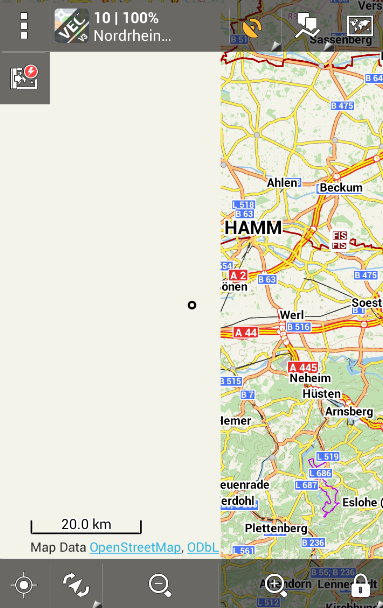
Yes. There is really issue with missing tiles. Have you remember the very old issue that some metatiles contains so much data that wasn't generated properly? I guess that this is the issue. I've tried to generate Northrhine-Westfalia again with different setting of zoom-levels but without success

#440
I only guess that menion wanted to have some own version codes for customized map-writer.. :)
#441
Maps / Re: New vector maps for Locus - feedback
December 20, 2014, 11:13:32
I guess that map and poi DB were downloaded correctly, am I right? It seems that there is something wrong with downloading of elevation *hgt files. Menion we'll check it
#442
@balloni55

map-writer-0.5.0 - this wrong. We're still on map-writer 0.3.0, sorry for it

map-writer-0.5.0 - das ist falsch. Wir sind immer noch auf der Karte map-writer-0.3.0
#443
Other features / Re: Offline POI database
December 20, 2014, 09:49:39
@balloni55

Icon Size
You're probably right. I can remember that I wanted to have POI icon bigger and also with shading effect to show that icon is "different" – in this case click-able. So why not, I think that this is interesting idea.

Never visible icons/pois
You're right that some icons or POIs are not visible because the themes for vector maps. But from my opinion should themes respect some map standards because POIs and map itself are still little bit separated. The question is – do you really need to have on map Fire station? Dentist or veterinary? I don't think so. I guess that we should improve the integration of POI db into vector maps.  For example to have the same icons in the list and on the map, add possibility to turn-on/off visibility of some group of POIs (independent on the theme). Do not hesitate create feature request on help desk and vote for it...

Phones
There were in the first beta version of POIdb. But we've removed them ... let's convince me that public phones are needed  :)
#444
@jusc
I guess that you've probably seen some changes in topic: http://forum.locusmap.eu/index.php?topic=3896.105

However the changes:

  • all units can be defined as pixels or like dp value which respect different resolution of devices
  • dy for lines
  • curve="cubic" for lines that helps to create smooth curved lines (useful for contour-lines)
  • possibility to define symbol-width symbol-height for symbol element

Possible tags: http://docs.locusmap.eu/doku.php?id=manual:map_tools:vector_maps_theme_config
#445
Themes - Vector maps / Re: Theme developing question
November 21, 2014, 15:37:40
Quote from: john_percy
This is just for Symbol, not lineSymbol? Am I correct?
Yes, only for Symbol
#446
Themes - Vector maps / Re: Theme developing question
November 20, 2014, 09:08:39
@Wojtas82

I'm sorry but this is more complicated for us and we aren't able to solve it at this moment. I can only suggest to try join "blue dotted" path into the one long way.

To your proposal about lineSymbol
Unfortunately locus does not support these parameters. But there is small improvement the "symbol" can contain new parametr symbol-width symbol-height. Interesting is also parametr for "line" curve="cubic"  that renders smooth lines. see http://docs.locusmap.eu/doku.php?id=manual:map_tools:vector_maps_theme_config
#447
Themes - Vector maps / Re: Theme developing question
November 11, 2014, 15:26:07
@Wojtas82
Sorry this is tricky part we didn't solve yet (at least as I can remember). OSM ways are cropped  in Mapsforge format into MetaTiles and we're not able to link the same way on two metatiles. For this reason is complicated to compute the "gap" along specific way.  Do you know if MapsForge 0.4v enables such rules?
#448
@JoxM
It's little bit out of topic :) Anyway there is already similar feature request on http://help.locusmap.eu/responses/support_amoled  Unfortunately this ideas is declined at this moment because it's quite difficult to implement it. However you can vote for it :)
#450
OK no problem.
Fixed GPX is in attachment. Again wrong styles in HTML description that does not make sense...