Title: [APP] - version 4.9.+ ( 04/2022 )
Post by: Menion on April 25, 2022, 16:11:17
Post by: Menion on April 25, 2022, 16:11:17
New Locus Map (4) version
Important links
- list of news (https://help.locusmap.eu/announcement/locus-map-version-4-9-25-4-2022) of public versions
- Public versions (http://bit.ly/lmVersions)
- Beta versions (http://bit.ly/lmVersionsTest)
Versions
25. 4. 2022 - Locus 4.9.0
3. 5. 2022 - Locus 4.9.1
6. 5. 2022 - Locus 4.9.2
Important links
- list of news (https://help.locusmap.eu/announcement/locus-map-version-4-9-25-4-2022) of public versions
- Public versions (http://bit.ly/lmVersions)
- Beta versions (http://bit.ly/lmVersionsTest)
Versions
25. 4. 2022 - Locus 4.9.0
3. 5. 2022 - Locus 4.9.1
6. 5. 2022 - Locus 4.9.2
Title: Re: [APP] - version 4.9.+ ( 04/2022 )
Post by: balloni55 on April 25, 2022, 19:28:27
Post by: balloni55 on April 25, 2022, 19:28:27
Hello menion
displaying centered and rotating map
i start PIP from side panel
next i click on "arrow in two directions" inside PIP > main locus window open but map orientation freeze, only compass arrow rotate
Question, when I click on the PIP window it is enlarged for a short time but displayed darkened is there a reason for this
Title: Re: [APP] - version 4.9.+ ( 04/2022 )
Post by: Žajdlík Josef on April 26, 2022, 08:29:22
Post by: Žajdlík Josef on April 26, 2022, 08:29:22
After pressing the back button for the first time on the phone, this warning message will be shown.
Title: Re: [APP] - version 4.9.+ ( 04/2022 )
Post by: Menion on April 26, 2022, 08:41:29
Post by: Menion on April 26, 2022, 08:41:29
@lor74cas
incorrect texts in the notification > hmm, these texts are set once when the task starts and are never updated. Not a simple task to be true :). This notify center is in the queue and waiting for the bigger update, so ...
@joeloc
thanks for the logs related to the app killing. These are logs directly made by Locus Map right? They are useful for some debugging and testing tasks, but in case, the system kills the app, the app has no chance (no time) to write any info about this crash into these logs. So in case, we try to debug some "crash", it is necessary to create a system log (http://docs.locusmap.app/doku.php?id=manual:faq:how_to_create_debug_log) which should be! everything.
@balloni55
It looks like PiP behaves quite different compare to my tests. Still Samsung with Android 11?
@Žajdlík Josef
hmm, maybe something because of the Dashboard you use?
Title: Re: [APP] - version 4.9.+ ( 04/2022 )
Post by: balloni55 on April 26, 2022, 08:43:25
Post by: balloni55 on April 26, 2022, 08:43:25
QuoteStill Samsung with Android 11?yes
Title: Re: [APP] - version 4.9.+ ( 04/2022 )
Post by: Žajdlík Josef on April 26, 2022, 09:20:28
Post by: Žajdlík Josef on April 26, 2022, 09:20:28
Quote from: Menion on April 26, 2022, 08:41:29
@Žajdlík Josef
hmm, maybe something because of the Dashboard you use?
I do not know, but in the previous version 4.8x it did not. I attach Dashborad settings.
Title: Re: [APP] - version 4.9.+ ( 04/2022 )
Post by: lor74cas on April 26, 2022, 14:15:43
Post by: lor74cas on April 26, 2022, 14:15:43
Quote from: Žajdlík Josef on April 26, 2022, 08:29:22No dashboard, but same issue.
After pressing the back button for the first time on the phone, this warning message will be shown.
Not only with back button, but also:
touch icon of layers in the map and than back, same popup.
If you ignore the pop up it does not trigger anymore, but exiting Locus and clearing it from memory, at the restart it cames again.
Title: Re: [APP] - version 4.9.+ ( 04/2022 )
Post by: Tapio on April 26, 2022, 14:31:02
Post by: Tapio on April 26, 2022, 14:31:02
Quotechg: improved system of generating shaping points for recorded/imported tracks loaded to route planner
What's the use case of this, how can this be useful? Just curious... I'd never try route planner on a recorded track. So now I did and it created shaping point #1 somewhere in the middle and some other shaping points somewhere.
So if Locus could algorithmically recreate a route from a recorded track (like BRouter web can do in "Load track as route"), that would make sense... but I don't see that on the horizon.
Title: Re: [APP] - version 4.9.+ ( 04/2022 )
Post by: Menion on April 26, 2022, 14:55:14
Post by: Menion on April 26, 2022, 14:55:14
@Zajdlík Josef, @lor74cas
ah, I probably get it. Not a technical problem you should worry about, just a notification that should not be visible. Fixed, thanks.
@balloni55
Petr just tested it on his new Samsung device and no such problem with PiP as you have. Really interesting. I'll be probably looking on this function a little more later, and because it is not a critical issue, let it be for while, thanks.
@tapio
This change automatically generates shaping points on recorded tracks on places, which should help easily modify the recorded track in the Route planner without a worry, that by movement on a single point, the whole track will be totally changed (as it worked before). If you do not have needs to modify recorded tracks, this feature has no benefit for you ...
Title: Re: [APP] - version 4.9.+ ( 04/2022 )
Post by: Tapio on April 26, 2022, 21:37:38
Post by: Tapio on April 26, 2022, 21:37:38
Kinda interesting. This could, if e. g. there were more shaping points, help recreating a clean track.
Title: Re: [APP] - version 4.9.+ ( 04/2022 )
Post by: CabrioTourer on April 26, 2022, 22:34:39
Post by: CabrioTourer on April 26, 2022, 22:34:39
Interesting new feature to generate shaping points in planner for imported tracks.
I guess it's difficult to find a balance between to many or not enough points.
So I just tried it and found some errors in my example. Just picked one area to show two issues. When you check complete track it's easy to find more.
I imported the attached gpx. Opened it in planner. Then did a recalc with brouter, car-fast.
Title: Re: [APP] - version 4.9.+ ( 04/2022 )
Post by: Andrew Heard on April 27, 2022, 08:09:08
Post by: Andrew Heard on April 27, 2022, 08:09:08
Quote from: Menion on April 26, 2022, 14:55:14@tapio - see my topic (https://help.locusmap.eu/topic/28008-cant-edit-existing-track-in-webplanner-without-triggering-recalculate-all-2) here on equivalent problem with WebPlanner - if the WebPlanner had same functionality as LM4 now has for automatically generating shaping points it would be so much better. This is a very useful Route Planner improvement for any GPX recorded elsewhere (not LM) without Via or other points. Without it, any recalculate-all will often completely change the route.
This change automatically generates shaping points on recorded tracks on places, which should help easily modify the recorded track in the Route planner without a worry, that by movement on a single point, the whole track will be totally changed (as it worked before). If you do not have needs to modify recorded tracks, this feature has no benefit for you ...
Title: Re: [APP] - version 4.9.+ ( 04/2022 )
Post by: Andrew Heard on April 27, 2022, 08:16:36
Post by: Andrew Heard on April 27, 2022, 08:16:36
Quote from: CabrioTourer on April 26, 2022, 22:34:39@CabrioTourer - check out how http://brouter.de/brouter-web allows total user control of balance of points - Load > Load Track as Route > Tuning > Fuzziness slider control - one side very few shaping points, other side of slider - lots of shaping points - no need for system to compromise because user decides - very nice system IMHO.
Interesting new feature to generate shaping points in planner for imported tracks.
I guess it's difficult to find a balance between to many or not enough points.
Title: Re: [APP] - version 4.9.+ ( 04/2022 )
Post by: slarti76 on April 27, 2022, 08:25:57
Post by: slarti76 on April 27, 2022, 08:25:57
Menion, you still looking at this? I checked again with release 4.9.0, but behaviour was the same, apart from map rotation now working.
Oh, and additional thing: Does anyone else notice that the Text-to-Speech setting is reset? I always set it to none (don't want any audio output), but it happened to me at least three times now that after an update, it was active again. And once, I even suddenly had miles instead of km as distance unit.
Nothing severe, just a little worrying that settings change out of the blue, wondering if others experienced that, too...
Quote from: slarti76 on April 22, 2022, 12:00:00Quote from: Menion on April 22, 2022, 11:26:11Guilty pleasure... ;)
@slarti76
Locus & Pokémon GO ;DQuote from: Menion on April 22, 2022, 11:26:11Thanks for the tests! You were really able to resize and move this PiP window fully freely? Weird, it should not be possible.Well, as I said, ratio was fixed, but I could make it much bigger. Is that really not supposed to be possible? I mean, e.g. if I use VLC as pop-up, I can resize it to like 90% of the screen width (but also the ratio is fixed).
Ah, I just realized something: A video is, of course, in landscape - so resizing to full width is possible. Locus was initially 1:1, which obviously also allowed it. Once you changed the ratio to 3:2, it's not possible anymore, because then you could basically resize it the more or less full screen size. So Android doesn't allow it. Of course it's ridiculous why Android forces this on the user, also that snapping to left or right of screen, but we all know Google...
Does that sound like a possible explanation to you? (I don't have a portrait video around that I could try with VLC...)
Anyway, perhaps you could at least let the user choose whether it wants the pop-up in portrait, landscape, or square. Everything after that is Android, and we have to live with it. But 3:2 portrait is very likely not what you want in every situation...Quote from: Menion on April 22, 2022, 11:26:11It is also not possible to define own custom buttons there. For this, you may simply use the split-screen mode of your device, you do not need a PiP.Sure, ok. But then why have that bar at all? As I said, just put the Navi Icon in the upper left and voilà - space saved...Quote from: Menion on April 22, 2022, 11:26:11- map zoom > there should be no changes when switching to PiP, so you should see a zoom visible on current map.Oh, you're right, didn't realize that. However, I had "Automatic Zooming" on, and that doesn't seem to work in PIP - could that be enabled there, too?
Oh, and additional thing: Does anyone else notice that the Text-to-Speech setting is reset? I always set it to none (don't want any audio output), but it happened to me at least three times now that after an update, it was active again. And once, I even suddenly had miles instead of km as distance unit.
Nothing severe, just a little worrying that settings change out of the blue, wondering if others experienced that, too...
Title: Re: [APP] - version 4.9.+ ( 04/2022 )
Post by: 0709 on April 27, 2022, 10:19:15
Post by: 0709 on April 27, 2022, 10:19:15
Quotevery nice system IMHOBut only really VERY valuable if a track glitch detector (prevention) is also provided. And on condition that both the very useful Via and Shaping Planner points are transferred into the gpx file. This nice web planner, especially the version of Marcus with its exceptionally fast updates, loses its "brilliance" because of an insufficiently performant gpx transfer mode. It can be done simply, very discreetly, and robustly. This has been amply demonstrated and tested.
A track glitch decetion and warning may be nice, but you also need to have the right tools to fix it. And you can do that on the condition that you fully respect and preserves the cause of it, namely the planner point(s), and so can thus also reposition them. Therefore both planner points must remain fully supported and available also after and through a gpx file transfer. Since this is the only transfer method for BRouter web, in contrast to the Locus 'Gold' eco system where the exchange is of course more direct. A question of customer loyalty ;-)
Title: Re: [APP] - version 4.9.+ ( 04/2022 )
Post by: CabrioTourer on April 27, 2022, 15:59:13
Post by: CabrioTourer on April 27, 2022, 15:59:13
Quote from: Andrew Heard on April 27, 2022, 08:16:36Quote from: CabrioTourer on April 26, 2022, 22:34:39@CabrioTourer - check out how http://brouter.de/brouter-web allows total user control of balance of points - Load > Load Track as Route > Tuning > Fuzziness slider control - one side very few shaping points, other side of slider - lots of shaping points - no need for system to compromise because user decides - very nice system IMHO.
Interesting new feature to generate shaping points in planner for imported tracks.
I guess it's difficult to find a balance between to many or not enough points.
I'm not sure that I understand what you mean.
Shaping points in my example were created by Locus when I imported a track. . The gpx comes from kurviger.de
The problem I see is that Locus creates the points just by guessing. Without taking the router logic into account the user will use later.
Or at least this is what I assume how it works from my findings. Correct me if I'm wrong.
So with this feauture I have no control where and how many shaping points are created.
I just have the fact that even without any change in shaping points position a recalculate will create different route with many stupid things.
Recalc is the worst case ofc.
The same will happen for a part of the route whenever I move a shaping point or later during navigation when Locus needs to recalculate partialy.
For me such a feature would be a dream. Today I always need to use the route planner manually to create a route which will follow the exact same path as defined by an external gpx.
Maybe I completely misunderstand the usage of this feauture.
Title: Re: [APP] - version 4.9.+ ( 04/2022 )
Post by: 0709 on April 27, 2022, 17:28:02
Post by: 0709 on April 27, 2022, 17:28:02
After importing the gpx into the route planner, some attached Shaping Points are now automatically offered in the Locus route planner. I had a first test...sure works pretty nice usefull.
- By the way, you can also set Via Points as the default in the Locus route planner Settings.
- Only Turn and Via points lead to navigation alerts and give distance values @ navigation.
The planner point placement is random. It's hard to do otherwise since the (recorded) import track NOW is not yet matched with the BRouter osm data.
That will come later and that is precisely the final task that you want to accomplish by using the route planner.
The advantage is, if you now reposition one of the shaping points or create an additional one, you will not suddenly change the entire track loop (based on the imported track) total unexpectedly.
In short, you will only change a small segment at a time, possibly still drastically and unexpectedly ;-)
These unexpected larger deviations are of course also influenced by the selected Brouter routing profile in use. Select this as correctly as possible according to you expected usage.
Now it concerns only a small segment piece and so you have better control of it to produce your route as an "osm map matched track" slowly but controlled this segment by segment.
If you have the original track import then also presented in a different color then you have a perfect guide to accomplish this task quite comfortably.
I see that you also briefly mentioned Kurviger.
In Locus, the Shaping Points are only used as route reference points during the production of a map matched track route traject.
Once in the navigation and also by means of the gpx transfers this useful info is completely neglected and thus almost completely lost.
There is still a residual associated track point left but this is hardly reflected or found in the very large numbers of track points.
If you then also use Locus autorouting to point in the navigation, the useful shaping points are also not available anymore as point targets.
The big difference with the (imo) superior Kurviger results are therefore as follows:
Both the Via Points and the Shaping Points are neatly stored in the navigation as well as in the .kurviger file transfers.
In Kurviger the Via Points AND the Shaping Points are both planner router references as well as Targets in the navigation.
The autorecalculation in Kurviger is always directed to either a Via or a Shaping Point. Ready and clear known targets.
The difference is this.
A Via Point is announced in navigation both by audio TTS as well as visually.
A Shaping Point (= a muted Via Point) is therefore NOT announced.
Promoting a neatly kept Shaping Point to Via Point or vice versa is so very simple
Title: Re: [APP] - version 4.9.+ ( 04/2022 )
Post by: freischneider on April 27, 2022, 17:28:12
Post by: freischneider on April 27, 2022, 17:28:12
Import track into route planner:
I think there has been a lot of discussion in this proposal.
https://help.locusmap.eu/topic/navigation-from-track
If Locus sets the shaping point every 500m (or 200m adjustable). Exactly in the order the track runs.
And if there is a crossing in the distance of x meters. Then Locus sets the point not exactly at 500 meters, but x meters after the intersection.
Title: Re: [APP] - version 4.9.+ ( 04/2022 )
Post by: 0709 on April 27, 2022, 17:37:44
Post by: 0709 on April 27, 2022, 17:37:44
QuoteAnd if there is a crossing in the distance of x meters. Then Locus sets the point not exactly at 500 meters, but x meters after the intersection.How can Locus known there is a crossing before the creation of the new map matched track/route ?
First you can just accept that there is or will be mistakes. This by a trackglitch and thereby creates false instructions and a correcting U-turn. Notice the U-turns are positioned on the exact same location spot as the now map matched Planner (Via or Shaping) resulting trackpoint.
Be happy, so just let it happen. As you the user will be warned immediately ! These trackglitches are now nicely INDICATED by the Locus trackglitch detector tool. (Red circle)
What to do ?
Find the Route planner Point (Via or Shaping) and move this into a favarouble position further on the expected road direction or path, and so the indicator gets cleared now, and also the result will be fine. (Yes the final correction is so still to do by some human planner operator interaction)
Title: Re: [APP] - version 4.9.+ ( 04/2022 )
Post by: Andrew Heard on April 28, 2022, 01:41:55
Post by: Andrew Heard on April 28, 2022, 01:41:55
Quote from: CabrioTourer on April 27, 2022, 15:59:13@CabrioTourer - agree; but still better than no points
The problem I see is that Locus creates the points just by guessing.
QuoteSo with this feauture I have no control where and how many shaping points are created.agree; Brouter - no control over where, but at least allows you to decide on show many
how could an app make an intelligent decision where to place auto-shaping-points?
Quote from: CabrioTourer on April 27, 2022, 15:59:13I think you understand correctly, well same as my understanding at least
Maybe I completely misunderstand the usage of this feauture.
as @0709 says many times, preserving the shaping points within any exported/ imported GPX would be a worthwhile improvement too
Title: Re: [APP] - version 4.9.+ ( 04/2022 )
Post by: joeloc on April 28, 2022, 12:22:04
Post by: joeloc on April 28, 2022, 12:22:04
Quote from: Menion on April 26, 2022, 08:41:29Ok, will do a system log next time. Shouldn't be too long, Locus died twice today already. 30MB zipped is a lot though... Samsung/Google really put a lot in there.
@joeloc
thanks for the logs related to the app killing. These are logs directly made by Locus Map right? They are useful for some debugging and testing tasks, but in case, the system kills the app, the app has no chance (no time) to write any info about this crash into these logs. So in case, we try to debug some "crash", it is necessary to create a system log (http://docs.locusmap.app/doku.php?id=manual:faq:how_to_create_debug_log) which should be! everything.
Did you find out why Locus retries live tracking every second when offline? Doesnt this prevent device sleep and all other good battery saving things? I usually go airplane mode when I need to save battery, this works nicely to shut up all social media crap. But if it makes Locus use more power than less, I have to reconsider this tactic :-)
Btw, thanks for max scale setting per map. Works fine and makes Overlay-Heatmap-Life a lot better.
Title: Re: [APP] - version 4.9.+ ( 04/2022 )
Post by: Tapio on April 28, 2022, 16:28:40
Post by: Tapio on April 28, 2022, 16:28:40
Route Planner. I think the most common thing is inserting shaping points somewhere into a track- and this is a bit too hidden. First we have to go to the three dot submenu, pick "Trackpoint XY", then convert it.
I understand there's the same logic here as on tracks. You toggle between track segment and trackpoint.
The toggling to trackpoint should be bettom left, just like in normal track window. See screenshot - there could be a button "Trackpoint XY". That's my idea. Would follow the same logic as the track window.
Not following the logic, but ultra super mega convenient would be, if all three trackpoint commands ("Change to") were already visible in the orange screenshot area. Because why not - after toggling, the trackpoint screen additionally includes only Help and Streetview. Both are also available in the "Route segment" view. So you could unify and simplify it.
Title: Re: [APP] - version 4.9.+ ( 04/2022 )
Post by: Andrew Heard on April 29, 2022, 01:26:46
Post by: Andrew Heard on April 29, 2022, 01:26:46
Totally agree converting/ promoting an ordinary track point to a Shaping or Via point is unnecessarily tedious at present. It's a very common use case. But we've had this discussion before right ;-(
Title: Re: [APP] - version 4.9.+ ( 04/2022 )
Post by: Tapio on April 29, 2022, 09:02:01
Post by: Tapio on April 29, 2022, 09:02:01
Quote from: Andrew Heard on April 29, 2022, 01:26:46Did we? Probably without Menion, because I feel he'd instantly agree 😁
Totally agree converting/ promoting an ordinary track point to a Shaping or Via point is unnecessarily tedious at present. It's a very common use case. But we've had this discussion before right ;-(
Title: Re: [APP] - version 4.9.+ ( 04/2022 )
Post by: Menion on April 29, 2022, 09:56:31
Post by: Menion on April 29, 2022, 09:56:31
PiP display: it is possible that panel ratio affects resize options. Anyway, this panel was made mainly for navigation. For this case it is optimized and because of this, it is a little higher. I do not see a sense to increase its size close to the full-screen.
Automatic zoom & rotation works for me as well as no glitches as balloni55 wrote above. Sorry, there is not much I may do for now.
Text-to-speech: I did no changes here and also did not noticed any "reset", sorry.
@CabrioTourer
When you create a route in any other web planner, then why do you need to "recalculate" it in the app?
I do not understand what magic you all search here. This small improvement should really help to more easily modify recorded tracks without worry, the whole track will be re-computed. Do not search for something more robust behind this.
Btw. points are not placed randomly! App firstly heavily simplifies track shape, thanks to this detect some places where the shape of the track change a lot and place point there.
Ah, I see, Willy nicely described it here (https://forum.locusmap.eu/index.php?topic=7917.msg67667#msg67667), thanks.
@joeloc
Live-tracking > internally live tracking is close to track recording service. App simply collects data in defined internal and sends them when possible. Live-tracking is running as a service so it keeps the device awake. Use it as is as currently there is no time for a major update.
@tapio
quick change to via/shaping etc ... hmm. I instantly agree :D ... just do it...
Title: Re: [APP] - version 4.9.+ ( 04/2022 )
Post by: slarti76 on April 29, 2022, 12:38:19
Post by: slarti76 on April 29, 2022, 12:38:19
Quote from: Menion on April 29, 2022, 09:56:31I think you meant me ;)
@tapio
Quote from: Menion on April 29, 2022, 09:56:31PiP display: it is possible that panel ratio affects resize options. Anyway, this panel was made mainly for navigation. For this case it is optimized and because of this, it is a little higher. I do not see a sense to increase its size close to the full-screen.No, I agreed, fullscreen makes no sense. But look at my screenshot: Imagine this in >50cm distance while biking, that is basically pointless! Perhaps this is something Samsung-y and not like that on your phone. But for me, it's now useless, whereas in the initial beta I could at least get it to ca. double the width, which makes it usable.
Please add an option to choose ratio (e.g. 3:2, 1:1, 2:3 is enough)!
Quote from: Menion on April 29, 2022, 09:56:31Automatic zoom & rotation works for me as well as no glitches as balloni55 wrote above. Sorry, there is not much I may do for now.Ok, will check automatic zoom again, didn't get around to check it with release version. Rotation works, I can confirm.
Title: Re: [APP] - version 4.9.+ ( 04/2022 )
Post by: CabrioTourer on April 29, 2022, 20:23:14
Post by: CabrioTourer on April 29, 2022, 20:23:14
Quote from: 0709 on April 27, 2022, 17:37:44
.As you the user will be warned immediately ! These trackglitches are now nicely INDICATED by the Locus trackglitch detector tool. (Red circle)
I think I missed something important. How works the "trackglitch detector" ?
Title: Re: [APP] - version 4.9.+ ( 04/2022 )
Post by: CabrioTourer on April 29, 2022, 20:40:44
Post by: CabrioTourer on April 29, 2022, 20:40:44
Quote from: Menion on April 29, 2022, 09:56:31
@CabrioTourer
When you create a route in any other web planner, then why do you need to "recalculate" it in the app?
I'm one of the guide's for Tours which has up to 30 participants. The group is splitted in smaller ones, each is leaded by a guide like me.
The organizer of the tour plans the route with whatever tool. Kurviger in this case. He exports the gpx for the guide's upfront.
Because I find it much easier to have navigation commands just when needed, I replan the gpx with Locus.
Btw: That's just a minor usage of Locus for me.
Title: Re: [APP] - version 4.9.+ ( 04/2022 )
Post by: Tapio on April 30, 2022, 10:22:35
Post by: Tapio on April 30, 2022, 10:22:35
I hate to say that, but that is not an improvement. It's rather indicating that you want to keep the unnecessary sub-window 🙄
EDIT: No, it is an improvement! Before there was a menu appearing.
IMO it would be clearer to understand, if it was accessible via a button bottom left. Like "TP 351", "EDIT Trackpoint"... idk exactly.
Is there a reason why you don't put all on one screen? Faster workflow.
Currently there is no toggle back to segment window.
Title: Re: [APP] - version 4.9.+ ( 04/2022 )
Post by: 0709 on April 30, 2022, 12:29:40
Post by: 0709 on April 30, 2022, 12:29:40
Quote from: CabrioTourer on April 29, 2022, 20:23:14
I think I missed something important. How works the "trackglitch detector" ?
https://t.ly/3M6e
Notice: NEVER place the shaping points on intersections!
There is not much publicity given to this nevertheless useful tool.
It works best with these track files as are produced by BRouter.
https://t.ly/ULDC
Title: Re: [APP] - version 4.9.+ ( 04/2022 )
Post by: Andrew Heard on May 01, 2022, 06:26:08
Post by: Andrew Heard on May 01, 2022, 06:26:08
@menion I'm not sure if of interest/ help, but the attached screen cap was when Cloud Sync button tapped first time. On second time the sync worked OK.
getMinBin$RemoteActionCompatParcelizer, code: 14117
getMinBin$RemoteActionCompatParcelizer, code: 14117
Title: Re: [APP] - version 4.9.+ ( 04/2022 )
Post by: Tapio on May 01, 2022, 12:07:38
Post by: Tapio on May 01, 2022, 12:07:38
I always thought - what do you think - it's hard to spot what's an upper level, what is collapsed, what's expanded?
Title: Re: [APP] - version 4.9.+ ( 04/2022 )
Post by: Viajero Perdido on May 01, 2022, 17:05:18
Post by: Viajero Perdido on May 01, 2022, 17:05:18
Is this new? A track being recorded is drawn over a point pop-up, not under it. This seems undesirable.
Use case: I noticed it after "scribbling a lot of red ink" while looking for a geocache, then trying to find out its name.
 (https://postimg.cc/y3VgqrfX)
Use case: I noticed it after "scribbling a lot of red ink" while looking for a geocache, then trying to find out its name.
(https://postimg.cc/y3VgqrfX)
Title: Re: [APP] - version 4.9.+ ( 04/2022 )
Post by: T-mo on May 01, 2022, 18:46:30
Post by: T-mo on May 01, 2022, 18:46:30
Quote from: tapio on May 01, 2022, 12:07:38this might be on Menion's ToOptimise-List as already noted..
I always thought - what do you think - it's hard to spot what's an upper level, what is collapsed, what's expanded?
current LoPoint-UI is that useful to me to not use it
Title: Re: [APP] - version 4.9.+ ( 04/2022 )
Post by: Andrew Heard on May 02, 2022, 00:07:46
Post by: Andrew Heard on May 02, 2022, 00:07:46
Quote from: tapio on May 01, 2022, 12:07:38@tapio we think very similar
I always thought - what do you think - it's hard to spot what's an upper level, what is collapsed, what's expanded?
Title: Re: [APP] - version 4.9.+ ( 04/2022 )
Post by: CabrioTourer on May 02, 2022, 08:25:08
Post by: CabrioTourer on May 02, 2022, 08:25:08
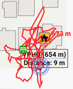
I played a bit with the track glitch detector. To check it I recalculated a route with another router profil.(The route in pictures was generated by BRouter offline)
I would like to ask why the one with the detected glitch was detected and why the three without were not detected. Is it bcs the recalculation isn't fully supported or is there something missing in the detection logic?
I had these two cases multiple times.
I would like to ask why the one with the detected glitch was detected and why the three without were not detected. Is it bcs the recalculation isn't fully supported or is there something missing in the detection logic?
I had these two cases multiple times.
Title: Re: [APP] - version 4.9.+ ( 04/2022 )
Post by: Menion on May 02, 2022, 09:07:01
Post by: Menion on May 02, 2022, 09:07:01
@slarti76
ah, sorry for calling you "tapio". Too many names on my head :).
Your screenshot: yes, it may be pointless. Then do not use it :). If you need a little bigger, but not the full-screen > use split-screen on your device!
@tapio
The button in the bottom left is doable, it just does not fit into the UI for me. I'll think about it, but for now, this is at least a one-tap improvement.
Offline LoPoins > this screen will be written from scratch. Currently, the priority in development is on the online LoPoins system. A little later we will be working on the new database for offline LoPoints together with UI.
@Andrew Heard
14117 means that "App is not yet initialized". Intersting :). Thanks, but let's hope, it won't happen again ...
@Viajero Perdido
ah damn. It is a bigger problem than it may look. Anyway fixed, thanks!
@CabrioTourer
- glitch on the roundabout is interesting, I'll try to simulate it.
- "glitches" on the big route can't be considered a problem. The so-called " Glitch detector" (funny name, thanks Willy), considers problematic parts of segments when they overlap up to 100m. Longer overlaps are currently considered as intent.
---
Btw. did anyone notice the option to create a "Silent Via-points"? There is a new option when creating new via-points during planning. Currently it is a checkbox with label "notify" ;).
Title: Re: [APP] - version 4.9.+ ( 04/2022 )
Post by: Viajero Perdido on May 02, 2022, 21:21:11
Post by: Viajero Perdido on May 02, 2022, 21:21:11
Thanks for the quick fix on the glitch I mentioned. Here's another (sorry), but I don't consider it urgent.
- Solve a geocache puzzle and update the coords on the website.
- In Locus, tap "Update cache". Icon moves as expected.
- Sync happens.
- On second device, cache details show the new coords, but icon still displays at original location. Hiding/showing the entire folder quickly fixes it.
Title: Re: [APP] - version 4.9.+ ( 04/2022 )
Post by: Andrew Heard on May 03, 2022, 05:50:59
Post by: Andrew Heard on May 03, 2022, 05:50:59
Quote from: Menion on May 02, 2022, 09:07:01strange, app had been running for > 10 minutes
14117 means that "App is not yet initialized". Intersting :). Thanks, but let's hope, it won't happen again ...
Quote from: Menion on May 02, 2022, 09:07:01I hadn't noticed - Silent Via-point = shaping point? except Silent Via-point written/ read from GPX file? If true, is there any need for both types?
Btw. did anyone notice the option to create a "Silent Via-points"? There is a new option when creating new via-points during planning. Currently it is a checkbox with label "notify" ;).
Title: Re: [APP] - version 4.9.+ ( 04/2022 )
Post by: slarti76 on May 03, 2022, 08:31:07
Post by: slarti76 on May 03, 2022, 08:31:07
Quote from: Menion on May 02, 2022, 09:07:01That's not comparable, because many apps get screwed up by the then unusual aspect ratio.
@slarti76
ah, sorry for calling you "tapio". Too many names on my head :).
Your screenshot: yes, it may be pointless. Then do not use it :). If you need a little bigger, but not the full-screen > use split-screen on your device!
Is a little expert setting with 3 choices really too much? Sorry for bothering, but I find it a wasted opportunity. Of course, the fault lies with Google and/or Samsung, but I assume you call some system function with a specific aspect ratio, so it shouldn't be such a biggie?!
Title: Re: [APP] - version 4.9.+ ( 04/2022 )
Post by: slarti76 on May 03, 2022, 08:34:04
Post by: slarti76 on May 03, 2022, 08:34:04
And another thing: You never reacted to this post of mine:
https://forum.locusmap.eu/index.php?topic=7885.msg67574#msg67574
I checked it again with release, same result: Slope Shading looks much better, Hill Shading no real improvement.
https://forum.locusmap.eu/index.php?topic=7885.msg67574#msg67574
I checked it again with release, same result: Slope Shading looks much better, Hill Shading no real improvement.
Title: Re: [APP] - version 4.9.+ ( 04/2022 )
Post by: Menion on May 03, 2022, 13:22:08
Post by: Menion on May 03, 2022, 13:22:08
@Viajero Perdido
well, to be true, I prefer direct communication here on the forum, so really no problem. Sometimes it may be useful to post some really specific or private problems over help desk so it won't bother others, but it depends ...
Sync issue: I think I've found a reason for this, thanks.
@Andrew Heard
In short ...
@slarti76
Hill shading: well I see quite a big difference in the shading of your screenshots. I'm comparing 224356 and 224409 images.
well, to be true, I prefer direct communication here on the forum, so really no problem. Sometimes it may be useful to post some really specific or private problems over help desk so it won't bother others, but it depends ...
Sync issue: I think I've found a reason for this, thanks.
@Andrew Heard
In short ...
- Via points: used to define shape during route planning, visible in the list of waypoints, used for recalculation, notified during navigation, exported/imported
- Via points - silent: same as via-points, but not notified by voice announcement during navigation
- Shaping points: used to define shape during route planning
@slarti76
Quotebecause many apps get screwed up by the then unusual aspect ratioOki and this is also the case for Locus Map?
Hill shading: well I see quite a big difference in the shading of your screenshots. I'm comparing 224356 and 224409 images.
Title: Re: [APP] - version 4.9.+ ( 04/2022 )
Post by: Andrew Heard on May 04, 2022, 05:50:51
Post by: Andrew Heard on May 04, 2022, 05:50:51
Quote from: Menion on May 03, 2022, 13:22:08@menion thanks for the explanation; I haven't yet tested, but what advantage do Shaping points have over new Silent Via point? Are new Silent Via point in itinerary list - I hope not, and therefore it would seem Shaping points could be totally replaced by silent points. Silent points are exported/ imported from GPX (I assume). You could remove old Shaping points, and refer to new Silent points as Shaping points. 3 different type of points, with subtle differences, are just asking for endless questions and waste of your support time.
In short ...
- Via points: used to define shape during route planning, visible in the list of waypoints, used for recalculation, notified during navigation, exported/imported
- Via points - silent: same as via-points, but not notified by voice announcement during navigation
- Shaping points: used to define shape during route planning
Another Cloud Sync Whoopsy attached. Code: 14117. Once-off error. I was doing nothing unusual at the time. WiFi enabled > main menu > Cloud Sync. I had turned off the screen so not sure how long it took, but > 10s before error.
Title: Re: [APP] - version 4.9.+ ( 04/2022 )
Post by: slarti76 on May 04, 2022, 08:07:04
Post by: slarti76 on May 04, 2022, 08:07:04
Quote from: Menion on May 03, 2022, 13:22:08No, Locus itself handles that well. It's just the matter of what app you're trying to show Locus together with - I mean, if Split Screen were a perfect solution all the time, we wouldn't need PIP at all ;)
@slarti76Quotebecause many apps get screwed up by the then unusual aspect ratioOki and this is also the case for Locus Map?
Quote from: Menion on May 03, 2022, 13:22:08Hill shading: well I see quite a big difference in the shading of your screenshots. I'm comparing 224356 and 224409 images.That's what I meant: L12 with 200% Zoom still looks better than L13 with 100% Zoom (well, in the screenshot it's 600% vs. 300%, but the principle applies). And for Slope Shading, it's really better after your change, so I really wonder what's going wrong here...
Title: Re: [APP] - version 4.9.+ ( 04/2022 )
Post by: Menion on May 04, 2022, 09:22:30
Post by: Menion on May 04, 2022, 09:22:30
Btw. new version just published on the Google Play.
@Andrew Heard
Do not think about the option to make via-point silent as a third type of point. These points are still via points with tiny options to not notify during navigation, that's all.
Shaping points are a core feature of route planners and I still consider it a very good choice for planning routes, so no changes are planned here.
@slarti76
ah I see it now, thanks. Will be improved in the next app version.
Title: Re: [APP] - version 4.9.+ ( 04/2022 )
Post by: Tapio on May 04, 2022, 11:04:26
Post by: Tapio on May 04, 2022, 11:04:26
"Save as new" in Route Planner: Good, BUT:
Why not just use common behaviour as in most applications, "Save" vs. "Save as..."?
"Save": a) If new+unsaved track, effectively be a "Save as...". b) If editing an already saved track: Instantly save without asking.
"Save as": Ask for name etc. before saving in any case. Take over old name if track was already saved. If using the same name, ie you effectively overwrite, then it should ask for confirmation (currently does not).
Keeping the undo steps (not flushing them) after save is VERY nice to have. At least when allowing save without confirmation. But then it would need to stay in planner obviously.
Title: Re: [APP] - version 4.9.+ ( 04/2022 )
Post by: Tapio on May 04, 2022, 11:13:17
Post by: Tapio on May 04, 2022, 11:13:17
I found a bug.
- Tap a track in track manager
- "Route planner" (button to the bottom right)
- Save, "Overwrite"
- "Route planner" - again
- Cannot do anything on the track
- Tap a track in track manager
- "Route planner" (button to the bottom right)
- Save, "Overwrite"
- "Route planner" - again
- Cannot do anything on the track
Title: Re: [APP] - version 4.9.+ ( 04/2022 )
Post by: CabrioTourer on May 04, 2022, 12:44:44
Post by: CabrioTourer on May 04, 2022, 12:44:44
I understand the 100m rule in glitch detector.
Just an idea to make it better: If the next or prev point is an via point it will not be detected as glitch. If both are shaping points it will.
This will even detect those glitches and the way to tell Locus that it's not a glitch is simple. Just use (silent) via point.
Btw:
I'm using via points mainly to get a voice notification during navigation. I use this to report start and end of a new path I explore now. I use then the "quick point"? dialog to assess the path and make the assessment visible via different point icons.
What about a shaping point with an option to enable voice?
Title: Re: [APP] - version 4.9.+ ( 04/2022 )
Post by: Menion on May 05, 2022, 10:22:08
Post by: Menion on May 05, 2022, 10:22:08
@tapio
"Save in the route planner" > so the only suggestion is to ignore the "Overwrite route?" dialog when saving right? I think it is fine as is :). One small additional step to be sure you really know what to do is worth it.
Bug in the route planner: ah I see it, thanks!
@CabrioTourer
I'm not sure I understand how this may work. Currently, the app detects glitches on all connections between segments. Give me a good reason why some connections should be excluded and I'll do it.
"Shaping points with voice announcement"? Heh. Sorry, shaping points are used only for the setup of the route. They are not easily available out of the route planner screen.
Title: Re: [APP] - version 4.9.+ ( 04/2022 )
Post by: Andrew Heard on May 06, 2022, 09:52:20
Post by: Andrew Heard on May 06, 2022, 09:52:20
Route Planner: is this a bug? certainly not sorted by Distance.
Title: Re: [APP] - version 4.9.+ ( 04/2022 )
Post by: Tapio on May 07, 2022, 07:41:07
Post by: Tapio on May 07, 2022, 07:41:07
Line to nav. target, nice but not yet (color) configurable.
Title: Re: [APP] - version 4.9.+ ( 04/2022 )
Post by: slarti76 on May 08, 2022, 11:49:03
Post by: slarti76 on May 08, 2022, 11:49:03
Quick question about dashboards:
The internal icons are all black, which is not very useful with a darkish gray background for the tiles as I have. No the icons are obviously monochrome, so it should be possible to change color?! Can that be implemented? Or did I overlook something?
The internal icons are all black, which is not very useful with a darkish gray background for the tiles as I have. No the icons are obviously monochrome, so it should be possible to change color?! Can that be implemented? Or did I overlook something?
Title: Re: [APP] - version 4.9.+ ( 04/2022 )
Post by: Joska on May 09, 2022, 22:24:12
Post by: Joska on May 09, 2022, 22:24:12
Hello Slarti
You can use your own icons, i.e. as png-pictures.
Joska
You can use your own icons, i.e. as png-pictures.
Joska
Title: Re: [APP] - version 4.9.+ ( 04/2022 )
Post by: slarti76 on May 10, 2022, 08:35:46
Post by: slarti76 on May 10, 2022, 08:35:46
Quote from: Joska on May 09, 2022, 22:24:12But I want to use the built-in icons, they're fine. I don't have the time to screenshot those and change their color with a paint program. Or search for fitting icons. It's not that I don't like the icons, it's just the color...
Hello Slarti
You can use your own icons, i.e. as png-pictures.
Joska
Title: Re: [APP] - version 4.9.+ ( 04/2022 )
Post by: Tapio on May 10, 2022, 12:16:36
Post by: Tapio on May 10, 2022, 12:16:36
Small UI bug, after clicking continue, then "Delete", the UI does not refresh, still says there's the unfinished download.
Title: Re: [APP] - version 4.9.+ ( 04/2022 )
Post by: Menion on May 10, 2022, 16:20:49
Post by: Menion on May 10, 2022, 16:20:49
@Andrew Heard
it will be probably correct. The problem is in the visible distance below the item title. I'll improve it.
@tapio
"line to nav. target" - ah you are correct. I'll inherit color from the navigation route style
The issue with notification > hmm I'm heavily pushed to the completely new map manager (that was partially done, but never finished), so ... anyway thanks :)
@slarti76
an old problem with the color of icons I've never solved.
I've at least added a quick fix > next time you pick an "Internal icon", it will be colored to match the style of the text.
Title: Re: [APP] - version 4.9.+ ( 04/2022 )
Post by: slarti76 on May 10, 2022, 17:05:36
Post by: slarti76 on May 10, 2022, 17:05:36
Quote from: Menion on May 10, 2022, 16:20:49@slarti76Thx, sounds to me like a perfectly sufficient solution. In the end, that's what I wanted - custom color is not really necessary. Looking forward to it :)
an old problem with the color of icons I've never solved.
I've at least added a quick fix > next time you pick an "Internal icon", it will be colored to match the style of the text.
Title: Re: [APP] - version 4.9.+ ( 04/2022 )
Post by: Joska on May 13, 2022, 09:27:38
Post by: Joska on May 13, 2022, 09:27:38
[/quote]. It's not that I don't like the icons, it's just the color...
[/quote]
What colours, you are surchin for.... ;)
Title: Re: [APP] - version 4.9.+ ( 04/2022 )
Post by: CabrioTourer on May 14, 2022, 12:07:12
Post by: CabrioTourer on May 14, 2022, 12:07:12
Found a bug in time calculation in route planner but don't know what are the right way to send the data to reproduce.
Today I searched for the reason why two nearly identical routes has huge difference in calculated time.
At least I found one.
A part of the route uses a street where I have alread a defined point. When I add this point as via point, the route itself doesnt change. But the time increases by 30 min. I double checked. The length doesn't changed but the time.
I'm using brouter.
If someone from the devs would like to check I can share the data.
But which way of sharing doesn't influences the internal data? My doubt is if we export / import via gpx the effect will be gone.
I'm using cloud sync. In case this is the best way to share please send me an email with steps howTo.
(mzk@libertynet.eu)
P. S.
Can reproduce the same with my second device. Doesn't look like a temporary hiccup.
Title: Re: [APP] - version 4.9.+ ( 04/2022 )
Post by: Tapio on May 15, 2022, 13:10:49
Post by: Tapio on May 15, 2022, 13:10:49
Dashboard, Chart elements: If it is displayed without any text labels, lines should not be displayed as well IMO. You don't know what they relate to, anyway.
Dashboard in general: internal icons on black background are black on black.
Dashboard in general: internal icons on black background are black on black.
Title: Re: [APP] - version 4.9.+ ( 04/2022 )
Post by: Menion on May 16, 2022, 14:12:35
Post by: Menion on May 16, 2022, 14:12:35
@CabrioTourer
problem with times on planner route: may you simply share a start/new middle/end point coordinates with me here + the routing profile you use, thanks.
@tapio
lines in the dashboard ... well at least you may compare values on different places in the dashboard so, from my point of view, they are useful.
Title: Re: [APP] - version 4.9.+ ( 04/2022 )
Post by: Sersus on May 16, 2022, 15:29:14
Post by: Sersus on May 16, 2022, 15:29:14
On Xiaomi with Android 10 Locus Map of course is excluded from being unloaded from memory, from any battety optimisation and it has the permission for using Location service under any conditions.
The app itself also set not to turn fixing off in background, especially during navigation and track recording.
To put it simply, it has exactly the same inner settings and external permissions as Locus Classic has simultaneously in my phone.
BUT. I've been using Locus Map several times and it is constantly lose fix! Sometimes it can work as it should be for a period of time, sometimes it cannot fix even with the screen on for a long time.
Yesterday I decided to cycle with Locus Classic and it worked like a charm.
The typical scenario is using the voice navigation along custom tracks with the screen off.
------
I'm at a loss.
Title: Re: [APP] - version 4.9.+ ( 04/2022 )
Post by: CabrioTourer on May 17, 2022, 15:32:36
Post by: CabrioTourer on May 17, 2022, 15:32:36
Quote from: Menion on May 16, 2022, 14:12:35
@CabrioTourer
problem with times on planner route: may you simply share a start/new middle/end point coordinates with me here + the routing profile you use, thanks.
It's not the same bcs time dropped instead increased but something similar. I hope it will do the job
Import all three points
Goto route planner and select routing offline brouter. Profile fast car.
In route planner make sure default is shaping point.
Plan a route from start to end. It should calculate 1:53h for 84.4 km
Click on via point and choose
--(+)-- (integrate into route)
This will not change route length (still 84.4km) but
calculated time dropped to 1:47h. This should not happen bcs route doesn't changed.
Title: Re: [APP] - version 4.9.+ ( 04/2022 )
Post by: slarti76 on May 18, 2022, 14:53:09
Post by: slarti76 on May 18, 2022, 14:53:09
Quote from: CabrioTourer on May 17, 2022, 15:32:36Well, technically the time should be at least a few seconds longer, because a waypoint is supposedly a stopping point, so you have to break and afterwards speed up again.
This will not change route length (still 84.4km) but
calculated time dropped to 1:47h. This should not happen bcs route doesn't changed.
Ok, joke aside, at least I can understand why the result of the underlying algorithm would not be exactly the same. Of course it makes no sense that it's shorter.
(and yeah, I'm working in the train business, where stop-or-no-stop is quite a factor...)
Title: Re: [APP] - version 4.9.+ ( 04/2022 )
Post by: CabrioTourer on May 18, 2022, 16:49:45
Post by: CabrioTourer on May 18, 2022, 16:49:45
Good point this I forgot. In my original route it will be 30 min longer after adding the via point. Might be because Locus calculates a stop with driver change and waiting for another vehicle to pass ;)
Title: Re: [APP] - version 4.9.+ ( 04/2022 )
Post by: Menion on May 27, 2022, 15:34:44
Post by: Menion on May 27, 2022, 15:34:44
*** New Beta 4.9.2.2 *** just published.
Maybe some of you noticed new texts for translation on the Crowdin related to the "NTRIP client". This is something I worked on during last two weeks. It was made mainly for the Locus GIS, but if someone here is skilled to use it, we may discuss about it ;).
Anyway in the Beta: mainly some fixes + a nice new selector for offline LoRouter segments download.
@Sersus
I'm really sorry, but I have no idea how to help here. In case, you use the same setup for both apps, there is nothing more I may do as both apps share identical source code for handling GNSS in the device. All that remains is the black box in the Android > own internal logic that decides which app should be killed.
@CabrioTourer
hmm, I was fixing a few days ago minor issue in separating of tracks and seems that when I use your data for the test, I get correct results now (no change in the time). So maybe try it again with the next version, but for me, it looks like the issue is fixed now. Thanks!
Title: Re: [APP] - version 4.9.+ ( 04/2022 )
Post by: luce on May 27, 2022, 21:58:30
Post by: luce on May 27, 2022, 21:58:30
The offline LoRouter segments downloader is great!
Title: Re: [APP] - version 4.9.+ ( 04/2022 )
Post by: Andrew Heard on May 28, 2022, 05:32:37
Post by: Andrew Heard on May 28, 2022, 05:32:37
I notice change in UI terminology
- route (existing) > re-route
- track editor > repair
Title: Re: [APP] - version 4.9.+ ( 04/2022 )
Post by: balloni55 on May 28, 2022, 19:14:07
Post by: balloni55 on May 28, 2022, 19:14:07
"visible and all waypoint in Geocache overview"
for me only count of visible WPTs are displayed, see SS
"NTRIP client"
where is this feature hidden?
for me only count of visible WPTs are displayed, see SS
"NTRIP client"
where is this feature hidden?
Title: Re: [APP] - version 4.9.+ ( 04/2022 )
Post by: Viajero Perdido on May 28, 2022, 20:01:05
Post by: Viajero Perdido on May 28, 2022, 20:01:05
Quote from: Andrew Heard on May 28, 2022, 05:32:37
track editor > repair
Hmm. "Repair" suggests the track is broken or invalid. May I suggest "Adjust" or "Modify", or even "Fine-tune"? (I assume "Edit" is already taken by a different function, right? I haven't looked at the beta.)
Title: Re: [APP] - version 4.9.+ ( 04/2022 )
Post by: Andrew Heard on May 29, 2022, 00:09:04
Post by: Andrew Heard on May 29, 2022, 00:09:04
Quote from: Viajero Perdido on May 28, 2022, 20:01:05@Viajero Perdido - good point - I did actually wonder (worry) whether my route was broken when I first read this new "repair" menu item. I like "Fine-tune" even better, but maybe too long? And "Adjust" or "Modify" could apply equally to the Route Editor? It is rather difficult area to keep everyone happy.
Hmm. "Repair" suggests the track is broken or invalid. May I suggest "Adjust" or "Modify", or even "Fine-tune"? (I assume "Edit" is already taken by a different function, right? I haven't looked at the beta.)
Title: Re: [APP] - version 4.9.+ ( 04/2022 )
Post by: slarti76 on May 30, 2022, 08:16:14
Post by: slarti76 on May 30, 2022, 08:16:14
Menion, you can now disregard my previous comment about Map Shading - now in newest beta I can confirm that also the Hill Shading is better in ZL13+, not just the Slope Shading. Thx!
Also, the coloring of Dashboard icons works. In fact, you - on purpose? - made a workaround possible to choose any color for the icons: As they're colored with the current text color, it's possible to choose the desired icon color as text color (e.g. white), then select/reload icon, then choose the (differing) text color (e.g. yellow) - voilà.
@Repair: I, like Andrew, also thought at first something was wrong. I really think, "Repair" has the wrong connotations. And "Modify" was perfectly fine...
Anyway, I experienced increased crashes inEditor Repairer. Can't give you any details yet, but I had several crashes in short order when doing some deleting points or editing points and then moving around in the track with the < and > buttons. Just as a heads up - I will give more info if I can manage to reproduce it, but perhaps you changed something and can already check it...
Also, the coloring of Dashboard icons works. In fact, you - on purpose? - made a workaround possible to choose any color for the icons: As they're colored with the current text color, it's possible to choose the desired icon color as text color (e.g. white), then select/reload icon, then choose the (differing) text color (e.g. yellow) - voilà.
@Repair: I, like Andrew, also thought at first something was wrong. I really think, "Repair" has the wrong connotations. And "Modify" was perfectly fine...
Anyway, I experienced increased crashes in
Title: Re: [APP] - version 4.9.+ ( 04/2022 )
Post by: Menion on May 31, 2022, 17:46:33
Post by: Menion on May 31, 2022, 17:46:33
Hi guys,
@balloni55
Hmm, damn, small display issue ... thanks :-\
And NTRIP is not yet added to the Locus Map app. It was made mainly for the Locus GIS, but I'm asking if even here between you is anyone who knows and uses this and will be interested to give it a try.
Truth is that with this, even a cheap BT device may have a meter (or even better) accuracy. Well, internet connection and access to the NTRIP server are necessary, I know ... as I wrote, just asking.
@Viajero Perdido, @Andrew Heard
hmm and isn't the track editor tool exactly to "Repair" some incorrect recordings or problematic small parts after import etc etc?
...
Anyway, I've rather forwarded this to @Michal and he suggested using a "Fine-tune". So thanks Andrew for the suggestion.
@slarti76
Hill-shading > perfect. Thanks for pushing me into this, I agree it is a great improvement.
Hack with dashboard icons: heh, yes I'm aware of this and not perfectly happy that something like this works. I hope to improve options how dashboard cells are set soon, so maybe this will change a little this year.
Crash: hmm, I'm not aware of any problem, sorry. Steps to reproduce seems to be necessary here.
Title: Re: [APP] - version 4.9.+ ( 04/2022 )
Post by: Jethro10 on June 01, 2022, 19:08:28
Post by: Jethro10 on June 01, 2022, 19:08:28
I found this post on the previous version
@joeloc
Disappearing points: this sounds like a serious issue. There were no changes in the database system for a very long time. Hmm, sorry, no idea.
I also have this, often. I tend to add POI's to a folder called mapping as I walk about to later as to Open Street Map and I'm loosing a lot. Two possible clues.
First it I use the same name I get a message to "ignore and add anyway, etc. Etc." I am using the same name. Eg "Gate Here". A third one of the same name often doesn't ask to ignore and just deleted or overridden one of the previous ones. This certainly happens.
This "may" be if they are very close to each other, it seems to happen more often if they are close, maybe a few metres rather than 100's metres (does the system think it's the same one?)
After the above triggers the fault it seems to just be random and many don't add or may get deleted.
I get home to map what I thought were 20 POIs and I have maybe 7.
At first, being a new user I though it was used error so I may have more info as I use it more now I have some clues.
Jeff
Title: Re: [APP] - version 4.9.+ ( 04/2022 )
Post by: freischneider on June 01, 2022, 21:44:39
Post by: freischneider on June 01, 2022, 21:44:39
@Jethro 10: wrote you a PM. Better way to map in OSM.
Title: Re: [APP] - version 4.9.+ ( 04/2022 )
Post by: baegas on June 02, 2022, 01:22:19
Post by: baegas on June 02, 2022, 01:22:19
It would be cool if the Locus Map included the ntrip client.
I use a mock location app that can connect to the ntrip server separately because of rtk
If you can connect to the ntrip server in Locus Map, it will be convenient because one processor disappears.
I use a mock location app that can connect to the ntrip server separately because of rtk
If you can connect to the ntrip server in Locus Map, it will be convenient because one processor disappears.
Title: Re: [APP] - version 4.9.+ ( 04/2022 )
Post by: Menion on June 02, 2022, 13:44:49
Post by: Menion on June 02, 2022, 13:44:49
I'll forward you to the new topic because the new version was just uploaded on the Google Play. For 25% of users for today, rest during the weekend once I confirm that all works correctly. Version is also on the Google Drive of course ;).
https://forum.locusmap.eu/index.php?topic=7974.msg68027#msg68027
And ...
@Jethro10
if you will be able to simulate this problem in some exact steps, please let me know.
@freischneider
feel free to share suggestions publicly. Maybe just in a separate topic. I'll be really glad if this forum will be about Locus Map but also maps and some personal experiences, not just about the single app ...
@baegas, @balloni55
oki, I'll think about how to do it properly and let you know. For me, it is important that someone is capable to test it ...