Title: [APP] - version 3.17.x (16. 5. 2016+)
Post by: Menion on May 16, 2016, 15:36:07
Post by: Menion on May 16, 2016, 15:36:07
16.05.2016 - Locus 3.17.0 - new version
- Blog post about major version: blog post (http://www.locusmap.eu/news-version-3-17-0)
- Detailed list of news: list of news (http://help.locusmap.eu/announcement/version-3-17-0-16-5-2016)
17.05.2016 - Locus 3.17.0.1 - unofficial beta version
- ...
20.05.2016 - Locus 3.17.0.2 - beta version
- Changes: read news after app starts...
22.05.2016 - Locus 3.17.1 - new version
- Changes: read news after app starts...
22.05.2016 - Locus 3.17.2 - new version
- ...
01.06.2016 - Locus 3.17.2.1 - beta version
- Changes: read news after app starts...
10.06.2016 - Locus 3.17.2.3 - beta version
- Changes: read news after app starts...
18.06.2016 - Locus 3.17.2.4 - beta version
- Changes: read news after app starts...
24.06.2016 - Locus 3.17.2.8 - beta version
- Changes: read news after app starts...
Title: Re: [APP] - version 3.17.x (16. 5. 2016+)
Post by: gynta on May 16, 2016, 21:44:38
Post by: gynta on May 16, 2016, 21:44:38
Option "Dialog" doesn't work.
 (http://postimg.org/image/ijoi7z0lt/)
(http://postimg.org/image/ijoi7z0lt/)
Title: Re: [APP] - version 3.17.x (16. 5. 2016+)
Post by: Menion on May 16, 2016, 22:02:24
Post by: Menion on May 16, 2016, 22:02:24
Hmm and what happen when you select a dialog and then tap on this button? Maybe you work on a simulator (VM) without a compass?
Title: Re: [APP] - version 3.17.x (16. 5. 2016+)
Post by: gynta on May 16, 2016, 22:39:10
Post by: gynta on May 16, 2016, 22:39:10
After choose "dialog" - the button is ghosted.
After tapping, the option "rotate map" is active instead of "dialog"
hm think it works in old versions...
will check it again..
brb...
edit
think it should work in same way like "zoom lock/screen lock/magnifer/dialog" button.
 (http://postimg.org/image/5x5s4tgsx/)
...and here it works.
edit2
have to install an older version to check because last PRO has the same behavior.
edit3
It works with locuspro_343_3.5.3_release.apk
After tapping, the option "rotate map" is active instead of "dialog"
hm think it works in old versions...
will check it again..
brb...
edit
think it should work in same way like "zoom lock/screen lock/magnifer/dialog" button.
(http://postimg.org/image/5x5s4tgsx/)...and here it works.
edit2
have to install an older version to check because last PRO has the same behavior.
edit3
It works with locuspro_343_3.5.3_release.apk
Title: Re: [APP] - version 3.17.x (16. 5. 2016+)
Post by: Christian on May 17, 2016, 00:20:56
Post by: Christian on May 17, 2016, 00:20:56
Updated to 3.17.
Uptdated LoMap "Bayern"
Now i have errors in map rendering :(
 (http://postimg.org/image/idhl1uaxd/) .
  (http://postimg.org/image/f75vkk0y9/)
Uptdated LoMap "Bayern"
Now i have errors in map rendering :(
(http://postimg.org/image/idhl1uaxd/) . (http://postimg.org/image/f75vkk0y9/)
Title: Re: [APP] - version 3.17.x (16. 5. 2016+)
Post by: gynta on May 17, 2016, 00:43:08
Post by: gynta on May 17, 2016, 00:43:08
hm no errors here with new bavaria map
you can try:
-restart your phone
-dl your hgt files again
-clear chache
 (http://postimg.org/image/haaf9zd75/)
you can try:
-restart your phone
-dl your hgt files again
-clear chache
(http://postimg.org/image/haaf9zd75/)
Title: Re: [APP] - version 3.17.x (16. 5. 2016+)
Post by: Andrew Heard on May 17, 2016, 00:45:28
Post by: Andrew Heard on May 17, 2016, 00:45:28
Huge release. Well done.
The update of Locus maps & buying of LoCoins for offline addresses worked perfectly.
I've noticed even more improvements to my "check list" of offline addresses. Streets previously associated with wrong cities have now been fixed.
The update of Locus maps & buying of LoCoins for offline addresses worked perfectly.
I've noticed even more improvements to my "check list" of offline addresses. Streets previously associated with wrong cities have now been fixed.
Title: Re: [APP] - version 3.17.x (16. 5. 2016+)
Post by: Menion on May 17, 2016, 07:18:21
Post by: Menion on May 17, 2016, 07:18:21
@gynta: I think I saw something like this on Genymotion, so I'll try to simulate it
@Christian: ufff, nice. How this may happen ... LoMaps + any internal theme? Isn't it a problem of shading? (try to disable it)
@Andrew Heard: glad to hear it! :)
@Christian: ufff, nice. How this may happen ... LoMaps + any internal theme? Isn't it a problem of shading? (try to disable it)
@Andrew Heard: glad to hear it! :)
Title: Re: [APP] - version 3.17.x (16. 5. 2016+)
Post by: Andrew Heard on May 17, 2016, 08:30:29
Post by: Andrew Heard on May 17, 2016, 08:30:29
I'm pretty sure I've just found a BRouter bug after doing my first actual ride with BRouter navigation. But I'm a little surprised no Locus users have reported the problem, so I could be wrong, and would therefore really appreciate any Locus/ BRouter users to confirm my suspicion please.
Summary: The BRouter GPX file doesn't include a timestamp to associate each <wpt> with each <trkpt>, and so even though Locus correctly displays a blue dot icon for the navigation command, when in navigation mode Locus is unaware these waypoints are part of the track, and no navigation commands occur.
But instead of further explaining here I've done a very long post to the BRouter Google group. Please see what you think. Thankyou (!)
PS (1 day of testing later) - ignore the above text, I will create a new topic with further observations.
https://groups.google.com/forum/#!topic/osm-android-bikerouting/3A8xA6UOhOI
Title: Re: [APP] - version 3.17.x (16. 5. 2016+)
Post by: Christian on May 17, 2016, 08:38:41
Post by: Christian on May 17, 2016, 08:38:41
Quote from: menion on May 17, 2016, 07:18:21Hillshading disabled = problem is gone.
@Christian: ufff, nice. How this may happen ... LoMaps + any internal theme? Isn't it a problem of shading? (try to disable it)
With hillshading it happens to all themes even to internal hiking theme.
It happens also if colouring of altitude in map is active :(
Title: Re: [APP] - version 3.17.x (16. 5. 2016+)
Post by: Menion on May 17, 2016, 09:22:42
Post by: Menion on May 17, 2016, 09:22:42
Hmm very interesting. If same problem happen also for new colouring, that means that there is some problem with interpolation from HGT files. Are you using HGT files downloaded also together with LoMap or some own from different source?
I've just download same LoMap together with HGT files directly over Locus and for my suprise, all works fine. This have to work on all devices same (with same data) as whole shading is my invention and not dependent on any external library or Android version, weird ...
I've just download same LoMap together with HGT files directly over Locus and for my suprise, all works fine. This have to work on all devices same (with same data) as whole shading is my invention and not dependent on any external library or Android version, weird ...
Title: Re: [APP] - version 3.17.x (16. 5. 2016+)
Post by: Christian on May 17, 2016, 10:00:14
Post by: Christian on May 17, 2016, 10:00:14
I deleted all of the srtm files (once downloaded from external website), cleared cache and others, restarted Locus and my phone = problem still exists.
In addition i got this rendering with kind of hillshading and altitude (without srtm files!):
 (http://postimg.org/image/9xp8uttw1/)
Problem with error in rendering happens also to online maps.
Disable hillshading let disappear the error.
Means - error should be in hillshading / colouring module...
In addition i got this rendering with kind of hillshading and altitude (without srtm files!):
(http://postimg.org/image/9xp8uttw1/)Problem with error in rendering happens also to online maps.
Disable hillshading let disappear the error.
Means - error should be in hillshading / colouring module...
Title: Re: [APP] - version 3.17.x (16. 5. 2016+)
Post by: gynta on May 17, 2016, 10:04:21
Post by: gynta on May 17, 2016, 10:04:21
oh.. so next step can be: create backup, reinstall locus
Title: Re: [APP] - version 3.17.x (16. 5. 2016+)
Post by: jusc on May 17, 2016, 16:00:11
Post by: jusc on May 17, 2016, 16:00:11
@menion,
are there any new restrictions to see external themes in the theme selection (overview)?
I can´t see my newest theme, but all older (with other themes more than 60! ;D )
if I copy for test an older "theme".xml into new folder. It works, shows all icons like hike, bike ,city ...
With a trick, change theme with an old xml and copy the new xml into the folder before clicking on hike or bike p. ex. the new theme works, but Ican´t see it any longer in the list.
It´s a Marshmallow phone.
Title: Re: [APP] - version 3.17.x (16. 5. 2016+)
Post by: poutnikl on May 17, 2016, 16:53:47
Post by: poutnikl on May 17, 2016, 16:53:47
Quote from: Andrew Heard on May 17, 2016, 08:30:29Summary: The BRouter GPX file doesn't include a timestamp to associate each <wpt> with each <trkpt>, and so even though Locus correctly displays a blue dot icon for the navigation command, when in navigation mode Locus is unaware these waypoints are part of the track, and no navigation commands occur.
Note that not present timestamps are not issue themselves. As Locus DOES combine waypoints with the track if told so by checkbox in the import dialog.
 (http://postimg.org/image/gfq7nliy1/)
So simple routing works fine . The issue reportedly ( Andrew, 0709 ) occur if the route goes through some trackpoint more times,
therefore there is multiple trackpoints and waypoints with the identical coordinates. ( I cannot yet confirm )
Title: Re: [APP] - version 3.17.x (16. 5. 2016+)
Post by: JoxM on May 17, 2016, 19:57:31
Post by: JoxM on May 17, 2016, 19:57:31
Nice work again, but there is a bug in the geocaching logging section.
If you want to log there is only a single line to write into. Even on a RETURN there is no linebreak.
If you want to log there is only a single line to write into. Even on a RETURN there is no linebreak.
Title: Re: [APP] - version 3.17.x (16. 5. 2016+)
Post by: Menion on May 17, 2016, 20:27:35
Post by: Menion on May 17, 2016, 20:27:35
@Christian: small mystery ... try to clear also a cache on your SD card in /android/data/menion.android.locus.pro/cache/map/shading/hillshading (or something like this).
@jusc: there should be no change. Just check "version" parameter in top of your themes. Version 1 is used for MapsForge V3 maps, version 4 for MapsForge V4 maps.
@poutnikl: yes, agree. In case you will plan route over same place in one route, there is possibility that Locus cause some mess there. Have to improve it ...
@JoxM: ah thanks, I'll check it
Title: Re: [APP] - version 3.17.x (16. 5. 2016+)
Post by: Christian on May 17, 2016, 20:59:58
Post by: Christian on May 17, 2016, 20:59:58
Quote from: menion on May 17, 2016, 20:27:35Sdcard is broken. No card = no cache on card :)
@Christian: small mystery ... try to clear also a cache on your SD card in /android/data/menion.android.locus.pro/cache/map/shading/hillshading (or something like this).
Tomorrow i will buy a new card.
Title: Re: [APP] - version 3.17.x (16. 5. 2016+)
Post by: gynta on May 17, 2016, 21:37:01
Post by: gynta on May 17, 2016, 21:37:01
track export 2 Strava -> typ -> virtual ride = twice
 (http://postimg.org/image/ixzwqjys1/)
edit
...but "WeightTraining" is missing
(http://postimg.org/image/ixzwqjys1/)edit
...but "WeightTraining" is missing
Title: Re: [APP] - version 3.17.x (16. 5. 2016+)
Post by: Andrew Heard on May 18, 2016, 02:57:05
Post by: Andrew Heard on May 18, 2016, 02:57:05
Quote from: poutnikl on May 17, 2016, 16:53:47@poutnikl no my example was just the "general case" of single waypoint corresponding to multiple track points. But it may be "red herring". Real problem is here - http://forum.locusmap.eu/index.php?topic=5119.msg42845#msg42845 (http://forum.locusmap.eu/index.php?topic=5119.msg42845#msg42845).
So simple routing works fine . The issue reportedly ( Andrew, 0709 ) occur if the route goes through some trackpoint more times,
therefore there is multiple trackpoints and waypoints with the identical coordinates. ( I cannot yet confirm )
Title: Re: [APP] - version 3.17.x (16. 5. 2016+)
Post by: bobo20141010 on May 18, 2016, 05:45:18
Post by: bobo20141010 on May 18, 2016, 05:45:18
"MAP SHADING-Enable-TYPE" hoping to multiple choice
Title: Re: [APP] - version 3.17.x (16. 5. 2016+)
Post by: poutnikl on May 18, 2016, 08:04:22
Post by: poutnikl on May 18, 2016, 08:04:22
Quote from: Andrew Heard on May 18, 2016, 02:57:05@poutnikl no my example was just the "general case" of single waypoint corresponding to multiple track points. But it may be "red herring". Real problem is here - http://forum.locusmap.eu/index.php?topic=5119.msg42845#msg42845 (http://forum.locusmap.eu/index.php?topic=5119.msg42845#msg42845).
That is strange, as I got for multiple identical trackpoints multiple identical hint waypoints ( but with different hints ). I just thought Locus interpreted them incorrectly - and Menion confirmed this may be a trouble and will try to fix it.
But I may have got it incorrectly your report.
Title: Re: [APP] - version 3.17.x (16. 5. 2016+)
Post by: jusc on May 18, 2016, 08:32:58
Post by: jusc on May 18, 2016, 08:32:58
Quote from: menion on May 17, 2016, 20:27:35
@jusc: there should be no change. Just check "version" parameter in top of your themes. Version 1 is used for MapsForge V3 maps, version 4 for MapsForge V4 maps.
Thanks, this works, but what was the reason to change it? I never thought about this.
Title: Re: [APP] - version 3.17.x (16. 5. 2016+)
Post by: Menion on May 18, 2016, 08:49:58
Post by: Menion on May 18, 2016, 08:49:58
@Christian: if SD card is broken, then same directory will be in internal memory ;)
@gynta: thank you! Copy & paste issue, second "Virtual ride" is a "Weight training". Such options, crazy ... hike & bike should be enough :)
@bobo20141010: I was thinking about adding some more options to shading ... well we will see interest on our help desk (http://help.locusmap.eu/search/tag%3Ashading)
@jusc: there were some complains that Locus use modified version of MapsForge and do not follow "standard". After long thinking, I decided to insert complete 0.6 version of MapsForge to Locus, but I needed to keep it separate from old system. Not just a map, but also a themes. So in new version of Locus it's separated and you may use maps in V4 format, but only with V4 themes. These themes cannot be used in "older" maps, that use modified version of mapsForge. To be true, main reason here is a simplicity on my side as a developer.
Title: Re: [APP] - version 3.17.x (16. 5. 2016+)
Post by: Christian on May 18, 2016, 09:19:07
Post by: Christian on May 18, 2016, 09:19:07
All subfolders in internal cache are empty.
(Cleared cache yesterday)
(Cleared cache yesterday)
Title: Re: [APP] - version 3.17.x (16. 5. 2016+)
Post by: Andrew Heard on May 18, 2016, 10:25:26
Post by: Andrew Heard on May 18, 2016, 10:25:26
@menion - regards "chg: connection to GPS automatic restart in case of connection troubles" - I have now experienced twice that GPS never starts if the device has been inside with GPS disabled for few hours then I run Locus outside with GPS enabled. The satellite map just sits with nothing on the map forever:
 (http://postimg.org/image/6skfphdvl/)
It makes no difference if I disable > re-enable the GPS from the satellite map.
Only workaround (so far) - drag down Android top notification panel > disable Location > enable Location > then from Locus satellite map disable GPS > enable GPS > then satellites appear as normal, fairly quickly.
(http://postimg.org/image/6skfphdvl/)It makes no difference if I disable > re-enable the GPS from the satellite map.
Only workaround (so far) - drag down Android top notification panel > disable Location > enable Location > then from Locus satellite map disable GPS > enable GPS > then satellites appear as normal, fairly quickly.
Title: Re: [APP] - version 3.17.x (16. 5. 2016+)
Post by: poutnikl on May 18, 2016, 11:36:31
Post by: poutnikl on May 18, 2016, 11:36:31
Regarding GPS troubles addressing...
when I got GPS lock lost, the Locus was happily beeping every 10s until last lock was more then 2 minutes old.
Than I did my verified manual trick ( cca 75% efficiency ) - switching on GPS Locus screen the GPS manually OFF and after 5+ s back ON.
And voila - working again. As I have said before, the OFF interval may matter.
Title: Re: [APP] - version 3.17.x (16. 5. 2016+)
Post by: sabaca on May 18, 2016, 11:46:18
Post by: sabaca on May 18, 2016, 11:46:18
In my Note 3 Locus crashes at startup
Title: Re: [APP] - version 3.17.x (16. 5. 2016+)
Post by: gynta on May 18, 2016, 11:47:35
Post by: gynta on May 18, 2016, 11:47:35
Quote from: sabaca on May 18, 2016, 11:46:18
In my Note 3 Locus crashes at startup
try: http://docs.locusmap.eu/doku.php?id=manual:faq:issue_reporting
Title: Re: [APP] - version 3.17.x (16. 5. 2016+)
Post by: Menion on May 18, 2016, 14:51:26
Post by: Menion on May 18, 2016, 14:51:26
@Andrew: hmm I'm almost sure that my small change should have no influence on this. I may disable it, as it's just one line of code, but it really should work without a problem.
Do you have exact steps I may follow to get exactly same problem?
I'm trying to play with it little bit, but GPS is always turned of correctly in Locus, hmm :/.
EDIT: maybe I've found some weird combination, so next version probably during weekend, thanks
Do you have exact steps I may follow to get exactly same problem?
I'm trying to play with it little bit, but GPS is always turned of correctly in Locus, hmm :/.
EDIT: maybe I've found some weird combination, so next version probably during weekend, thanks
Title: Re: [APP] - version 3.17.x (16. 5. 2016+)
Post by: Andrew Heard on May 19, 2016, 01:11:03
Post by: Andrew Heard on May 19, 2016, 01:11:03
Quote from: menion on May 18, 2016, 14:51:26@menion - something definitely different in 3.17.0. No amount of GPS disable/enable will wake it up. I also tried "GPS Status" app - also dead. Thanks for checking.
@Andrew: hmm I'm almost sure that my small change should have no influence on this. I may disable it, as it's just one line of code, but it really should work without a problem.
Do you have exact steps I may follow to get exactly same problem?
I'm trying to play with it little bit, but GPS is always turned of correctly in Locus, hmm :/.
EDIT: maybe I've found some weird combination, so next version probably during weekend, thanks
Only when I go Android > settings > Location > off > on > will the GPS wake up once in this new "sleep" mode. It seems connected to being in house/ office for long time (hours) that this new problem occurs? Sorry not exact steps yet. These things are often so hard to hunt down. Similar to this one - http://forum.locusmap.eu/index.php?topic=5119.msg42845#msg42845 - first I thought was BRouter/ GPX issue only after hours of testing to change opinion and think it was navigation recalculation=Never issue.
Title: Re: [APP] - version 3.17.x (16. 5. 2016+)
Post by: poutnikl on May 19, 2016, 08:46:59
Post by: poutnikl on May 19, 2016, 08:46:59
Quote from: Andrew Heard on May 19, 2016, 01:11:03......Similar to this one - http://forum.locusmap.eu/index.php?topic=5119.msg42845#msg42845 - first I thought was BRouter/ GPX issue only after hours of testing to change opinion and think it was navigation recalculation=Never issue.Or, Locus navigation API issue - see my latest posts in that thread.
Title: Re: [APP] - version 3.17.x (16. 5. 2016+)
Post by: eldron on May 19, 2016, 19:47:55
Post by: eldron on May 19, 2016, 19:47:55
Hi,
first of all - thanks for finally implementing an offline address search!
I do have a few questions about the new version though:
1) I purchased the map of Germany a while ago (before it was split). Am I correct in asuming that I won´t be able to use the offline address search without purchasing a new map?
2) Is it possible to use the offline address search without downloading a Locus Map? I don´t mind paying for the address database, but I usually use different maps (mainly openandromaps).
3) The changelog states this change: option to colorize map by altitude - where do I find this feature?
Title: Re: [APP] - version 3.17.x (16. 5. 2016+)
Post by: Christian on May 19, 2016, 20:00:11
Post by: Christian on May 19, 2016, 20:00:11
Quote from: eldron on May 19, 2016, 19:47:55Settings / Map advanced / shading
3) The changelog states this change: option to colorize map by altitude - where do I find this feature?
Einstellungen / Karte erweitert / Schattierung
Title: Re: [APP] - version 3.17.x (16. 5. 2016+)
Post by: gynta on May 19, 2016, 20:03:19
Post by: gynta on May 19, 2016, 20:03:19
Quote from: eldron on May 19, 2016, 19:47:55Hello eldron
I do have a few questions about the new version though:1) 2)
please read/reply here for more informations:
http://forum.locusmap.eu/index.php?topic=5016.msg41589#msg41589
Title: Re: [APP] - version 3.17.x (16. 5. 2016+)
Post by: slarti76 on May 20, 2016, 10:51:33
Post by: slarti76 on May 20, 2016, 10:51:33
Menion, thank you very much for the new version, lots of good stuff ;D
A tiny thing I appreciated are the new track icons - but do you think you could come up with one for simple walking (perhaps the hiking guy without the backpack) and snowshoeing (the hiking guy with sticks and some kind of snowshoes on the feet)?
Also, you added categories, like with the Garmin icons. I wonder, as you obviously have the code to do the categories: Couldn't you add this to the display of user icon libraries. I mean, they're ZIPs, so simple solution would be if the ZIP contains directories, these become the category titles and all icons in that directory go into that category. Deeper nested directories don't need to be handled especially, just flatten the structure. I have a lot of icons in many ZIPs, and ordering them like that would be easy without having to create dozens of separate ZIPs instead.
There might be a problem with GPX export and the paths used there, I can imagine - but I would be fine if the directory names would just be ignored for that. Can't have to icons with same name in one ZIP but different directory, then, but that's a conditions I'm fine with.
Is there a chance for that?
Title: Re: [APP] - version 3.17.x (16. 5. 2016+)
Post by: fzk on May 20, 2016, 18:33:59
Post by: fzk on May 20, 2016, 18:33:59
MapsForge V4 maps (language selection in map detail) + V4 themes: All ways and lines are too thick. The map looks unrealistic.
 (http://postimg.org/image/5i3wvgn7l/)
Regards Klaus
(http://postimg.org/image/5i3wvgn7l/)Regards Klaus
Title: Re: [APP] - version 3.17.x (16. 5. 2016+)
Post by: Viajero Perdido on May 20, 2016, 20:15:25
Post by: Viajero Perdido on May 20, 2016, 20:15:25
Interestingly, I can use Locus POIs with OAM maps without even having to do anything.
(There are subtle differences with OAM maps re trail rendering with the theme I use, hence I prefer those maps by a slight margin. But normally I'll choose most-recently-updated, because I'm an OSM editor and am always eager to see my changes.)
- Second-last map I selected was the latest Locus map (finally updated - yay!).
- Last map I selected was the latest OAM map (finally updated - yay!)
(There are subtle differences with OAM maps re trail rendering with the theme I use, hence I prefer those maps by a slight margin. But normally I'll choose most-recently-updated, because I'm an OSM editor and am always eager to see my changes.)
Title: Re: [APP] - version 3.17.x (16. 5. 2016+)
Post by: michaelbechtold on May 20, 2016, 23:32:36
Post by: michaelbechtold on May 20, 2016, 23:32:36
Quote from: sabaca on May 18, 2016, 11:46:18My Note 3 does not crash - what may be the difference ?
In my Note 3 Locus crashes at startup
Gesendet von meinem LG-H850 mit Tapatalk
Title: Re: [APP] - version 3.17.x (16. 5. 2016+)
Post by: Andrew Heard on May 21, 2016, 00:45:10
Post by: Andrew Heard on May 21, 2016, 00:45:10
Quote from: menion on May 18, 2016, 14:51:26@menion - for my testing/ observation - does 3.17.0.2 beta have this fix?
@Andrew: hmm I'm almost sure that my small change should have no influence on this. I may disable it, as it's just one line of code, but it really should work without a problem.
EDIT: maybe I've found some weird combination, so next version probably during weekend, thanks
Title: Re: [APP] - version 3.17.x (16. 5. 2016+)
Post by: Menion on May 21, 2016, 11:45:33
Post by: Menion on May 21, 2016, 11:45:33
@slarti: new icons ... we will see
Special handling of categorized icons make sense, I was thinking about it some time ago. Little harder to create really easy working solution and it also needs quite some time to make it work properly. Probably easier solution should be some XML file inside zip, that should define these categories. Anyway suggest to copy this idea on help desk http://help.locusmap.eu/ , as it's really not task on few minutes and I would like to see if there is some interest or not. Anyway it's doable.
@fzk: well ... and how may I help here? :). I'm just using default settings from MapsForge. Same theme + map with official sample application looks different? Width of lines should be only defined by theme.xml file, isn't it?
@Andrew Heard: yes, change was made already in 3.17.0.2
Title: Re: [APP] - version 3.17.x (16. 5. 2016+)
Post by: Tobias on May 21, 2016, 16:53:38
Post by: Tobias on May 21, 2016, 16:53:38
Quote from: menion on May 21, 2016, 11:45:33Are tiles scaled according to screen density or fixed at 256px? If the latter is true all sizes probably are still scaled but on not enough space, so everything looks too thick on high dpi
@fzk: well ... and how may I help here? :). I'm just using default settings from MapsForge. Same theme + map with official sample application looks different? Width of lines should be only defined by theme.xml file, isn't it?
Title: Re: [APP] - version 3.17.x (16. 5. 2016+)
Post by: Menion on May 21, 2016, 17:03:16
Post by: Menion on May 21, 2016, 17:03:16
Size of tiles is defined in map file itself. So Locus first get information about defined tile size from map header and then use this size to request MapsForge for rendering of tiles.
Title: Re: [APP] - version 3.17.x (16. 5. 2016+)
Post by: Bucky Kid on May 21, 2016, 19:01:12
Post by: Bucky Kid on May 21, 2016, 19:01:12
I have minor problems with maps movement in Locus 3.17.1. Randomly after releasing my finger the map makes a jump in reverse direction than my finger moved so the map control is less efficient.
Title: Re: [APP] - version 3.17.x (16. 5. 2016+)
Post by: Menion on May 21, 2016, 19:13:10
Post by: Menion on May 21, 2016, 19:13:10
Hmm, is this happen with all maps, or just some special map (not downloaded / created by Locus itself)? If it's not Locus based, then same problem was probably also in older versions and unfortunately I'll need such map to fix it. Anyway weird that this happen, I was sure that similar problems are forever fixed ... sorry for this.
Title: Re: [APP] - version 3.17.x (16. 5. 2016+)
Post by: Bucky Kid on May 21, 2016, 19:35:51
Post by: Bucky Kid on May 21, 2016, 19:35:51
So it was probably problem of my OS, after telephone restart map control seems to work as expected. Please ignore the bug report.
Title: Re: [APP] - version 3.17.x (16. 5. 2016+)
Post by: TrulloF on May 21, 2016, 20:57:04
Post by: TrulloF on May 21, 2016, 20:57:04
In 3.17.1 I get the following behavior, which was not present before (see screen shots). Map names don't work as before e. g. Germany North and Germany South are both displayed as Germany etc.
Thank you for looking into it.
 (http://postimg.org/image/a73o1rhdt/)
  (http://postimg.org/image/mkgi8o729/)
Thank you for looking into it.
(http://postimg.org/image/a73o1rhdt/) (http://postimg.org/image/mkgi8o729/)
Title: Re: [APP] - version 3.17.x (16. 5. 2016+)
Post by: gynta on May 21, 2016, 22:42:16
Post by: gynta on May 21, 2016, 22:42:16
what's wrong?
 (http://postimg.org/image/o6xrvvtq9/)
  (http://postimg.org/image/u3x1yylhd/)
(http://postimg.org/image/o6xrvvtq9/) (http://postimg.org/image/u3x1yylhd/)
Title: Re: [APP] - version 3.17.x (16. 5. 2016+)
Post by: Menion on May 21, 2016, 23:00:55
Post by: Menion on May 21, 2016, 23:00:55
Don't ask me guys ... stupid issue in last minutes before release, heh :)
Title: Re: [APP] - version 3.17.x (16. 5. 2016+)
Post by: Tobias on May 22, 2016, 10:30:15
Post by: Tobias on May 22, 2016, 10:30:15
Quote from: menion on May 21, 2016, 17:03:16Standard mapsforge 0.4+ map viewer uses flexible tile sizes, 256px@160dpi,512px@320dpi etc. The renderer scales all elements accordingly. Apps that don't use the map viewer like OruxMaps/BCN are AFAIK using a fixed size for compatibility reasons, like 512px or 256px. That's why I was guessing that's the same with Locus.
Size of tiles is defined in map file itself. So Locus first get information about defined tile size from map header and then use this size to request MapsForge for rendering of tiles.
Title: Re: [APP] - version 3.17.x (16. 5. 2016+)
Post by: john_percy on May 22, 2016, 11:00:39
Post by: john_percy on May 22, 2016, 11:00:39
Quote from: gynta on May 21, 2016, 22:42:16Not just Germany
what's wrong?

Title: Re: [APP] - version 3.17.x (16. 5. 2016+)
Post by: balloni55 on May 22, 2016, 12:56:33
Post by: balloni55 on May 22, 2016, 12:56:33
V 3.17.2
- map naming is solved :)
i didn´t know since when, but yesterday i noticed that after click on "Re-initialize map" i get a black screen and Locus stop after a while.
- map naming is solved :)
i didn´t know since when, but yesterday i noticed that after click on "Re-initialize map" i get a black screen and Locus stop after a while.
Title: Re: [APP] - version 3.17.x (16. 5. 2016+)
Post by: Kona on May 22, 2016, 14:01:28
Post by: Kona on May 22, 2016, 14:01:28
Hi,
Just updated my Locus Pro and my England map name changed into United Kingdom which is wrong.
Similar mistakes were and still are in Locus Store in naming United Kingdom countries.
Great Britain is only England, Scotland and Wales no more.
United Kingdom Includes England, Scotland, Wales and Northern Ireland, also Isle of Man, Jersey, which all should me in the United Kingdom folder.
If Isle of Man and Jersey are as separate maps with flags, England, Scotland and Wales would have use their own flags instead of Union Jack of United Kingdom.
Or maybe one map of United Kingdom might be better idea.
Also Canary Island would use their own flag as it's sold separately from Spain.
Last night my Galaxy S5 updated to Android 6.0 and found some problems with SD card, rendering of maps is pretty slow, where can I find any help about that issue?
Thank you.
Title: Re: [APP] - version 3.17.x (16. 5. 2016+)
Post by: Čelda on May 22, 2016, 15:39:58
Post by: Čelda on May 22, 2016, 15:39:58
Quote from: JoxM on May 17, 2016, 19:57:31
Nice work again, but there is a bug in the geocaching logging section.
If you want to log there is only a single line to write into. Even on a RETURN there is no linebreak.
I confirm that too. Rather unpleasant :-(
Title: Re: [APP] - version 3.17.x (16. 5. 2016+)
Post by: slarti76 on May 22, 2016, 17:12:05
Post by: slarti76 on May 22, 2016, 17:12:05
Quote from: menion on May 21, 2016, 11:45:33I realized that there is already an idea: http://help.locusmap.eu/topic/own-icon-pack-icons-divided-into-groups
@slarti: new icons ... we will see
Special handling of categorized icons make sense, I was thinking about it some time ago. Little harder to create really easy working solution and it also needs quite some time to make it work properly. Probably easier solution should be some XML file inside zip, that should define these categories. Anyway suggest to copy this idea on help desk http://help.locusmap.eu/ , as it's really not task on few minutes and I would like to see if there is some interest or not. Anyway it's doable.
And I already commented on it, sorry I forgot ;)
Anyway, good to bounce that one up - hope et'll be enough for you to consider. Like the XML approach, too!
Title: Re: [APP] - version 3.17.x (16. 5. 2016+)
Post by: Christian on May 22, 2016, 19:17:10
Post by: Christian on May 22, 2016, 19:17:10
Quote from: Christian on May 17, 2016, 00:20:56After a clean reinstall of Locus 3.17.2 it seems that hgt files were corrupted / broken and the cache were poisoned also. Likely i tried to delete the wrong cache (on SDCard) or somewhere else so i could not solve the problem some days ago.
Updated to 3.17.
Uptdated LoMap "Bayern"
Now i have errors in map rendering :(
When i try today to repeat the problem by moving / deleting hgt files while Locus were running the problem occurs again. But the origin problem started when my SDCard were broken. But the hgt files are stored internally. Mystic...
Now it seems ok. Thanx for support.
Title: Re: [APP] - version 3.17.x (16. 5. 2016+)
Post by: balloni55 on May 22, 2016, 19:44:54
Post by: balloni55 on May 22, 2016, 19:44:54
decision "don´t ask again"
- if "yes", decision is stored :) how can i undo?
- if "no", decision is not stored :-[
 (http://postimg.org/image/rvgselddd/)
- if "yes", decision is stored :) how can i undo?
- if "no", decision is not stored :-[
(http://postimg.org/image/rvgselddd/)
Title: Re: [APP] - version 3.17.x (16. 5. 2016+)
Post by: gynta on May 22, 2016, 21:11:41
Post by: gynta on May 22, 2016, 21:11:41
Quote from: balloni55 on May 22, 2016, 19:44:54i'm nor sure now... but is there a word in config.cfg like "gps ... notify..."?
- if "yes", decision is stored :) how can i undo?
Title: Re: [APP] - version 3.17.x (16. 5. 2016+)
Post by: Menion on May 23, 2016, 07:49:46
Post by: Menion on May 23, 2016, 07:49:46
@Tobias: hmm so you want to say that new mapsForge may dynamically change rendered tile size based on defined parameter? So Locus should define as you wrote, till density 320dpi, use 256px, then 512px? I'll look what I may do here, thanks
@Čelda: should be already fixed in last version
@Christian: weird, anyway glad it's solved
@balloni55: "don't ask" results are stored internally and there is no option to reset this settings for now
@Čelda: should be already fixed in last version
@Christian: weird, anyway glad it's solved
@balloni55: "don't ask" results are stored internally and there is no option to reset this settings for now
Title: Re: [APP] - version 3.17.x (16. 5. 2016+)
Post by: balloni55 on May 23, 2016, 08:33:37
Post by: balloni55 on May 23, 2016, 08:33:37
Quote"don't ask" results are stored internally and there is no option to reset this settings for nowok understand
and ?
Quoteif "no", decision is not stored
Title: Re: [APP] - version 3.17.x (16. 5. 2016+)
Post by: voldapet on May 23, 2016, 09:19:18
Post by: voldapet on May 23, 2016, 09:19:18
@kona
- please try 3.17.2 for issue with naming of map
Thank you also for your suggestion about United K., I'll move Jersey and Isle of Man into United Kingdom folder.
The performance - this is more on menion, but he's couple days off.
- please try 3.17.2 for issue with naming of map
Thank you also for your suggestion about United K., I'll move Jersey and Isle of Man into United Kingdom folder.
The performance - this is more on menion, but he's couple days off.
Title: Re: [APP] - version 3.17.x (16. 5. 2016+)
Post by: jusc on May 23, 2016, 11:44:18
Post by: jusc on May 23, 2016, 11:44:18
After a fresh installation of Locus pro I can´t change my cursors. Wrong link? ( to online maps of locus store)
Title: Re: [APP] - version 3.17.x (16. 5. 2016+)
Post by: Andrew Heard on May 23, 2016, 12:08:14
Post by: Andrew Heard on May 23, 2016, 12:08:14
3.17.1 & 3.17.2 have same release notes?
Title: Re: [APP] - version 3.17.x (16. 5. 2016+)
Post by: Menion on May 23, 2016, 17:26:13
Post by: Menion on May 23, 2016, 17:26:13
@jusc: not sure what is wrong. I'm able to change cursors and also download new from store...
@andrew: there were no change that worth it :)
Sent from my SM-G930F using Tapatalk
@andrew: there were no change that worth it :)
Sent from my SM-G930F using Tapatalk
Title: Re: [APP] - version 3.17.x (16. 5. 2016+)
Post by: Tobias on May 23, 2016, 18:52:00
Post by: Tobias on May 23, 2016, 18:52:00
Quote from: menion on May 23, 2016, 07:49:46I just thought that's the reason why lines are too thick in Klaus' example (http://forum.locusmap.eu/index.php?topic=5113.msg43014#msg43014). All render parameters like line thickness are scaled with the device scale factor in standard mapsforge (like with "dp" in Locus fork), even if the tile size is fixed. It looks normal if tile sizes are also scaled by this factor, but more cramped with high dpi if tile sizes stays at 256px.
@Tobias: hmm so you want to say that new mapsForge may dynamically change rendered tile size based on defined parameter? So Locus should define as you wrote, till density 320dpi, use 256px, then 512px? I'll look what I may do here, thanks
There is the standard model with mapsforge viewer that tile sizes are scaled by device scale factor (and rounded to a multiple of 64, see here (https://github.com/mapsforge/mapsforge/blob/03c750a58f744bb4387b95a48e95c094a05fab00/mapsforge-map/src/main/java/org/mapsforge/map/model/DisplayModel.java)), so it's 256px at 160dpi, 384px at 240dpi, 512px at 320dpi and so on.
But other apps are using because of compatibility reasons with their own map viewer fixed sizes at all dpi, e.g. OruxMaps 512px or BCN 256px. So the latter looks similar to Locus with ML maps, the former looks less cramped at the same zoom level.
Title: Re: [APP] - version 3.17.x (16. 5. 2016+)
Post by: jusc on May 23, 2016, 20:00:32
Post by: jusc on May 23, 2016, 20:00:32
Quote from: menion on May 23, 2016, 17:26:13Ok,
@jusc: not sure what is wrong. I'm able to change cursors and also download new from store...
Have I to copy my cursors to internal SD?
Title: Re: [APP] - version 3.17.x (16. 5. 2016+)
Post by: Kona on May 24, 2016, 17:44:53
Post by: Kona on May 24, 2016, 17:44:53
Quote from: voldapet on May 23, 2016, 09:19:18
Thank you also for your suggestion about United K., I'll move Jersey and Isle of Man into United Kingdom folder.
The performance - this is more on menion, but he's couple days off.
I have to apologize you guys, Isle of Man and Jersey actually were placed good separately in Locus Store :P
Isle of Man are dependencies of the Crown and are not part of the UK. Sorry again.
BTW it would be nice to have a nice English, Welsh etc. flags in .map files respectively, using Smart Choice menu.
Title: Re: [APP] - version 3.17.x (16. 5. 2016+)
Post by: gynta on May 24, 2016, 18:10:04
Post by: gynta on May 24, 2016, 18:10:04
Quote from: jusc on May 23, 2016, 20:00:32Hello JürgenQuote from: menion on May 23, 2016, 17:26:13Ok, Have I to copy my cursors to internal SD?
@jusc: ...and also download new from store...
Locus Store isn't able to save the downloaded file into right place?
or cursors are not selectable?
or selecting cursor have no effect?
path is appdir(Locus)/icons/cursors/yourcoursor.zip
but, ...i think, you know it ::)
and what means
QuoteWrong link? (to online maps of locus store)in this case?
Title: Re: [APP] - version 3.17.x (16. 5. 2016+)
Post by: jusc on May 24, 2016, 20:31:37
Post by: jusc on May 24, 2016, 20:31:37
Hi,
Yes Ich found it. ;D
After fresh installation I recognised that both directories on internal and external card were empty.
I wondered, why Locus doesn't offer another directory.
So I copied the cursors from another phone.
Yes Ich found it. ;D
After fresh installation I recognised that both directories on internal and external card were empty.
I wondered, why Locus doesn't offer another directory.
So I copied the cursors from another phone.
Title: Re: [APP] - version 3.17.x (16. 5. 2016+)
Post by: gynta on May 27, 2016, 13:39:13
Post by: gynta on May 27, 2016, 13:39:13
About travel time (http://docs.locusmap.eu/doku.php?id=manual:user_guide:tracks:planning#estimated_travel_time)
please replace "cross country skiing" icon inside Locus - because Locus use a "ski alpine" icon.
currently:
 (http://postimg.org/image/ga7fxw0l7/) (= ski alpine)
correct:
 (http://postimg.org/image/5bzwe8fzv/)
please replace "cross country skiing" icon inside Locus - because Locus use a "ski alpine" icon.
currently:
(http://postimg.org/image/ga7fxw0l7/) (= ski alpine)correct:
Title: Re: [APP] - version 3.17.x (16. 5. 2016+)
Post by: Menion on June 02, 2016, 08:19:39
Post by: Menion on June 02, 2016, 08:19:39
Hello @0709, thanks for feedback. There is indeed issue in merging more computed segments into one over "Add new route" function. Thanks, I'll fix it.
About some automatic adding "via points". Well, I'll think about it later.
EDIT
@gynta: ah icon, well I'll need to order it from scinkk cause they are all quite united and mainly made in svg.
About some automatic adding "via points". Well, I'll think about it later.
EDIT
@gynta: ah icon, well I'll need to order it from scinkk cause they are all quite united and mainly made in svg.
Title: Re: [APP] - version 3.17.x (16. 5. 2016+)
Post by: jajaballard on June 02, 2016, 14:08:03
Post by: jajaballard on June 02, 2016, 14:08:03
With the latest beta using Elevate beta theme i got this behavior:

Gruß
Ralf
vom Schmartfon
Gruß
Ralf
vom Schmartfon
Title: Re: [APP] - version 3.17.x (16. 5. 2016+)
Post by: Christian on June 02, 2016, 15:32:23
Post by: Christian on June 02, 2016, 15:32:23
LOL
I guess its big enough now ;D
I guess its big enough now ;D
Title: Re: [APP] - version 3.17.x (16. 5. 2016+)
Post by: balloni55 on June 02, 2016, 19:19:42
Post by: balloni55 on June 02, 2016, 19:19:42
if offline map (raster) is loaded/displayed and i click on blue button on left side "Map theme"
locus close immediately.
EDIT: also while using online map
locus close immediately.
EDIT: also while using online map
Title: Re: [APP] - version 3.17.x (16. 5. 2016+)
Post by: jusc on June 03, 2016, 10:56:16
Post by: jusc on June 03, 2016, 10:56:16
Quote from: jajaballard on June 02, 2016, 14:08:03Hello Ralf,
With the latest beta using Elevate beta theme i got this behavior:
Gruß
Ralf
vom Schmartfon
which map and which theme (download links) did you use?
Title: Re: [APP] - version 3.17.x (16. 5. 2016+)
Post by: jajaballard on June 04, 2016, 07:49:44
Post by: jajaballard on June 04, 2016, 07:49:44
Hello Jusc,
I'm using this theme from OAM: locus-actions://http/www.openandromaps.org/wp-content/users/tobias/Elevate4_Locus.xml
And OAM maps from: http://www.openandromaps.org/downloads/deutschland
Gruß
Ralf
vom Schmartfon
I'm using this theme from OAM: locus-actions://http/www.openandromaps.org/wp-content/users/tobias/Elevate4_Locus.xml
And OAM maps from: http://www.openandromaps.org/downloads/deutschland
Gruß
Ralf
vom Schmartfon
Title: Re: [APP] - version 3.17.x (16. 5. 2016+)
Post by: Menion on June 04, 2016, 08:17:15
Post by: Menion on June 04, 2016, 08:17:15
@0709: issue with merging of tracks after "add new route" should be fixed now. I was thinking about it for a while and best solution for me seems to be completely remove first waypoint (at first trackpoint) and last waypoint (on last trackpoint) from every segment. Seems to work fine, we will see.
@balloni55: thanks, crash with changing of themes fixed
@jajaballard: may you confirm that you did not do any extra modifications in theme? Also what about other icons on map, same nice size?
@balloni55: thanks, crash with changing of themes fixed
@jajaballard: may you confirm that you did not do any extra modifications in theme? Also what about other icons on map, same nice size?
Title: Re: [APP] - version 3.17.x (16. 5. 2016+)
Post by: gynta on June 04, 2016, 10:08:27
Post by: gynta on June 04, 2016, 10:08:27
Quote from: menion on June 02, 2016, 08:19:39svg attached
@gynta: ah icon, well I'll need to order it from scinkk cause they are all quite united and mainly made in svg.
Title: Re: [APP] - version 3.17.x (16. 5. 2016+)
Post by: jajaballard on June 04, 2016, 11:19:12
Post by: jajaballard on June 04, 2016, 11:19:12
Yes, no modification from my side. Yes, other icons are effected too. The came up with zoom Level 16 or 17, disappear with 18 come back with 20.
Using the same in Pro works fine.
Gruß
Ralf
vom Schmartfon
Using the same in Pro works fine.
Gruß
Ralf
vom Schmartfon
Title: Re: [APP] - version 3.17.x (16. 5. 2016+)
Post by: SwissPoPo on June 04, 2016, 12:24:16
Post by: SwissPoPo on June 04, 2016, 12:24:16
@jajaballard
The elevate theme in this download is a mapsforge v4 theme.
Only the elevate LE theme is a locus theme and should work.
I think you have to ask Tobias for a corrected version.
mapsforge use a default size of 20dp if no size is specified. Locus uses the original svg size.
The elevate theme in this download is a mapsforge v4 theme.
Only the elevate LE theme is a locus theme and should work.
I think you have to ask Tobias for a corrected version.
mapsforge use a default size of 20dp if no size is specified. Locus uses the original svg size.
Title: Re: [APP] - version 3.17.x (16. 5. 2016+)
Post by: john_percy on June 04, 2016, 15:35:09
Post by: john_percy on June 04, 2016, 15:35:09
The Elevate theme ought to work in Locus with Mapsforge v4 multilingual maps. The theme is meant to be universal, so if it works elsewhere, menion will still have to have a look.
Title: Re: [APP] - version 3.17.x (16. 5. 2016+)
Post by: jajaballard on June 04, 2016, 16:25:10
Post by: jajaballard on June 04, 2016, 16:25:10
As I said before, same theme works fine in current Pro Version.
Gruß
Ralf
vom Schmartfon
Gruß
Ralf
vom Schmartfon
Title: Re: [APP] - version 3.17.x (16. 5. 2016+)
Post by: gynta on June 05, 2016, 23:04:44
Post by: gynta on June 05, 2016, 23:04:44
missing button from theme switch - back to themes main.
last beta | last pro
 (http://postimg.org/image/k7n81x03v/) |
  (http://postimg.org/image/gcjtzcgy3/)
last beta | last pro
(http://postimg.org/image/k7n81x03v/) | (http://postimg.org/image/gcjtzcgy3/)
Title: Re: [APP] - version 3.17.x (16. 5. 2016+)
Post by: Christian on June 07, 2016, 18:02:17
Post by: Christian on June 07, 2016, 18:02:17
When edit track on map - cut part of track, in most cases Locus message is "not successful". Afterwards Locus freezes :(
3.17.2 Pro, fresh installed.
3.17.2 Pro, fresh installed.
Title: Re: [APP] - version 3.17.x (16. 5. 2016+)
Post by: gynta on June 10, 2016, 14:27:24
Post by: gynta on June 10, 2016, 14:27:24
last beta
can't change start position (mapcenter, gps, poi,...) in "search in tracks"
see clip...
can't change start position (mapcenter, gps, poi,...) in "search in tracks"
see clip...
Title: Re: [APP] - version 3.17.x (16. 5. 2016+)
Post by: Andrew Heard on June 10, 2016, 19:30:56
Post by: Andrew Heard on June 10, 2016, 19:30:56
In latest beta the bug with redundant track recording button on LHS when user has own button on RHS has returned. Previous workaround to not have user button last no longer works. Can't provide screen capture as touring for 2 months.
Title: Re: [APP] - version 3.17.x (16. 5. 2016+)
Post by: Andrew Heard on June 10, 2016, 19:34:28
Post by: Andrew Heard on June 10, 2016, 19:34:28
In latest beta when start navigation from existing track I notice again that Locus has trouble to start navigation and uses guidance mode for no apparent reason when I view map.
Title: Re: [APP] - version 3.17.x (16. 5. 2016+)
Post by: Menion on June 10, 2016, 19:50:18
Post by: Menion on June 10, 2016, 19:50:18
As some of you already noticed, new Beta version 3.17.2.3, enjoy some interesting changes!
@gynta: thanks, I'll check it
@Andrew: feature where side, track recording, button was hidden, was completely removed. Now, when you enable control of recording with side panel, this button will be always visible. This hidden feature cause more miss-understanding then benefits-
And navigation ... in "More options", do you have enabled "Navigation" mode?
Title: Re: [APP] - version 3.17.x (16. 5. 2016+)
Post by: Andrew Heard on June 10, 2016, 20:02:49
Post by: Andrew Heard on June 10, 2016, 20:02:49
@menion - I would like just one track recording button, but the left side one hides when not recording.
With navigation - do you mean a setting? It was good again in Pro, but beta was again unreliable. I haven't changed anything.
With navigation - do you mean a setting? It was good again in Pro, but beta was again unreliable. I haven't changed anything.
Title: Re: [APP] - version 3.17.x (16. 5. 2016+)
Post by: Menion on June 10, 2016, 20:48:09
Post by: Menion on June 10, 2016, 20:48:09
Andrew, understand your point. Anyway when and why this side button hide was never clear to common user, sometimes not even to me. So I've rather removed this feature, then to repeatedly answer to questions on support why this sometimes hide and sometimes not.
About navigation, I wrote about this settings:
 (http://postimg.org/image/4esy4ecfv/)
About navigation, I wrote about this settings:
(http://postimg.org/image/4esy4ecfv/)
Title: Re: [APP] - version 3.17.x (16. 5. 2016+)
Post by: balloni55 on June 10, 2016, 22:03:08
Post by: balloni55 on June 10, 2016, 22:03:08
backup portrait/landscape solved :)
3 missing activity icons
 (http://postimg.org/image/z7sdhdr0b/)
3 missing activity icons
Title: Re: [APP] - version 3.17.x (16. 5. 2016+)
Post by: Menion on June 10, 2016, 22:13:35
Post by: Menion on June 10, 2016, 22:13:35
@0709: thanks, I'll check it tomorrow
@balloni55: sure, they are in preparation. I know it don't worry :).
Btw. what about lost of custom icons for recording profiles, is it a big problem? I finally decided for this solution, because options to set a "name" (for example "cycle"), "icon" (for example "cycle icon") and also "activity" (for example "cycle"), was really crazy. So it's at least reduced to two options only. And icon of profile is based on selected activity, which seems to me quite logical.
Title: Re: [APP] - version 3.17.x (16. 5. 2016+)
Post by: gynta on June 11, 2016, 01:05:38
Post by: gynta on June 11, 2016, 01:05:38
Quote from: menion on June 10, 2016, 22:13:35nope, but...
what about lost of custom icons for recording profiles, is it a big problem?
 (http://postimg.org/image/pgu75naqj/)
Title: Re: [APP] - version 3.17.x (16. 5. 2016+)
Post by: balloni55 on June 11, 2016, 13:59:39
Post by: balloni55 on June 11, 2016, 13:59:39
different map folder naming BETA/PRO on one device
 (http://postimg.org/image/iznfekee3/)
identically icon for different mode
 (http://postimg.org/image/gbcuczy6z/)
EDIT: opening navigation, "Guidance" is always preselected, more logically for me is last used ;)
(http://postimg.org/image/iznfekee3/)identically icon for different mode
Title: Re: [APP] - version 3.17.x (16. 5. 2016+)
Post by: Andrew Heard on June 11, 2016, 15:38:15
Post by: Andrew Heard on June 11, 2016, 15:38:15
@menion - no worries on changed track record button, I've now deleted my right side user button and now assume if left button hidden then recording is stopped. I was just reporting a change since Pro.
Regards start navigation - no, I started using tap track>navigate. Today with 3.17.2.3 has been OK thanks.
Regards start navigation - no, I started using tap track>navigate. Today with 3.17.2.3 has been OK thanks.
Title: Re: [APP] - version 3.17.x (16. 5. 2016+)
Post by: gynta on June 11, 2016, 21:02:03
Post by: gynta on June 11, 2016, 21:02:03
Hi Wolfgang
Quote from: balloni55 on June 11, 2016, 13:59:391x nav, 2x guide isn't so bad :)
identically icon for different mode
Quote...more logically for me is last used ;)hmm, but it works for me in this way...
Title: Re: [APP] - version 3.17.x (16. 5. 2016+)
Post by: balloni55 on June 11, 2016, 21:50:48
Post by: balloni55 on June 11, 2016, 21:50:48
Hi Günter
thanks for clip ;)
you are right! it was my fault, i didnt start Navigation/Guidance
thanks for clip ;)
you are right! it was my fault, i didnt start Navigation/Guidance
Title: Re: [APP] - version 3.17.x (16. 5. 2016+)
Post by: gynta on June 11, 2016, 22:33:19
Post by: gynta on June 11, 2016, 22:33:19
Mapmanager
Option "Refresh list" doesn't exists in the online map (3dot)menu
 (http://postimg.org/image/qagoe1m3f/)
  (http://postimg.org/image/dkcg0ye57/)
Is there a particular reason?
because If i make some changes in online maps (xml,..) refresh of whole offline maps are needless but takes a long time here. I only want refresh the online maps list.
Option "Refresh list" doesn't exists in the online map (3dot)menu
(http://postimg.org/image/qagoe1m3f/) (http://postimg.org/image/dkcg0ye57/)Is there a particular reason?
because If i make some changes in online maps (xml,..) refresh of whole offline maps are needless but takes a long time here. I only want refresh the online maps list.
Title: Re: [APP] - version 3.17.x (16. 5. 2016+)
Post by: michaelbechtold on June 12, 2016, 07:41:16
Post by: michaelbechtold on June 12, 2016, 07:41:16
This happens from time to time when crossing the level limit of transparent maps into vector range:

Also: This latest beta burnt battery like Locus never did before. Screen off. GPS on and recording on.

I suppose some stuff Locus now does differently, triggers all those system components activities.
Also: This latest beta burnt battery like Locus never did before. Screen off. GPS on and recording on.
I suppose some stuff Locus now does differently, triggers all those system components activities.
Title: Re: [APP] - version 3.17.x (16. 5. 2016+)
Post by: Menion on June 12, 2016, 10:39:12
Post by: Menion on June 12, 2016, 10:39:12
@gynta: seems you had a looong night. Nice picture, but as I wrote to @balloni55, missing icons are in preparations. Agree with "kayaking", I'll try to improve it. And missing crowdin ... c'mon :)
@balloni55: different names are really interesting as I'm not aware of any more changes here, hmm, have to test it. And icons in navigation ... well, I'm still not 100% sure about these modes :/
@Andrew Heard: perfect.
@gynta: "Refresh list" button - hmm, for your surprise, this button refresh list of online maps and offline maps at once. I personally consider this button as "too advanced" button that should not be needed anyway from time to time is useful, agree. In most cases it's useful for offline maps, so I've placed it only into this tab. Hmm ...
@michaelbechtold:
- problem with maps: how may I simulate it? Vector map and some overlay and? ...
- CPU usage: from you second screenshot, Locus seems to consume only 6 minutes of CPU time, so why you blame just a Locus for this?
Title: Re: [APP] - version 3.17.x (16. 5. 2016+)
Post by: michaelbechtold on June 12, 2016, 11:00:44
Post by: michaelbechtold on June 12, 2016, 11:00:44

I assure you that I did not start Locus in my birth year ;-)
Title: Re: [APP] - version 3.17.x (16. 5. 2016+)
Post by: michaelbechtold on June 12, 2016, 16:53:34
Post by: michaelbechtold on June 12, 2016, 16:53:34
Latest beta also discarded Recorded Track without notice.
Gesendet von meinem LG-H850 mit Tapatalk
Gesendet von meinem LG-H850 mit Tapatalk
Title: Re: [APP] - version 3.17.x (16. 5. 2016+)
Post by: balloni55 on June 13, 2016, 08:57:05
Post by: balloni55 on June 13, 2016, 08:57:05
If i change "activity" inside save dialog of track recording, this change isn´t considered.
Activity icon in stored track is always as set in recording profile.
Activity icon in stored track is always as set in recording profile.
Title: Re: [APP] - version 3.17.x (16. 5. 2016+)
Post by: Menion on June 13, 2016, 13:29:05
Post by: Menion on June 13, 2016, 13:29:05
@balloni55: thanks! Funny, I've completely forget to write and test this part :). Fixed
@michaelbechtold: Michael sorry to say it, but your posts are completely useless for me. When there is any problem, I need to simulate it. But I do not have any track ( to simulate problem with incorrect date/time ), I do not know how to simulate some "discard of track" during track recording ( are you talking about situation when you stop track recording and no point is recorded? If so, what you expect here as an user? ) , I still see some steps how to simulate problems from your first long post ...
@michaelbechtold: Michael sorry to say it, but your posts are completely useless for me. When there is any problem, I need to simulate it. But I do not have any track ( to simulate problem with incorrect date/time ), I do not know how to simulate some "discard of track" during track recording ( are you talking about situation when you stop track recording and no point is recorded? If so, what you expect here as an user? ) , I still see some steps how to simulate problems from your first long post ...
Title: Re: [APP] - version 3.17.x (16. 5. 2016+)
Post by: michaelbechtold on June 13, 2016, 14:57:24
Post by: michaelbechtold on June 13, 2016, 14:57:24
They were useful as a stake in the ground and a reminder :-)
E.g. for the extreme track durations; I did not encounter this for the first time, but forgot to report in the past ... I will send you the gpx file in a mail.
Re. the black zones in display: overlays has SQLite map data up to level 11 incl., level 12 is transparent.
Magnify from 11 to 12, and then I saw the effect. Numerous times, in different places. At level 18 or 19, the proper vector map display comes back.
The discard of track has no pattern. In my years of Locus (but not with the early releases) I had that maybe a handful of times. Nothing special about them. Hit the red button, existing folder, export is activated, no edits. Save button. Gone. No message, no entry in DB, no exported file. Hard to replicate, I know very well.
Title: Re: [APP] - version 3.17.x (16. 5. 2016+)
Post by: Menion on June 13, 2016, 15:11:36
Post by: Menion on June 13, 2016, 15:11:36
GPX file will be fine, thanks.
Discard of track: it should really happen only in case, no single trackpoint is recorded. Maybe forget to enable GPS, maybe no GPS signal at all? Don't know if I Locus should notify that "No trackpoint is recorded, really discard?" Will be such question better and more logical for you, then simply "nothing" as now?
And maps ... hmm. If overlay has only level 12, then in level 18/19, it will be completely disabled, so it's correct. But why it is draw as black, it's a question. Some incorrect combination o transparency and some blend mode maybe? But again ... be able to simulate this problem is a key for me ... unfortunately :).
Title: Re: [APP] - version 3.17.x (16. 5. 2016+)
Post by: michaelbechtold on June 13, 2016, 16:09:09
Post by: michaelbechtold on June 13, 2016, 16:09:09
0709 found the smoke of this gun.
The duration points to Jan 1, 1970, the beginning of Unix time counting ...
The duration points to Jan 1, 1970, the beginning of Unix time counting ...
Title: Re: [APP] - version 3.17.x (16. 5. 2016+)
Post by: Menion on June 13, 2016, 16:30:05
Post by: Menion on June 13, 2016, 16:30:05
Yes I know it will be this value, because this value has absolute value of milliseconds equal exactly "0". But I wanted to know, how this value appear in Locus. Oki, I'll try to play with it little bit.
Title: Re: [APP] - version 3.17.x (16. 5. 2016+)
Post by: Menion on June 15, 2016, 13:10:22
Post by: Menion on June 15, 2016, 13:10:22
Thanks for an email Michale (btw, please change your support email to locus.map@asamm.com . Email you used is not longer used).
Seems you were a victim of one small issue on previous version. On the end of recorded track is one single invalid point. Exported file looks like:
Last point is without a time and other values. I'll try to fix it on Locus side, thank you.
Seems you were a victim of one small issue on previous version. On the end of recorded track is one single invalid point. Exported file looks like:
Code Select
    ....
    </trkpt>
    <trkpt lat="49.985613" lon="9.138136">
    </trkpt>
  </trkseg>
</trk>
</gpx>
Last point is without a time and other values. I'll try to fix it on Locus side, thank you.
Title: Re: [APP] - version 3.17.x (16. 5. 2016+)
Post by: michaelbechtold on June 15, 2016, 13:31:45
Post by: michaelbechtold on June 15, 2016, 13:31:45
TXs Menion.
Maybe this irregularity could be related to the track closing without commit to DB ? Both are random effects that smell like uninitialized object, i.e. random content with unpredictable effects. Just guessing.
Good luck in any case.
Cheers
Michael
Maybe this irregularity could be related to the track closing without commit to DB ? Both are random effects that smell like uninitialized object, i.e. random content with unpredictable effects. Just guessing.
Good luck in any case.
Cheers
Michael
Title: Re: [APP] - version 3.17.x (16. 5. 2016+)
Post by: Menion on June 15, 2016, 15:05:10
Post by: Menion on June 15, 2016, 15:05:10
Yes. Issue happen when I changed order of some conditions and when you disabled GPS and THEN! tapped on "Stop" of track recording, one more point was also saved into database. But is wasn't a point from GPS, but already an empty map center with zero speed and maybe also invalid coordinates. Not sure if this is fixed in last public version (think so), but it's definitely fixed in Beta version.
Title: Re: [APP] - version 3.17.x (16. 5. 2016+)
Post by: Menion on June 18, 2016, 08:30:33
Post by: Menion on June 18, 2016, 08:30:33
Hello guys,
wish you a nice weekend. New beta 3.17.2.4 is out if you will to do some tests before release of final version (maybe next Thursday).
wish you a nice weekend. New beta 3.17.2.4 is out if you will to do some tests before release of final version (maybe next Thursday).
Title: Re: [APP] - version 3.17.x (16. 5. 2016+)
Post by: balloni55 on June 18, 2016, 14:04:26
Post by: balloni55 on June 18, 2016, 14:04:26
New beta 3.17.2.4
- map folder naming > solved :)
- activity change inside save dialog is considered now > solved :)
thanks ;)
- map folder naming > solved :)
- activity change inside save dialog is considered now > solved :)
thanks ;)
Title: Re: [APP] - version 3.17.x (16. 5. 2016+)
Post by: joeloc on June 19, 2016, 09:03:54
Post by: joeloc on June 19, 2016, 09:03:54
Unless Locus finally finds an intelligent way to deal with multiple labels, i guess the panoramio layer and also the georeferenced photos layer need to default to "show Labels on hover" Mode. Otherwise they simply cover too much of the map to be useful.
 (https://postimg.org/image/retd70zqf/)
Suggestion for intelligent Labels from 3 years ago: http://help.locusmap.eu/topic/more_intelligent_display_of_many_waypoints
Now more important than ever :)
Ps, also... the waypoint Name for geotagged pictures seems to uppercase the first letter of the picture Name. That's weird, it shouldnt be changed at all.
(https://postimg.org/image/retd70zqf/)Suggestion for intelligent Labels from 3 years ago: http://help.locusmap.eu/topic/more_intelligent_display_of_many_waypoints
Now more important than ever :)
Ps, also... the waypoint Name for geotagged pictures seems to uppercase the first letter of the picture Name. That's weird, it shouldnt be changed at all.
Title: Re: [APP] - version 3.17.x (16. 5. 2016+)
Post by: lor74cas on June 19, 2016, 09:53:27
Post by: lor74cas on June 19, 2016, 09:53:27
Quote from: joeloc on June 19, 2016, 09:03:54I also suggest to apply a date filter on geotagged photos, as you can see it works but if you have to much photos it's a mess.
Unless Locus finally finds an intelligent way to deal with multiple labels, i guess the panoramio layer and also the georeferenced photos layer need to default to "show Labels on hover" Mode. Otherwise they simply cover too much of the map to be useful.
Suggestion for intelligent Labels from 3 years ago: http://help.locusmap.eu/topic/more_intelligent_display_of_many_waypoints
Now more important than ever :)

Inviato dal mio SM-G800F utilizzando Tapatalk
Title: Re: [APP] - version 3.17.x (16. 5. 2016+)
Post by: Andrew Heard on June 19, 2016, 17:46:49
Post by: Andrew Heard on June 19, 2016, 17:46:49
Sorry if this has already been discussed. I have noticed that any track point that doesn't have a timestamp results in displayed statistics Total time of 100,000s of hours. Simple to reproduce - just edit GPX file, delete time, import. Can I suggest these tracepoints are ignored for this time calculation?
Title: Re: [APP] - version 3.17.x (16. 5. 2016+)
Post by: michaelbechtold on June 19, 2016, 19:59:01
Post by: michaelbechtold on June 19, 2016, 19:59:01
Quote from: menion on June 13, 2016, 15:11:36Some more food for the black tile invasion issue in case of overlay: if you have black tiles and then click on overlay button, they are immediately displayed with correct map data.
GPX file will be fine, thanks.
Discard of track: it should really happen only in case, no single trackpoint is recorded. Maybe forget to enable GPS, maybe no GPS signal at all? Don't know if I Locus should notify that "No trackpoint is recorded, really discard?" Will be such question better and more logical for you, then simply "nothing" as now?
And maps ... hmm. If overlay has only level 12, then in level 18/19, it will be completely disabled, so it's correct. But why it is draw as black, it's a question. Some incorrect combination o transparency and some blend mode maybe? But again ... be able to simulate this problem is a key for me ... unfortunately :).
Effect is the same since a number of betas, incl. very latest.
As I have seen that only on the LG G5, which is damn fast, this may be a timing issue.
Gesendet von meinem LG-H850 mit Tapatalk
Title: Re: [APP] - version 3.17.x (16. 5. 2016+)
Post by: michaelbechtold on June 19, 2016, 20:23:46
Post by: michaelbechtold on June 19, 2016, 20:23:46
P.S.: and it only happens on the currently visible map page. When scrolling away, the vector map is correctly shown. Going back to the initial page will show a correct vector map, too, using the very latest beta. in earlier betas this was not the case, as far as I remember. You had to play around longer to get rid of the black tiles.
Gesendet von meinem LG-H850 mit Tapatalk
Gesendet von meinem LG-H850 mit Tapatalk
Title: Re: [APP] - version 3.17.x (16. 5. 2016+)
Post by: john_percy on June 19, 2016, 23:20:59
Post by: john_percy on June 19, 2016, 23:20:59
I don't think the black tiles are necessarily connected to overlays. If I change the theme on a vector map I occasionally and irreproducibly may get a black tile or two.
Title: Re: [APP] - version 3.17.x (16. 5. 2016+)
Post by: john_percy on June 19, 2016, 23:35:08
Post by: john_percy on June 19, 2016, 23:35:08
"Mute sounds navigation"does not mute out of track notifications.
Title: Re: [APP] - version 3.17.x (16. 5. 2016+)
Post by: Menion on June 20, 2016, 18:23:15
Post by: Menion on June 20, 2016, 18:23:15
@Andrew Heard: did you tried latest Beta version?
@michaelbechtold: this will be complicated task, because yes, it may be some racing issue which is one most complicated problems that may happen. As @john_percy wrote, it rarely happen to me as well. I'll try to watch it more carefully, but for now, I cannot promise any quick fix, sorry.
@john_percy: about muting a sound .. I was thinking a while if this is a problem or not, but your are probably right, it should be muted as well. So consider it as fixed, thank you!
Title: Re: [APP] - version 3.17.x (16. 5. 2016+)
Post by: gynta on June 20, 2016, 23:21:44
Post by: gynta on June 20, 2016, 23:21:44
about new "Paddling" track record activity
'think "Paddling" is a label for: Kayaking, Canoeing, Stand Up Paddle (SUP)
Your icon "Paddling" is more "Canoeing"
Isn't it?
 (https://postimg.org/image/6aiju0cxd/)
'think "Paddling" is a label for: Kayaking, Canoeing, Stand Up Paddle (SUP)
Your icon "Paddling" is more "Canoeing"
Isn't it?
(https://postimg.org/image/6aiju0cxd/)
Title: Re: [APP] - version 3.17.x (16. 5. 2016+)
Post by: balloni55 on June 21, 2016, 08:32:52
Post by: balloni55 on June 21, 2016, 08:32:52
enlarged Panoramio thumbnails are unsharp
 (https://postimg.org/image/nbarxqa8n/)
(https://postimg.org/image/nbarxqa8n/)
Title: Re: [APP] - version 3.17.x (16. 5. 2016+)
Post by: joeloc on June 21, 2016, 09:19:45
Post by: joeloc on June 21, 2016, 09:19:45
I just had an idea on how to "unify" the old "map elements" and the new "map layers". They are basically the same thing, having two completely different UIs for control should be avoided.
http://help.locusmap.eu/topic/merge-new-map-layers-and-old-elements-in-user-interface
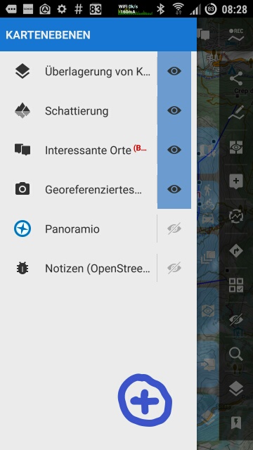
http://help.locusmap.eu/topic/merge-new-map-layers-and-old-elements-in-user-interface
Title: Re: [APP] - version 3.17.x (16. 5. 2016+)
Post by: lor74cas on June 21, 2016, 14:24:51
Post by: lor74cas on June 21, 2016, 14:24:51
Quote from: joeloc on June 21, 2016, 09:19:45
I just had an idea on how to "unify" the old "map elements" and the new "map layers". They are basically the same thing, having two completely different UIs for control should be avoided.
http://help.locusmap.eu/topic/merge-new-map-layers-and-old-elements-in-user-interface
Voted
Title: Re: [APP] - version 3.17.x (16. 5. 2016+)
Post by: Menion on June 21, 2016, 15:31:56
Post by: Menion on June 21, 2016, 15:31:56
@gynta: well ... I don't know, but I think it's not so important :)
@balloni55: reducing memory and size of images .. hmm, I've reduced these previews little bit
@balloni55: reducing memory and size of images .. hmm, I've reduced these previews little bit
Title: Re: [APP] - version 3.17.x (16. 5. 2016+)
Post by: gynta on June 21, 2016, 18:19:49
Post by: gynta on June 21, 2016, 18:19:49
Quote from: menion on June 21, 2016, 15:31:56I don't know, but I think it's not so important :)So why do you do it? too much time? ;D
Title: Re: [APP] - version 3.17.x (16. 5. 2016+)
Post by: Andrew Heard on June 21, 2016, 18:47:11
Post by: Andrew Heard on June 21, 2016, 18:47:11
@menion yes just did same test in latest beta- export to 1.0 GPX, delete single time, import, confirm total track time is huge number.
Title: Re: [APP] - version 3.17.x (16. 5. 2016+)
Post by: Menion on June 21, 2016, 19:57:30
Post by: Menion on June 21, 2016, 19:57:30
Quote from: gynta on June 21, 2016, 18:19:49Why I do what? Adding various activities to this new system? Because I wanted to offer wider list of options then just hike, bike, walk. Anyway I because I personally do not see huge difference in "paddling" vs "canoeing" in terms of icon ... maybe someone who do this activity will be angry because of this (and it will be reason to improve it). Are you angry? :)
So why do you do it? too much time? ;D
@Andrew: may you please export and share your track (GPX)? I oped this is already fixed, seems not ...
Title: Re: [APP] - version 3.17.x (16. 5. 2016+)
Post by: balloni55 on June 22, 2016, 10:57:11
Post by: balloni55 on June 22, 2016, 10:57:11
Hello menion
"notify battery optimisation on Android 6+"
- info text in popup window should describe better where battery settings are changed (device settings....)
on my device > Einstellungen/Akku/3-dot button/Akku-Leistungsoptimierung/Nicht optimiert
- after i´ve returned to battery optimisation in settings of my device, the the popup label didn´t apeare at start of locus.
bug or feature?
Title: Re: [APP] - version 3.17.x (16. 5. 2016+)
Post by: joeloc on June 22, 2016, 12:46:53
Post by: joeloc on June 22, 2016, 12:46:53
I just noticed around 5000 files in /Locus/cache/images... seem to be PNG files without .png ending. Who creates those? Panoramio layer? Geolocated pictures layer? And why PNG... didnt we find out that JPG is better on mobile? Just wondering where it comes from and if this is really neccessary. It puts a little strain on the file system and on everybody who plays with file-based backups or syncing Locus folders across devices... or just in general.
Title: Re: [APP] - version 3.17.x (16. 5. 2016+)
Post by: gynta on June 22, 2016, 13:56:16
Post by: gynta on June 22, 2016, 13:56:16
Quote from: menion on June 21, 2016, 19:57:30nono, I thought you'd like make a perfect job. sorry my fault ;D ;D
...Are you angry? :)
btw.
told you few day ago in helpdesk (can't find it yet)
Search - Search in tracks -> check Points arround... -> only "mapcenter" is allowed...
Title: Re: [APP] - version 3.17.x (16. 5. 2016+)
Post by: Menion on June 22, 2016, 14:50:15
Post by: Menion on June 22, 2016, 14:50:15
@0709: if I understand correctly, you wants to set name to generated "Via points" to something different? Current, points created during "Add new route" (for example) are named "Via points" (defined on crowdin as 'via_point'). This name also should be read during navigation with TTS. Text for this is defined as "pass_point" in tts files, so it's simply point name (defined as %s).
So summary:
- Locus name generated via points by translated text if point do not have own name, so usually "Via point"
- TTS generated command by "name after xx metres"
So what should I improve? If German translation of "Via point" is not the best for this generated command, should I add some other option to crowdin, like
- label in UI
- name of generated via point
right?
About "rtepointactions" - the list of actions was created when I started work on navigation system many years ago, based on actions in MapQuest navigation. Anyway some actions are not used at all for now, like this number 2 and 23. Both do absolutely nothing for now.
@balloni55: hmm isn't "Android system battery optimization" enough? Not sure if it's needed to specify it more. To be true, I think that various devices has this settings on various places and Locus has no possibility to find out exact place in devices settings.
Fact that you do not see this dialog again ... didn't you used "Don't ask again" checkbox?
@joeloc: this directory is used for caching of all downloaded images from internet in format, they are downloaded. Images from Panoramio and cached local photos in miniaturized version should be already cached on different place in /sdcard/Android/data/menion.android.locus/cache . Anyway 5000 is quite nice number ... seems I'll have to reduce some older files here as this may also slow down access to these files. Thanks for info
@gynta: well, I was probably tired from neverending discussion about private room in Live tracking we have in team. Otherwise I'm always on side of perfectionism (as far as my strength reached). So "Paddling" changed to "Canoeing", thanks :).
About search around other then map center location - seems that same problem is also in "Points", "Wiki", "Google Places". Small issue found and problem fixed, thank again!
Title: Re: [APP] - version 3.17.x (16. 5. 2016+)
Post by: balloni55 on June 22, 2016, 15:04:15
Post by: balloni55 on June 22, 2016, 15:04:15
Quotedidn't you used "Don't ask again" checkbox?you are right ;)
but after that i´ve uninstalled BETA and installed it new, so i expect on first start without restore from backup this dialog again
Title: Re: [APP] - version 3.17.x (16. 5. 2016+)
Post by: Menion on June 22, 2016, 15:21:25
Post by: Menion on June 22, 2016, 15:21:25
hm it should appear in case, you have still ENABLED battery optimization.
Hmm, but when you re-install whole Locus, system should not remember this "battery optimization" settings. Interesting.
Hmm, but when you re-install whole Locus, system should not remember this "battery optimization" settings. Interesting.
Title: Re: [APP] - version 3.17.x (16. 5. 2016+)
Post by: Menion on June 22, 2016, 16:54:59
Post by: Menion on June 22, 2016, 16:54:59
Very interesting, I have absolutely no idea where this text comes from :).
When "Via point" is created, it should be named by a) point from which was created or b) by translation of "via_point" text. In case of German, it's : https://crowdin.com/translate/menion/3292/en-de#6646312
When "Via point" is created, it should be named by a) point from which was created or b) by translation of "via_point" text. In case of German, it's : https://crowdin.com/translate/menion/3292/en-de#6646312
Title: Re: [APP] - version 3.17.x (16. 5. 2016+)
Post by: Menion on June 24, 2016, 11:05:51
Post by: Menion on June 24, 2016, 11:05:51
Hi people,
version 3.17.2.8 was just published on Google Play as probably latest Beta version. Enjoy your weekend!
version 3.17.2.8 was just published on Google Play as probably latest Beta version. Enjoy your weekend!
Title: Re: [APP] - version 3.17.x (16. 5. 2016+)
Post by: balloni55 on June 24, 2016, 12:55:25
Post by: balloni55 on June 24, 2016, 12:55:25
version 3.17.2.8
Locus stop if i go back from additional theme window clicking two times top left of e.g. "elevate" or "HiLo"
https://www.dropbox.com/s/l8kjmwe4v6rqp9u/stop.mp4?dl=0
Locus stop if i go back from additional theme window clicking two times top left of e.g. "elevate" or "HiLo"
https://www.dropbox.com/s/l8kjmwe4v6rqp9u/stop.mp4?dl=0
Title: Re: [APP] - version 3.17.x (16. 5. 2016+)
Post by: joeloc on June 24, 2016, 14:45:28
Post by: joeloc on June 24, 2016, 14:45:28
Quote from: menion on June 22, 2016, 14:50:15Interesting... that cache seems to be on /extSdCard/Android/data/menion... for me. A bit weird... and not good... since access to /extSdCard is a lot slower. Oh well... will try to move it.
@joeloc: this directory is used for caching of all downloaded images from internet in format, they are downloaded. Images from Panoramio and cached local photos in miniaturized version should be already cached on different place in /sdcard/Android/data/menion.android.locus/cache . Anyway 5000 is quite nice number ... seems I'll have to reduce some older files here as this may also slow down access to these files. Thanks for info
Anyway... I have a geotagged_photos folder there which seems to get horribly huge... like two files per image. one for image and and extra one for metadata?!
I have >10.000 geotagged pictures on my phone. Android is already struggling sometimes with its own media library caching. But is it really strictly neccessary for Locus to implement an extra cache on top of that?! Thats like 20.000 additional files for the sdcard... in a single directory. Can you not use the media store for this somehow? Maybe I have a wrong idea of what the media store does on Android... but I thought thumbnails would be part of it. If every app did its own image caching, I imagine my phone suffering badly.
If this extra locus cache is 100% neccessary, it might be better to put it into a database instead of 20.000 single tiny files. Normally I am always in favor of file system vs databases... but basically tripling the number of files on my sdcard justs smells like a way too high price.
Title: Re: [APP] - version 3.17.x (16. 5. 2016+)
Post by: joeloc on June 24, 2016, 15:08:56
Post by: joeloc on June 24, 2016, 15:08:56
3.17.2.8:
I know I always complain about performance... but really... it seems to get worse with every new beta version :-). I have long since come to accept the sad fact that it takes 2 seconds plus a "working..." dialog to open a track from a track list. But with 3.17.2.8, it now takes about 5 (five!) seconds to just see the bloody track list! And also 5 (five!) seconds when you close a track (and go back to the track list). These 5 (five!) seconds pass without any visible sign, Locus just seems dead.
This is on one of todays fastest smartphones with just around 100 tracks in the folder, so nothing obnoxiously out of the ordinary. Can we at least focus a tiny little bit on efficient code and performance in general? Soon? Stuff like that is exactly what makes Locus user interface cumbersome and sluggish and unresponsive. And I am currently sitting in a comfy armchair at home just fooling around... it will feel much worse outdoors on a bike.
Title: Re: [APP] - version 3.17.x (16. 5. 2016+)
Post by: Menion on June 24, 2016, 15:32:38
Post by: Menion on June 24, 2016, 15:32:38
@balloni55: thanks, I'll check it
@joeloc: 10.000+ tagged photos, heh ... I'll be thinking about it.
And performance. Are you willing to share with me your current point & track database? There were no changes in how Locus load data from database. Only difference is, that your database grow and grow, nothing more. Seems that it will need some improvements in structure of database because from tests, 95% of time is spend on database query.
Title: Re: [APP] - version 3.17.x (16. 5. 2016+)
Post by: joeloc on June 24, 2016, 15:54:53
Post by: joeloc on June 24, 2016, 15:54:53
Quote from: menion on June 24, 2016, 15:32:38I'll gladly share it... I just cant seem to find a working email address of yours.
@balloni55: thanks, I'll check it
@joeloc: 10.000+ tagged photos, heh ... I'll be thinking about it.
And performance. Are you willing to share with me your current point & track database? There were no changes in how Locus load data from database. Only difference is, that your database grow and grow, nothing more. Seems that it will need some improvements in structure of database because from tests, 95% of time is spend on database query.
As for the querys and a horribly performing database solution (remember deleting track points?)... too bad... but that's not an excuse that works for your users :-).
But seriously... I am in track list... I tap on a track... I tap the back button. Not a single bit in the database has changed. Why then is the complete track list rebuilt/reloaded/requeried/rewhatevered? These extra five seconds really make it hard to browse... very hard. And if it was just one second... still way too much for simply closing a window in a snappy UI.
Even if I edit/change a track and then go back to the list... you'd only have to reload/update this one track. Not the whole hundred. Not over and over again. My poor battery...
Title: Re: [APP] - version 3.17.x (16. 5. 2016+)
Post by: gynta on June 24, 2016, 16:01:10
Post by: gynta on June 24, 2016, 16:01:10
I suggest, to rename button "select" to "room(s) manager"
because behind this button is much more then (rooms)"select"
like edit, remove, share, aktivate,...
 (https://postimg.org/image/nyf8xo67b/)
plz don't offer an unfinished feature. That's a bad marketing idea.
 (https://postimg.org/image/vv3egstpj/)
because behind this button is much more then (rooms)"select"
like edit, remove, share, aktivate,...
(https://postimg.org/image/nyf8xo67b/)plz don't offer an unfinished feature. That's a bad marketing idea.
(https://postimg.org/image/vv3egstpj/)
Title: Re: [APP] - version 3.17.x (16. 5. 2016+)
Post by: Menion on June 24, 2016, 16:05:21
Post by: Menion on June 24, 2016, 16:05:21
Well what should I say. You never-ending complains helps, it push me to do task that I'm well aware, but that I also know that affect top 5% of users that has 1000+ tracks and so on. Anyway after all these terrible years with you, I still know that there is not better alternative :).
Anyway send me your data to jiri.mlavec@asamm.com. I'll do some performance tests to see where it is mainly stuck. Thanks and nice weekend.
@gynta: firstly it was only a "Select" and "Rooms manager" was at top in menu. But Petr and Michal forced me to merge them, but "Select" button remained. Anyway agree, thanks, I'll try to improve it.
EDIT: and page in preparation ... well I need an Url to this page. Try to tap on this url in device, where is already installed Locus. It's most easy method how to connect to any room. But web page is not yet fully ready. At least there is some information what may users expect ;).
@balloni55: issue fixed. The second back button should not be there in this case.
Title: Re: [APP] - version 3.17.x (16. 5. 2016+)
Post by: Menion on June 24, 2016, 17:55:01
Post by: Menion on June 24, 2016, 17:55:01
@joeloc: I'm testing your database, thanks for it!
On Sony Tablet Z4, list of first track folder is almost instant, track screen after tap on first track in lest then second
... oki, too powerful. So let's try it on "older" SGS2!
List loaded after 800ms, track detail after 2 seconds.
Well, isn't there something different what I may try? What about your internal memory/SD card? Data are in internal memory? If on card, is it some faster card?
Title: Re: [APP] - version 3.17.x (16. 5. 2016+)
Post by: gynta on June 24, 2016, 18:11:09
Post by: gynta on June 24, 2016, 18:11:09
Quote from: menion on June 24, 2016, 16:05:21That's exactly what I did.
...Try to tap on this url in device, where is already installed Locus...
edit
ahh, got it.
After that - i have to choose "open link with Locus"
A word of advice would be nice here!
Title: Re: [APP] - version 3.17.x (16. 5. 2016+)
Post by: Menion on June 24, 2016, 18:18:52
Post by: Menion on June 24, 2016, 18:18:52
And you ended on web page in your browser? You should get in offer of app also Locus Map. Hmm, have to try it again, thanks.
Title: Re: [APP] - version 3.17.x (16. 5. 2016+)
Post by: gynta on June 24, 2016, 18:20:31
Post by: gynta on June 24, 2016, 18:20:31
edit my post above.
sorry, too late :)
sorry, too late :)
Title: Re: [APP] - version 3.17.x (16. 5. 2016+)
Post by: ta-ka on June 24, 2016, 18:22:22
Post by: ta-ka on June 24, 2016, 18:22:22
I'm testing private room feature of the Live Tracking with version 3.17.2.8. Removing own room in rooms manager behaves strange. It doesn't remove the room but duplicates it. Could you confirm this? By the way, detaching non-own room removes the room as expected.
EDIT: @gynta, nice clip :P I was about prepareing the same.
EDIT: @gynta, nice clip :P I was about prepareing the same.
Title: Re: [APP] - version 3.17.x (16. 5. 2016+)
Post by: gynta on June 24, 2016, 18:23:47
Post by: gynta on June 24, 2016, 18:23:47
@menion
i have another clip for you.
"delete/remove" room duplicates the entry...
edit
damn again too late ;D
i have another clip for you.
"delete/remove" room duplicates the entry...
edit
damn again too late ;D
Title: Re: [APP] - version 3.17.x (16. 5. 2016+)
Post by: Menion on June 24, 2016, 20:09:11
Post by: Menion on June 24, 2016, 20:09:11
Thanks guys, fixed. Funny issue :)
EDIT: if you don't mind, I'll delete your duplicated rooms manually for now.
EDIT: if you don't mind, I'll delete your duplicated rooms manually for now.
Title: Re: [APP] - version 3.17.x (16. 5. 2016+)
Post by: gynta on June 24, 2016, 20:24:47
Post by: gynta on June 24, 2016, 20:24:47
sure
Title: Re: [APP] - version 3.17.x (16. 5. 2016+)
Post by: ta-ka on June 24, 2016, 20:27:59
Post by: ta-ka on June 24, 2016, 20:27:59
@menion
Thanks for the fix. Please delete my rooms. (You know my 'My Locus Profile', I guess.)
Thanks for the fix. Please delete my rooms. (You know my 'My Locus Profile', I guess.)
Title: Re: [APP] - version 3.17.x (16. 5. 2016+)
Post by: gynta on June 25, 2016, 00:19:54
Post by: gynta on June 25, 2016, 00:19:54
beta ignores online custom map icons
last pro vs last beta (same folder settings)
 (https://postimg.org/image/wzvrs7i0x/)
  (https://postimg.org/image/kwluqwhkx/)
last pro vs last beta (same folder settings)
(https://postimg.org/image/wzvrs7i0x/) (https://postimg.org/image/kwluqwhkx/)
Title: Re: [APP] - version 3.17.x (16. 5. 2016+)
Post by: Joachim Buhl on June 25, 2016, 10:41:19
Post by: Joachim Buhl on June 25, 2016, 10:41:19
Hello Menion
There was a change in the statistics view in one of the last versions (Beta?), right?
I normally want to share a screenshot from the ride in my MTB-whatsapp-groups, to make the guys sitting at home jealous ;-).
The important information are: distance, time and height-meters. In the new screen layout these information are not on one (screenshot) page any more. Thats not nice. Instead I can find calories, pace and so on, which is not so interesting for others.
Can you change this back please? Or hide elements, or customize the view......
Thanks
Joachim
Title: Re: [APP] - version 3.17.x (16. 5. 2016+)
Post by: Menion on June 25, 2016, 12:11:45
Post by: Menion on June 25, 2016, 12:11:45
@0709: hmm point sprint has no effect on recalculation I believe. Anyway when you use "recalculate", it should be made with "Car - fast" option. Check second 29 in your video - do you see a green symbol on "Recalculate" button? This is it ( btw. long click to change it ).
From your video, problem is that BRouter lead you over some green area without a road? Maybe map data are older then BRouter and road is not yet in the map?
@gynta: thanks, fixed
@Joachim Buhl: Change it back? No, sorry. Discuss, yes :). May idea was to place all "elevation values" next to each other. So all six elevation values are in same section. What you want, is system before, so most interesting information at top, rest below. Cannot say I agree, anyway it's quite matter of taste. Any I do not plan any settings here, sorry. What others think?
Btw. how you share your results? Just take a screenshot with your device and share it over some WhatsApp application, right? What if Locus offer this "screenshot" from full statistics screen? Maybe it should be even a little better ... small map preview and statistics below...
Title: Re: [APP] - version 3.17.x (16. 5. 2016+)
Post by: michaelbechtold on June 25, 2016, 12:22:20
Post by: michaelbechtold on June 25, 2016, 12:22:20
Quote from: menion on June 25, 2016, 12:11:45@Joachim Buhl: Change it back? No, sorry. Discuss, yes :). May idea was to place all "elevation values" next to each other. So all six elevation values are in same section. What you want, is system before, so most interesting information at top, rest below. Cannot say I agree, anyway it's quite matter of taste. Any I do not plan any settings here, sorry. What others think?Grouping all elevation stuff together makes sense, also having the most relevant results on top makes sense. So put those on top, followed by most relevant elevation and then the rest of it.
Btw. how you share your results? Just take a screenshot with your device and share it over some WhatsApp application, right? What if Locus offer this "screenshot" from full statistics screen? Maybe it should be even a little better ... small map preview and statistics below...
A full information sharing function would be the luxury way out. Very much appreciated and ending any dispute. I hope ;-)
Title: Re: [APP] - version 3.17.x (16. 5. 2016+)
Post by: Menion on June 25, 2016, 12:28:13
Post by: Menion on June 25, 2016, 12:28:13
So placing "Elevation" section above "Speed" section is acceptable solution?
And some "Share my record" which generates some really nice image that should be shared where-ever wants .. sounds good :). More people interested in such task, feel free to create an idea on help desk. It has my vote and it also fits to my plans on next month (improved Share on Facebook mainly for points).
And some "Share my record" which generates some really nice image that should be shared where-ever wants .. sounds good :). More people interested in such task, feel free to create an idea on help desk. It has my vote and it also fits to my plans on next month (improved Share on Facebook mainly for points).
Title: Re: [APP] - version 3.17.x (16. 5. 2016+)
Post by: michaelbechtold on June 25, 2016, 12:30:50
Post by: michaelbechtold on June 25, 2016, 12:30:50
Quote from: menion on June 25, 2016, 12:28:13I thought speed, duration, distance on top, then elevation.
So placing "Elevation" section above "Speed" section is acceptable solution?
And some "Share my record" which generates some really nice image that should be shared where-ever wants .. sounds good :). More people interested in such task, feel free to create an idea on help desk. It has my vote and it also fits to my plans on next month (improved Share on Facebook mainly for points).
And this share would also work via mail, WhatsApp, Threema and alike, via standard Android sharing mechanics I hope.
Gesendet von meinem LG-H850 mit Tapatalk
Title: Re: [APP] - version 3.17.x (16. 5. 2016+)
Post by: michaelbechtold on June 25, 2016, 13:33:12
Post by: michaelbechtold on June 25, 2016, 13:33:12
Another thing, old one in fact. How can I switch e.g. Panoramio and other screen elements on and off with ONE tap from the map UI ? Map overlay is a function that I can put in the upper or right function bar. I did not find the new ones.
Gesendet von meinem LG-H850 mit Tapatalk
Gesendet von meinem LG-H850 mit Tapatalk
Title: Re: [APP] - version 3.17.x (16. 5. 2016+)
Post by: balloni55 on June 25, 2016, 13:36:26
Post by: balloni55 on June 25, 2016, 13:36:26
Hello menion
two minor details ;)
- left action panel didnt scroll
https://www.dropbox.com/s/03g8kh6f9cec686/left%20action%20panel%20didn%C2%B4t%20scroll.mp4?dl=0
- refrech of "eye button" state only after second opening
https://www.dropbox.com/s/eqtuxixtdd09i5i/eye%20button%20refrech.mp4?dl=0
two minor details ;)
- left action panel didnt scroll
https://www.dropbox.com/s/03g8kh6f9cec686/left%20action%20panel%20didn%C2%B4t%20scroll.mp4?dl=0
- refrech of "eye button" state only after second opening
https://www.dropbox.com/s/eqtuxixtdd09i5i/eye%20button%20refrech.mp4?dl=0
Title: Re: [APP] - version 3.17.x (16. 5. 2016+)
Post by: michaelbechtold on June 25, 2016, 14:36:32
Post by: michaelbechtold on June 25, 2016, 14:36:32
Very telling video! 5 functions accessible on the left side, 10 on the right. What are people smoking to deny understanding the need for smaller buttons on the left ??
Gesendet von meinem LG-H850 mit Tapatalk
Gesendet von meinem LG-H850 mit Tapatalk
Title: Re: [APP] - version 3.17.x (16. 5. 2016+)
Post by: balloni55 on June 25, 2016, 15:58:03
Post by: balloni55 on June 25, 2016, 15:58:03
Hello Michael
i´m a non smoker, i´m only a betatester ;)
be sure my favorite map screen is without any button on left side !
and so i´ll be happy to know where to disable record button on left side
 (https://postimg.org/image/5ijsqo1q9/)
question from your post #164 is also interesting for me
i´m a non smoker, i´m only a betatester ;)
be sure my favorite map screen is without any button on left side !
and so i´ll be happy to know where to disable record button on left side
(https://postimg.org/image/5ijsqo1q9/)question from your post #164 is also interesting for me
Title: Re: [APP] - version 3.17.x (16. 5. 2016+)
Post by: jajaballard on June 25, 2016, 16:44:19
Post by: jajaballard on June 25, 2016, 16:44:19
1+ for share my record.
Gruß
Ralf
vom Schmartfon
Gruß
Ralf
vom Schmartfon
Title: Re: [APP] - version 3.17.x (16. 5. 2016+)
Post by: Menion on June 25, 2016, 20:01:50
Post by: Menion on June 25, 2016, 20:01:50
@michaelbechtold: Panoramio cannot be placed to side panel, you have to use "Map Layers" panel
@balloni55: thanks for videos, I'll check it. And track record button cannot be hidden now, only in case you use bottom panel for a control of track record, not a side panel
@0709: hmm maybe I undestand. Point "Sprint" has icon incorrectly placed out of track, so I though it's just some point in the field. If it lay directly on a track, then it's probably correctly used as "Via point". And I probably understand how the line was created - BRouter computed route just on a road above green area (as I wrote, it compute route for a car! ) and Locus created direct connection to Via point.
About some settings for BRouter ... this is more general problem, not just in case of BRouter. Because there are missing some kind of "Routing profiles", it is not clear how Locus should recompute tracks that has no definition about it's original "compute" source, like for example TCX files. I have to think about it and offer some general solution, agree. Thanks
Title: Re: [APP] - version 3.17.x (16. 5. 2016+)
Post by: michaelbechtold on June 25, 2016, 20:43:54
Post by: michaelbechtold on June 25, 2016, 20:43:54
Quote from: balloni55 on June 25, 2016, 15:58:03My message was not for you :-)
Hello Michael
i´m a non smoker, i´m only a betatester ;)
be sure my favorite map screen is without any button on left side !
and so i´ll be happy to know where to disable record button on left side
question from your post #164 is also interesting for me
Gesendet von meinem LG-H850 mit Tapatalk
Title: Re: [APP] - version 3.17.x (16. 5. 2016+)
Post by: Andrew Heard on June 26, 2016, 11:25:21
Post by: Andrew Heard on June 26, 2016, 11:25:21
@menion sorry for delay, am cycle touring, Android Chrome won't allow to attach any file strange, as I said before simple to reproduce, just delete any (time) XML from GPX, my test file then has 407000 hours.
Title: Re: [APP] - version 3.17.x (16. 5. 2016+)
Post by: gynta on June 26, 2016, 11:43:46
Post by: gynta on June 26, 2016, 11:43:46
Quote from: Joachim Buhl on June 25, 2016, 10:41:19
...change in the statistics view...Can you change this back please? Or hide elements, or customize the view...
Quote from: menion on June 25, 2016, 12:11:45What if Locus offer this "screenshot" from full statistics screen? Maybe it should be even a little better ... small map preview and statistics below...
Quote from: michaelbechtold on June 25, 2016, 12:22:20A full information sharing function would be the luxury way out. Very much appreciated and ending any dispute. I hope ;-)
Quote from: menion on June 25, 2016, 12:28:13
some "Share my record" which generates some really nice image that should be shared where-ever wants .. sounds good :). More people interested in such task, feel free to create an idea on help desk. It has my vote and it also fits to my plans on next month (improved Share on Facebook mainly for points).
Quote from: michaelbechtold on June 25, 2016, 12:30:50
share would also work via mail, WhatsApp, Threema and alike, via standard Android sharing mechanics I hope.
Quote from: balloni55 on June 25, 2016, 15:58:03question from your post #164 is also interesting for me
Quote from: jajaballard on June 25, 2016, 16:44:19
1+ for share my record.
Guys! Where is the the idea on helpdesk (http://help.locusmap.eu/topic/add/idea/?text=Share%20my%20customized%20screenshot) ?
I like to vote :)
Title: Re: [APP] - version 3.17.x (16. 5. 2016+)
Post by: michaelbechtold on June 26, 2016, 11:58:47
Post by: michaelbechtold on June 26, 2016, 11:58:47
Sometimes simple brain helps to make the obvious happen. And just recently votes (well, partly at least driven by lies, which does not apply here) have a dreadful outcome ...
Gesendet von meinem LG-H850 mit Tapatalk
Gesendet von meinem LG-H850 mit Tapatalk
Title: Re: [APP] - version 3.17.x (16. 5. 2016+)
Post by: Andrew Heard on June 26, 2016, 13:14:43
Post by: Andrew Heard on June 26, 2016, 13:14:43
Do I miss something? Compass screen has sun icon for direction of sunrise but I don't see any moon icon for sunset.
Title: Re: [APP] - version 3.17.x (16. 5. 2016+)
Post by: john_percy on June 26, 2016, 15:09:05
Post by: john_percy on June 26, 2016, 15:09:05
Moon rise is not the same as sunset!
Title: Re: [APP] - version 3.17.x (16. 5. 2016+)
Post by: Menion on June 26, 2016, 15:25:13
Post by: Menion on June 26, 2016, 15:25:13
@michaelbechtold: did I miss something?
@Andres Heard & &john_percy .. sun on compass is current sun position. It has nothing to do with sunrise/sunset
@Andres Heard & &john_percy .. sun on compass is current sun position. It has nothing to do with sunrise/sunset
Title: Re: [APP] - version 3.17.x (16. 5. 2016+)
Post by: michaelbechtold on June 26, 2016, 15:41:23
Post by: michaelbechtold on June 26, 2016, 15:41:23
Brexit
Gesendet von meinem LG-H850 mit Tapatalk
Gesendet von meinem LG-H850 mit Tapatalk
Title: Re: [APP] - version 3.17.x (16. 5. 2016+)
Post by: Viajero Perdido on June 26, 2016, 16:35:30
Post by: Viajero Perdido on June 26, 2016, 16:35:30
Quote from: menion on June 26, 2016, 15:25:13sun on compass is current sun position.And a great feature it is. It tells me, for example, to keep my shadow at 2 o'clock when I'm navigating through the forest to a cache. Please don't ever remove it.
Title: Re: [APP] - version 3.17.x (16. 5. 2016+)
Post by: Joachim Buhl on June 26, 2016, 16:43:54
Post by: Joachim Buhl on June 26, 2016, 16:43:54
Done
http://help.locusmap.eu/topic/share-my-customized-screenshot
http://help.locusmap.eu/topic/share-my-customized-screenshot
Title: Re: [APP] - version 3.17.x (16. 5. 2016+)
Post by: Andrew Heard on June 26, 2016, 17:09:20
Post by: Andrew Heard on June 26, 2016, 17:09:20
Quote from: john_percy on June 26, 2016, 15:09:05I didn't say moon rise? I asked if icon for sunset, because there is icon for (I guess) sunrise.
Moon rise is not the same as sunset!
Title: Re: [APP] - version 3.17.x (16. 5. 2016+)
Post by: Andrew Heard on June 26, 2016, 17:12:30
Post by: Andrew Heard on June 26, 2016, 17:12:30
Quote from: menion on June 26, 2016, 15:25:13ok thanks for clarifying
@Andres Heard & &john_percy .. sun on compass is current sun position. It has nothing to do with sunrise/sunset
Title: Re: [APP] - version 3.17.x (16. 5. 2016+)
Post by: john_percy on June 26, 2016, 17:42:52
Post by: john_percy on June 26, 2016, 17:42:52
Quote from: Andrew Heard on June 26, 2016, 17:09:20My point was that using a moon icon for sunset makes no sense.Quote from: john_percy on June 26, 2016, 15:09:05I didn't say moon rise? I asked if icon for sunset, because there is icon for (I guess) sunrise.
Moon rise is not the same as sunset!
Title: Re: [APP] - version 3.17.x (16. 5. 2016+)
Post by: lor74cas on June 27, 2016, 08:00:20
Post by: lor74cas on June 27, 2016, 08:00:20
Hello
I noticed 3 blue buttons with access to same content:


I noticed 3 blue buttons with access to same content:
Title: Re: [APP] - version 3.17.x (16. 5. 2016+)
Post by: john_percy on June 27, 2016, 09:03:14
Post by: john_percy on June 27, 2016, 09:03:14
I attempted to connect to Locus Store with no internet connection. Result: unknown problem. I know what the problem was - no internet connection.

Title: Re: [APP] - version 3.17.x (16. 5. 2016+)
Post by: Menion on June 27, 2016, 20:18:03
Post by: Menion on June 27, 2016, 20:18:03
@lor74cas: well, feel free to update visibility of these buttons in menu > settings > maps > panels > left panel
@john_percy: hmm thanks :)
EDIT: and I'm closing this looong month. Hope you will like new features!
@john_percy: hmm thanks :)
EDIT: and I'm closing this looong month. Hope you will like new features!