Menu

Show posts

This section allows you to view all posts made by this member. Note that you can only see posts made in areas you currently have access to.

Show posts Menu

Messages - Viajero Perdido

#31
Maps / Re: Duplicated contour lines in Lomaps
November 01, 2022, 19:02:23
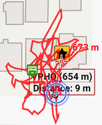
I think Locus is displaying two maps at once.  That's been an issue I've noticed for years, usually (for me) noticeable by a darker forest color, caused by identical OAM content (from adjacent overlapping maps) being rendered twice.  In your case, it looks like those maps show different contour sets.  (OAM recently switched to higher-precision contour data.)

Because of this, I've had to turn off "automatic map loading", which otherwise would be extremely useful.  I hope Menion fixes this some day.
#32
Locus Map / Re: [APP] - version 4.12.+ ( 09/2022 )
October 19, 2022, 21:52:59
Locus smoothly imported my geocache PQs this morning as always, now using an updated API from Groundspeak.  Well done.

There's a minor glitch in the API regarding names of two obscure cache types that affects GSAK, but I don't know about Locus.  Discussion here:  https://forums.geocaching.com/GC/index.php?/topic/382502-release-notes-website-pocket-query-api-october-18-2022/&do=findComment&comment=6038267

Probably harmless.  :)
#33
Locus Map / Re: [APP] - version 4.12.+ ( 09/2022 )
October 17, 2022, 17:36:25
Quote from: lor74cas on October 17, 2022, 14:02:40The site https://www.locusmap.eu/ is down.

I've noticed the Locus sites (this one, maybe others) sometimes don't load, I think due to DNS failure.  Then I try again, and it works.  I don't know what's happening there; it's been that way for months, and other sites aren't a problem for me.  (My DNS is provided by the VPN service I use.)

EDIT: ...but right now, I can't connect to https://www.locusmap.eu either.  Seems to be a different problem, because it's just waiting (ultimately PR_CONNECT_RESET_ERROR), whereas the problem I mentioned (which I consider minor) is always an immediate error.
#34
Information / Re: Update of the forum (2022/08)
August 19, 2022, 20:52:37
Maybe something in the theme is specifying pixels instead of points?  If Mapper uses a super high-res monitor, that may explain it.

The size appears normal for me on my 15yo monitor.
#35
Information / Re: Update of the forum
August 19, 2022, 15:38:51
Smooth upgrade, at least from the outside looking in.  I just had to log in again, browser auto-fills the details, a few seconds, done.

Looks good too.  :)
#36
Hi.  I'm a hiker and cacher too.  I think your best bet would be offline topo maps, either LoMaps or OpenAndroMaps (V5).  Both are similar, show roughly the same data, but have visual differences due mostly to themes.  (I prefer OAM + Elevate theme due to some rendering glitches of text labels with LoMaps.)

I suggest offline because, of course, as a hiker you may not have cell coverage, and to pre-load online maps of any size is quite inefficient (in general, not just in Locus).

If you have a level of Locus that supports it, turn on slope shading; it's beautiful and makes hills stand out clearly.

Auto-routing on trails is quite nice too, either via built-in LoRouter, or BRouter as a separate app, again depending on your Locus version.  "After 20 metres turn right."

PS, you'll want maps based on OSM (such as the two mentioned above) for best quality of trail data ... unless you're in Europe, in which case some non-OSM maps are apparently quite good too.  But avoid maps based on government data, such as Topo Canada, out of date.
#37
Hi.  I see that on wide screens, the point detail panel now appears on the right, rather than the bottom as before.

It would be very nice if a horizontal swipe could dismiss this panel.  (I keep trying and failing.)  Thanks.
#38
Select the track.  Edit as necessary.  Tap "..." in the bottom-right corner, Export, select OpenStreetMap.  Provide login details if needed.

It works well; I use it a lot.  :)

PS, that sends it to the "GPS Traces" list, not directly to the map database.  As you might know, directly uploading tracks to the map database is discouraged, as it's typically noisy data.
#39
Hmm.  Having my real name attached to the photo may discourage me from using the feature.  I try to be unfindable on the internet, with decent success.  (That's also why I never reviewed the app, sorry.)
#40
I see a glitch with TTS similar to what Slarti mentioned.  If I reboot the phone (Android 9), then try to navigate in Locus, there's no voice.  In Android Settings I need to go Accessibility, Text-to-Speech (simply open the dialog), at which point Locus suddenly says either "Text to Speech correctly set", or "Let's go", depending on where it was waiting.

This only happens once after each reboot, but it's been doing it for a few years.  I don't really mind, since I know the workaround.  It's a quirk.  :)
#41
I suggested "Fine Tune", but it wasn't my first choice.  "Edit Track" would be better (if not causing confusion with "Edit Info"), or "Track Editor" if a noun is appropriate here, or even "Modify Track" which I think was the original text.  "Modify Track" sounds ideal to me.

I'm not sure if nouns are appropriate as menu commands, but there's an advantage to the command being the same as the title of the screen that shows up, eg Route Planner, Track Editor.
#42
Quote from: Andrew Heard on May 28, 2022, 05:32:37
track editor > repair

Hmm.  "Repair" suggests the track is broken or invalid.  May I suggest "Adjust" or "Modify", or even "Fine-tune"?  (I assume "Edit" is already taken by a different function, right?  I haven't looked at the beta.)
#43
I've never seen this problem with my two Samsung tablets.  (I have no Samsung phones.)
#44
Thanks for the quick fix on the glitch I mentioned.  Here's another (sorry), but I don't consider it urgent.

  • Solve a geocache puzzle and update the coords on the website.
  • In Locus, tap "Update cache".  Icon moves as expected.
  • Sync happens.
  • On second device, cache details show the new coords, but icon still displays at original location.  Hiding/showing the entire folder quickly fixes it.
(I should really use the help system for this, apologies.  Next time.)
#45
Is this new?  A track being recorded is drawn over a point pop-up, not under it.  This seems undesirable.

Use case:  I noticed it after "scribbling a lot of red ink" while looking for a geocache, then trying to find out its name.