Menu

Show posts

This section allows you to view all posts made by this member. Note that you can only see posts made in areas you currently have access to.

Show posts Menu

Messages - gynta

#1
https://www.locusmap.eu/de/locus-map-lets-talk-future/

QuoteAbonnements für Premium Funktionen
Abonnements sind seit langen die Grundlage der Software-Welt. Gleiches gilt für moderne mobile Anwendungen. Viewranger, Endomondo, Backcountry Navigator ... Selbst bei Locus sind fortschrittliche Funktionen wie Private Live Tracking und unbegrenzte Online-Live-Ortung von My Live Location bereits mittels einem Abonnement verfügbar. Außerdem können einige Karten abonniert werden, z. B. Freytag-Berdt oder French IGN. Neu wird sein das Sie ein ganzes Paket an Funktionen abonnieren können und sich dann um nichts weiter kümmern müssen. Datensynchronisierung, Live-Tracking, LoMap-Downloads und -Updates, unbegrenzte Anzahl von Routenaufzeichnungsprofilen, Offline-Navigation, Premium-Support ... Und das alles zum Preis eines tschechischen Bieres pro Monat. Natürlich können Sie erheblich sparen, wenn Sie sich für ein längerfristiges Abonnement entscheiden.

The following users thanked this post: gynta
#2
Themes - Vector maps / Re: [Theme] Voluntary UK
February 15, 2019, 17:38:10
New version available in the  first post in this thread.
Summary: Continued improvement in Mapsforge v 4 theme. Better and more specific displays of mountain huts and shelters, especially with Hiking style. Improvement with display of contours, peaks, tunnels, mini roundabouts, toll roads, national borders and more.
The following users thanked this post: gynta
#3
Themes - Vector maps / Re: [Theme] Voluntary UK
January 02, 2019, 00:38:58
New version available in the first post in this thread.
The most significant changes are revisions to dashed lines for better compatibility with devices with later Android versions and the incorporation of Mapsforge v4 (multilingual) versions.
Plus, of course, numerous other small tweaks and improvements.
The following users thanked this post: gynta

#4
This is speed auto-zoom. See http://docs.locusmap.eu/doku.php?id=manual:user_guide:maps_settings:misc#speed_auto-zoom
It's now found in Settings > Controlling > Map screen > Zoom according to speed 
The following users thanked this post: gynta
#5
To all users of Locus and Openandromaps,

I have just published some major updates for my themes "outdoor" and "desert" and added the new theme "navigation". You can find some description (in German) and the downloads also on:

www.maiwolf.de/locus/
Please use always my website to download the NEWEST version of the theme!

Here a brief summary of changes:
- the 3 themes use a common backbone, meaning in general they use the same styling and symbols
- they differ in zoom levels, detail levels and amount of selectable features
- they can be used in parallel on the same device
- all symbols (nearly) are now switched to svg (scalable vector graphics)
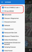
- the most predominant symbols can be switched to be only small circles to not overpopulate and confuse the map
- the "navigation" theme is thought to be used for car navigation and shows road bigger but leaves off some other elements (i. e. elevelation lines)

Feel free to use them and send me feedback.
I am constantly trying to improve these themes.

Regards

Here are some screenshots and the themes for download.

Theme icons which show up in Locus:


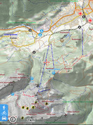
The "outdoor" theme:


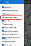
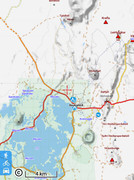
The "desert" theme:


The "navigation" theme:


The following users thanked this post: gynta
#6
ich denke jetzt hab ich deinen Wunsch verstanden ;)
Menü/Einstellungen/Punkte & Tracks/"Tracks" > Linienstiel

hat aber auch gebraucht bis ich die Einstellung gefunden habe

Edit, danke gynta ;)
The following users thanked this post: gynta
#7
I think you need to ask elsewhere: https://plus.google.com/105415797711448238292 though you may not get an answer as the group seems pretty inactive. Or you could go straight to the files: https://github.com/mjk912/LocusMapTweak

The following users thanked this post: gynta
#8
Hallo, ich stolpere gerade über eine unklare Übersetzung, wenn man Locus-Notifications loswerden möchte. In deutsch steht da:

"Unbestätigte Benachrichtigungen
können nicht einfach entfernt werden.

Bestätige erst und entferne danach die
Benachrichtigung durch Wischen"

Da stand ich nun davor und habe nicht begriffen, wie man denn nun bestätigen kann. Denn Entfernen durch Wischen erfolgt ja erst danach. Erst in englisch habe ich begriffen, was ich tun muss. In englisch heißt es an derselben Stelle:

"Cannot delete unconfirmed notification.

Confirm and delete by swiping
notification away individually."


Klarer ist mMn folgende Formulierung:

"Unbestätigte Benachrichtigungen
können nicht einfach entfernt werden.

Nach Wischen der einzelnen Benachrichtigung kannst du diese bestätigen und entfernen."


The following users thanked this post: gynta
#9
Hi gynta,
da fehlt ein i ;)

The following users thanked this post: gynta
#10
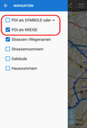
Cursors / Icons / Voices / [CURSORS] Motor boat
September 19, 2017, 06:41:46
The cursor navigation is a motor boat.
most screens (except for the smallest): mdpi, hdpi, xhdpi

for light maps


for dark maps


of course, used images from other sets too  :)
The following users thanked this post: gynta
#11
Themes - Vector maps / Re: [Theme] HiLo hiking theme
September 07, 2017, 11:08:03
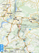
UPDATE: V10, 06.09.2017,
- The patterns for forest changed, in order to approach the representation of "Outdooractive"
- Texts in the hiking trail markings (OSMC: SYMBOL) are now displayed somewhat more reliably.
- Not constantly Water-bearing streams, rivers, etc. (waterway intermittent = wwi_yes) are shown with dashed lines (only with OpenAndroMaps)
- leisure = playground (playgrounds) are now displayed correctly, the symbol size has been adjusted and the label (from zoom 17) added
- amenity = kindergarten is no longer displayed in the same color as school, has now no special color anymore
- Fixed bug when rendering scrub, landuse is now natural in the code
- parking spaces where the access requires a license or permit (access = permit) are now displayed (only with OpenAndroMaps)
- Roads with tolls (highway = toll) are now displayed with red dots (as with OAM "Elevate")
- Ways to access a license or permit (access = permit) are now displayed with red dots (only with OpenAndroMaps)
- The symbol for bus_stop (bus stop) is now displayed differently in Germany as in the rest of the world (only with LoMaps)
- Viewing rock (free-standing tiles) was not correct, so the display is limited to only node.
- The display of rock (freestanding stones) has been supplemented by stone (marked stones) (for LoMaps) and nat_stone (for OpenAndroMaps)
- The icon for rock (Freestanding Stones) is redrawn - Landscape features now also switch off rock (freestanding stones)
- The color of highway = primary and trunk (federal roads and expressways) changed into a slightly more powerful yellow
- Correct display of information = map | board fixed - OSMC path icon "bcg_green_circle" added
- man_made = cutline is now displayed (only with OpenAndroMaps)
- man_made = cairn (hill of pebbles) is now displayed (only with OpenAndroMaps)
- Presentation of paths of the type sac_scale = T5 | T6 in black with long-short-short-long strokes
- Support for "raw_sac_scale" removed in OpenAndroMaps
- mountain_pass (mountain pass, saddle) is now displayed, switchable via the landscape features


The download link is in the Home Post to find.
The following users thanked this post: gynta
#12
Hallo,

wenn ich einen Punkt hinzufüge, habe ich ja Garmin-Icons oder die von Locus mitgelieferten (die hat Menion von https://mapicons.mapsmarker.com/)

Allesamt völlig Retro und pixelig, da in irgendeiner Vorkriegsauflösung für Endgeräte, die schon vom letzten Kaiser benutzt wurden.

Kennt jemand eine Quelle für bessere Icons, die höher aufgelöst sind? Kommt Locus überhaupt mit höheren Auflösungen klar bzw. skaliert das dann ordentlich?

Sonst muss ich mal http://waifu2x.udp.jp versuchen. Ein sehr schöner Algorithmus für comic-artige Bilder, z.B. bei Dwarf Fortress bekannt für das Hochskalieren alter Tilesets. Man bekommt da halt simple PNGs weitgehend ohne Artefakte hochskaliert. Ed gibt da wohl auf Github auch ein Kommandozeilenprogramm, nur ich hab gerade nicht so viel Zeit....

Thx

EDIT: Oben original, unten mit Waifu2x hochskaliert 2x.Am besten die Bilder anklicken, weil sie hier im Posting vom Browser nochmal hochskaliert werden.


The following users thanked this post: gynta
#13
Ich beschrieb die Einstellungen für mein Huawei P9 lite. Die verschiedenen Hersteller modifizieren Android nach ihren Vorstellungen, sodass Abweichungen bezüglich der von mir beschriebenen Einstellungen sehr wahrscheinlich sind. Worum es geht, wurde hinreichend beschrieben; da musst Du jetzt vielleicht etwas kreativ sein...
The following users thanked this post: gynta
#14
UPDATE:
V9, 27.01.2017,
- Bei Landstrassen und Bundesstrassen werden nur noch die "ref"s der Strasse angezeigt und keine Radwege/Wanderwege "ref"s mehr
- Landstraßennummern ("ref") Schriftart etwas kleiner und nicht mehr in Bold
- Autobahnnummern ("ref") Darstellung etwas verbessert
- Staatsgrenzen werden nun deutlicher (breitere Linie) dargestellt
- Bei peak (Bergspitzen) die Beschriftung etwas verkleinert
- Landschaftsmerkmale schaltet nun auch cliff (Klippen) ab
- way=tourism wird nun nach water gerendert, dadurch werden nun auch attraction auf dem Wasser angezeigt
- tourism=attraction hat eine eigene Farbe bekommen, damit es eine Unterscheidung zu pedestrian (Fußgängerzone) gibt
- railway|public_transport=platform (Bahnsteig) wird nun richtig dargestellt
- barrier=lift_gate (Schranken) werden nun dargestellt, ab Zoom 17
- Bei leisure=track (Laufbahn) Farbe angepasst
- Die Namen von place=suburb (Stadtteile) werden nun schon ab Zoom 13 angezeigt
- Die Namen von place=city,country,etc. (Städte,Länder,etc.) werden nun nicht mehr komplett in Großbuchstaben angezeigt
- Die Anzeige von Hausnummern vereinheitlicht
- historic=archaeological_site wird nun besser dargestellt
- highway=cycleway wird nun in Weiss mit grauem Rand (etwas schmaler wie tracktype=grade1) dargestellt
- Darstellungsreihenfolge bei tracktype=grade.. gedreht
- Symbole von peak und vulcano überarbeitet
- Neues Symbol peak_cross wird bei Gipfel mit Kreuz angezeigt
- Neues Symbol cross  wird bei man_made=cross (Kreuz) angezeigt
- natural=crater (Krater) werden nun angezeigt, ab Zoom 12 (nur bei OpenAndroMaps)
- natural=crevasse (Gletscherspalte) wird nun angezeigt, ab Zoom 14 (nur bei OpenAndroMaps)
- Bei den Contourlinien wird die Beschriftung nun nicht mehr gedreht dargestellt (benötigt Locus Map ab Version 3.21.1)

Der Downloadlink ist im Startpost zu finden.
The following users thanked this post: gynta
#15
Hurra!

Na endlich!

Die Höhen werden offline angezeigt!

Herzlichen Dank!

Das Problem lag darin, daß in Deinen Posts vom 16. November von M35 und N32 die Rede war.

Dort sind aber keine *.hgt für N51 E007 drin.

Ich hatte mir zusätzlich M33 heruntergeladen, aber auch dort passten die E-Werte nicht, sodaß ich vermutete, daß die Bezeichnungen evtl. nicht den Längengraden entsprechen.
The following users thanked this post: gynta